Category:Nearctic SVG maps of WWF ecoregions
Media in category "Nearctic SVG maps of WWF ecoregions"
The following 121 files are in this category, out of 121 total.
-
 Alaska Peninsula Montane Taiga map.svg 1,712 × 1,992; 338 KB
-
 Alaska-St. Elias Range tundra map.svg 1,712 × 1,992; 340 KB
-
 Alberta Mountain forests map.svg 1,712 × 1,992; 337 KB
-
 Alberta-British Columbia foothills forests map.svg 1,712 × 1,992; 341 KB
-
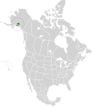
 Aleutian Islands tundra map.svg 1,712 × 1,992; 337 KB
-
 Allegheny Highlands forests map.svg 1,712 × 1,992; 337 KB
-
 Appalachian mixed mesophytic forests map.svg 1,712 × 1,992; 342 KB
-
 Appalachian-Blue Ridge forests map.svg 1,712 × 1,992; 343 KB
-
 Arctic coastal tundra map.svg 1,712 × 1,992; 341 KB
-
 Arctic foothills tundra map.svg 1,712 × 1,992; 337 KB
-
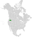
 Arizona Mountains Forests map.svg 1,712 × 1,992; 342 KB
-
 Aspen-Parkland.svg 1,304 × 1,263; 120 KB
-
 Atlantic coastal pine barrens map.svg 1,712 × 1,992; 338 KB
-
 Baffin coastal tundra map.svg 1,712 × 1,992; 337 KB
-
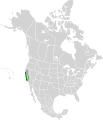
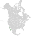
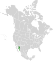
 Baja California Desert map.svg 1,712 × 1,992; 344 KB
-
 Beringia lowland tundra map.svg 1,712 × 1,992; 344 KB
-
 Beringia upland tundra map.svg 1,712 × 1,992; 339 KB
-
 Blue Mountains Forests map.svg 1,712 × 1,992; 338 KB
-
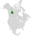
 British Columbia mainland coastal forests map.svg 1,712 × 1,992; 338 KB
-
 Brooks-British Range tundra map.svg 1,712 × 1,992; 340 KB
-
 California Central Valley Grasslands map.svg 1,712 × 1,992; 338 KB
-
 California Coastal Sage and Chaparral map.svg 1,712 × 1,992; 341 KB
-
 California Interior Chaparral and Woodlands map.svg 1,712 × 1,992; 339 KB
-
 California Montane Chaparral and Woodlands map.svg 1,712 × 1,992; 339 KB
-
 Cascade Mountains leeward forests map.svg 1,712 × 1,992; 338 KB
-
 Central and Southern Cascades Forests map.svg 1,712 × 1,992; 336 KB
-
 Central and Southern Mixed Grasslands map.svg 1,712 × 1,992; 344 KB
-
 Central British Columbia Mountain forests map.svg 1,712 × 1,992; 337 KB
-
 Central Canadian Shield forests map.svg 1,712 × 1,992; 338 KB
-
 Central Forests-Grassland Transition Zone map.svg 1,712 × 1,992; 346 KB
-
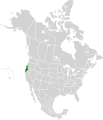
 Central Pacific coastal forests map.svg 1,712 × 1,992; 337 KB
-
 Central Tall Grasslands map.svg 1,712 × 1,992; 343 KB
-
 Central U.S. Hardwood Forests map.svg 1,712 × 1,992; 345 KB
-
 Chihuahuan Desert map.svg 1,712 × 1,992; 369 KB
-
 Colorado Plateau Shrublands map.svg 1,712 × 1,992; 348 KB
-
 Colorado Rockies Forests map.svg 1,712 × 1,992; 341 KB
-
 Cook Inlet taiga map.svg 1,712 × 1,992; 337 KB
-
 Copper Plateau taiga map.svg 1,712 × 1,992; 336 KB
-
 Davis Highlands tundra map.svg 1,712 × 1,992; 338 KB
-
 East Central Texas Forests map.svg 1,712 × 1,992; 336 KB
-
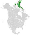
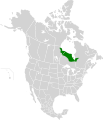
 Eastern Canadian Forests map.svg 1,712 × 1,992; 347 KB
-
 Eastern Canadian Shield taiga map.svg 1,712 × 1,992; 344 KB
-
 Eastern Cascades Forests map.svg 1,712 × 1,992; 338 KB
-
 Eastern forest-boreal transition map.svg 1,712 × 1,992; 339 KB
-
 Eastern Great Lakes Lowland Forests.svg 1,712 × 1,992; 339 KB
-
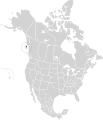
 Ecoregions quebec map.svg 1,630 × 2,000; 844 KB
-
 Edwards Plateau Savannas map.svg 1,712 × 1,992; 338 KB
-
 Flint Hills tall grasslands map 2.svg 1,712 × 1,992; 274 KB
-
 Flint Hills tall grasslands map.svg 1,712 × 1,992; 337 KB
-
 Florida Sand Pine Scrub map.svg 1,712 × 1,992; 339 KB
-
 Fraser Plateau and Basin complex map.svg 1,712 × 1,992; 336 KB
-
 Great Basin Montane Forests map.svg 1,712 × 1,992; 181 KB
-
 Great Basin Shrub Steppe map.svg 1,712 × 1,992; 337 KB
-
 Gulf of California Xeric Scrub map.svg 1,712 × 1,992; 347 KB
-
 Gulf of St. Lawrence lowland forests map.svg 1,712 × 1,992; 338 KB
-
 High Arctic tundra map.svg 1,712 × 1,992; 364 KB
-
 Interior Alaska-Yukon lowland taiga map.svg 1,712 × 1,992; 347 KB
-
 Interior Yukon-Alaska alpine tundra map.svg 1,712 × 1,992; 345 KB
-
 Kalaallit Nunaat high arctic tundra map.svg 300 × 500; 43 KB
-
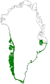 Kalaallit Nunaat low arctic tundra map.svg 300 × 500; 107 KB
-
 Klamath-Siskiyou Forests map.svg 1,712 × 1,992; 336 KB
-
 Low Arctic tundra map.svg 1,712 × 1,992; 349 KB
-
 Madrean Sky Islands Montane Forests map.svg 1,712 × 1,992; 345 KB
-
 Meseta Central Matorral map.svg 1,712 × 1,992; 349 KB
-
 Mid-Continental Canadian forests map.svg 1,712 × 1,992; 346 KB
-
 Middle Arctic tundra map.svg 1,712 × 1,992; 364 KB
-
 Middle Atlantic coastal forests map.svg 1,712 × 1,992; 341 KB
-
 Midwestern Canadian Shield forests map.svg 1,712 × 1,992; 340 KB
-
 Mississippi Lowland Forests map.svg 1,712 × 1,992; 341 KB
-
 Mojave Desert map.svg 1,712 × 1,992; 342 KB
-
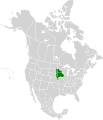
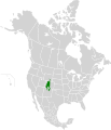
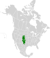
 Montana Valley and Foothill grasslands map.svg 1,712 × 1,992; 343 KB
-
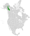
 Muskwa-Slave Lake forests map.svg 1,712 × 1,992; 339 KB
-
 Nebraska Sand Hills Mixed Grasslands map.svg 1,712 × 1,992; 339 KB
-
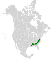
 New England-Acadian forests map.svg 1,712 × 1,992; 346 KB
-
 Newfoundland Highland forests map.svg 1,712 × 1,992; 338 KB
-
 North Central Rockies forests map.svg 1,712 × 1,992; 341 KB
-
 Northeastern coastal forests map.svg 1,712 × 1,992; 343 KB
-
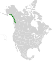
 Northern California Coastal Forests map.svg 1,712 × 1,992; 337 KB
-
 Northern Canadian Shield taiga map.svg 1,712 × 1,992; 341 KB
-
 Northern Cordillera forests map.svg 1,712 × 1,992; 342 KB
-
 Northern Mixed Grasslands.svg 1,712 × 1,992; 341 KB
-
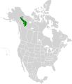
 Northern Pacific coastal forests map.svg 1,712 × 1,992; 340 KB
-
 Northern short grasslands map.svg 1,712 × 1,992; 346 KB
-
 Northern tall grasslands map.svg 1,712 × 1,992; 338 KB
-
 Northern transitional alpine forests map.svg 1,712 × 1,992; 336 KB
-
 Northwest Territories taiga map.svg 1,712 × 1,992; 343 KB
-
 Ogilvie-MacKenzie alpine tundra map.svg 1,712 × 1,992; 340 KB
-
 Okanagan dry forests map.svg 1,712 × 1,992; 337 KB
-
 Ozark Mountain Forests map.svg 1,712 × 1,992; 336 KB
-
 Pacific Coastal Mountain icefields and tundra map.svg 1,712 × 1,992; 343 KB
-
 Palouse grasslands map.svg 1,712 × 1,992; 339 KB
-
 Piney Woods Forests map.svg 1,712 × 1,992; 337 KB
-
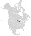
 Puget lowland forests map.svg 1,712 × 1,992; 337 KB
-
 Queen Charlotte Islands map.svg 1,712 × 1,992; 335 KB
-
 San Lucan Xeric Scrub map.svg 1,712 × 1,992; 343 KB
-
 Sierra de la Laguna Pine-Oak Forests map.svg 1,712 × 1,992; 339 KB
-
 Sierra Juarez and San Pedro Martir Pine-Oak Forests map.svg 1,712 × 1,992; 339 KB
-
 Sierra Madre Occidental Pine-Oak Forests map.svg 1,712 × 1,992; 369 KB
-
 Sierra Nevada Forests map.svg 1,712 × 1,992; 336 KB
-
 Snake-Columbia Shrub Steppe map.svg 1,712 × 1,992; 347 KB
-
 Sonoran Desert map.svg 1,712 × 1,992; 345 KB
-
 Sonoran-Sinaloan transition subtropical dry forest map.svg 1,712 × 1,992; 342 KB
-
 South Avalon-Burin oceanic barrens map.svg 1,712 × 1,992; 337 KB
-
 South Central Rockies Forests map.svg 1,712 × 1,992; 348 KB
-
 Southeastern Conifer Forests map.svg 1,712 × 1,992; 340 KB
-
 Southeastern mixed forests map.svg 1,712 × 1,992; 343 KB
-
 Southern Great Lakes forests map.svg 1,712 × 1,992; 343 KB
-
 Southern Hudson Bay Taiga map.svg 1,712 × 1,992; 339 KB
-
 Tamaulipan Mezquital map.svg 1,712 × 1,992; 346 KB
-
 Terrestrial ecoregions USA CAN MEX.svg 1,712 × 1,992; 696 KB
-
 Texas Blackland Prairies map.svg 1,712 × 1,992; 339 KB
-
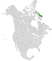
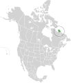 Torngat Mountain tundra map.svg 1,712 × 1,992; 340 KB
-
 Upper Midwest Forest-Savanna Transition Zone map.svg 1,712 × 1,992; 340 KB
-
 Wasatch and Uinta Montane Forests map.svg 1,712 × 1,992; 338 KB
-
 Western Great Lakes forests map.svg 1,712 × 1,992; 342 KB
-
 Western Gulf Coastal Grasslands map.svg 1,712 × 1,992; 340 KB
-
 Western Short Grasslands map.svg 1,712 × 1,992; 348 KB
-
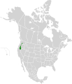
 Willamette Valley forests map.svg 1,712 × 1,992; 336 KB
-
 Wyoming Basin Shrub Steppe map.svg 1,712 × 1,992; 343 KB
-
 Yukon Interior dry forests map.svg 1,712 × 1,992; 338 KB
-
 Zoomed in map of Southern Great Lakes forests.png 497 × 340; 662 KB


