Category:Nederlands Hervormde Kerk, Brakel
| Object location | | View all coordinates using: OpenStreetMap |
|---|
church in Brakel, Netherlands  | |||||
| Upload media | |||||
| Instance of | |||||
|---|---|---|---|---|---|
| Location | Brakel, Zaltbommel, Gelderland, Netherlands | ||||
| Street address |
| ||||
| Located on street |
| ||||
| Heritage designation |
| ||||
| Inception |
| ||||
| Significant event |
| ||||
 | |||||
Kerk:
|
This is a category about rijksmonument number 10066
|
Toren:
|
This is a category about rijksmonument number 10067
|
| Address |
|
Media in category "Nederlands Hervormde Kerk, Brakel"
The following 88 files are in this category, out of 88 total.
-
 Brakel - Marktplein 4 Nederlands Hervormde kerk 10066.JPG 3,888 × 2,592; 5.5 MB
-
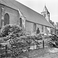
 Deel begraafplaats NH Kerk, Brakel.jpg 3,524 × 2,727; 5.74 MB
-
 Dorpsgezicht naar sepiatekening, (1735) - Brakel - 20039504 - RCE.jpg 884 × 1,200; 319 KB
-
 Exterieur DETAIL TUFSTEEN - Brakel - 20304947 - RCE.jpg 1,190 × 1,200; 507 KB
-
 Exterieur DETAIL TUFSTEEN - Brakel - 20304948 - RCE.jpg 1,195 × 1,200; 516 KB
-
 Exterieur DETAIL TUFSTEEN - Brakel - 20304949 - RCE.jpg 1,197 × 1,200; 538 KB
-
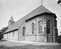 Exterieur ZUIDOOSTGEVEL - Brakel - 20339425 - RCE.jpg 1,200 × 967; 275 KB
-
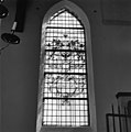
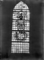
 Glas in loodraam - Brakel - 20039534 - RCE.jpg 1,186 × 1,200; 238 KB
-
 Glas in loodraam - Brakel - 20039535 - RCE.jpg 1,186 × 1,200; 215 KB
-
 Glas in loodraam - Brakel - 20039536 - RCE.jpg 1,192 × 1,200; 217 KB
-
 Glas in loodraam - Brakel - 20039537 - RCE.jpg 1,195 × 1,200; 219 KB
-
 Glas in loodraam - Brakel - 20039538 - RCE.jpg 1,188 × 1,200; 237 KB
-
 Glas in loodraam - Brakel - 20039539 - RCE.jpg 1,193 × 1,200; 242 KB
-
 Glas in loodraam - Brakel - 20039540 - RCE.jpg 1,190 × 1,200; 187 KB
-
 Interieur naar het koor - Brakel - 20039523 - RCE.jpg 1,200 × 953; 197 KB
-
 Interieur naar het koor - Brakel - 20039524 - RCE.jpg 955 × 1,200; 197 KB
-
 Interieur naar het westen - Brakel - 20039525 - RCE.jpg 1,200 × 955; 180 KB
-
 Interieur, aanzicht orgel, orgelnummer 220 - Brakel - 20417437 - RCE.jpg 825 × 1,200; 173 KB
-
 INTERIEUR, GEBRANDSCHILDERD RAAM - Brakel - 20270609 - RCE.jpg 1,195 × 1,200; 218 KB
-
 INTERIEUR, GEBRANDSCHILDERD RAAM - Brakel - 20270610 - RCE.jpg 1,197 × 1,200; 290 KB
-
 INTERIEUR, GEBRANDSCHILDERD RAAM - Brakel - 20270611 - RCE.jpg 1,195 × 1,200; 239 KB
-
 INTERIEUR, GEBRANDSCHILDERD RAAM - Brakel - 20270612 - RCE.jpg 1,195 × 1,200; 216 KB
-
 INTERIEUR, GEBRANDSCHILDERD RAAM - Brakel - 20270613 - RCE.jpg 1,200 × 1,190; 214 KB
-
 INTERIEUR, GEBRANDSCHILDERD RAAM - Brakel - 20270614 - RCE.jpg 1,188 × 1,200; 193 KB
-
 INTERIEUR, GEBRANDSCHILDERD RAAM - Brakel - 20270615 - RCE.jpg 1,190 × 1,200; 257 KB
-
 INTERIEUR, GEBRANDSCHILDERD RAAM - Brakel - 20270616 - RCE.jpg 1,200 × 1,200; 292 KB
-
 Interieur, glas in loodraam, raam nummer 1, detail - Brakel - 20360376 - RCE.jpg 1,200 × 831; 180 KB
-
 Interieur, glas in loodraam, raam nummer 1, detail - Brakel - 20360377 - RCE.jpg 1,200 × 793; 176 KB
-
 Interieur, glas in loodraam, raam nummer 1, detail - Brakel - 20360378 - RCE.jpg 1,200 × 786; 157 KB
-
 Interieur, glas in loodraam, raam nummer 2, detail - Brakel - 20360380 - RCE.jpg 1,200 × 806; 179 KB
-
 Interieur, glas in loodraam, raam nummer 2, detail - Brakel - 20360381 - RCE.jpg 1,200 × 805; 178 KB
-
 Interieur, glas in loodraam, raam nummer 2, detail - Brakel - 20360382 - RCE.jpg 1,200 × 789; 175 KB
-
 Interieur, glas in loodraam, raam nummer 3, detail - Brakel - 20360384 - RCE.jpg 1,200 × 787; 176 KB
-
 Interieur, glas in loodraam, raam nummer 3, detail - Brakel - 20360385 - RCE.jpg 1,200 × 788; 186 KB
-
 Interieur, glas in loodraam, raam nummer 3, detail - Brakel - 20360386 - RCE.jpg 1,200 × 785; 188 KB
-
 Interieur, glas in loodraam, raam nummer 3, detail - Brakel - 20360387 - RCE.jpg 1,200 × 783; 161 KB
-
 Interieur, glas in loodraam, raam nummer 5, detail - Brakel - 20360390 - RCE.jpg 787 × 1,200; 140 KB
-
 Interieur, glas in loodraam, raam nummer 5, detail - Brakel - 20360391 - RCE.jpg 1,200 × 788; 160 KB
-
 Interieur, glas in loodraam, raam nummer 5, detail - Brakel - 20360392 - RCE.jpg 1,200 × 817; 177 KB
-
 Interieur, glas in loodraam, raam nummer 6, detail - Brakel - 20360394 - RCE.jpg 1,200 × 784; 171 KB
-
 Interieur, glas in loodraam, raam nummer 6, detail - Brakel - 20360395 - RCE.jpg 1,200 × 788; 175 KB
-
 Interieur, glas in loodraam, raam nummer 6, detail - Brakel - 20360396 - RCE.jpg 1,200 × 785; 179 KB
-
 Interieur, glas in loodraam, raam nummer 7, detail - Brakel - 20360398 - RCE.jpg 1,200 × 784; 205 KB
-
 Interieur, glas in loodraam, raam nummer 7, detail - Brakel - 20360399 - RCE.jpg 1,200 × 820; 201 KB
-
 Interieur, glas in loodraam, raam nummer 7, detail - Brakel - 20360400 - RCE.jpg 1,200 × 783; 197 KB
-
 Interieur, glas in loodraam, raam nummer 7, detail - Brakel - 20360401 - RCE.jpg 1,200 × 787; 168 KB
-
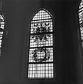
 Interieur, glasvenster in het koor - Brakel - 20039518 - RCE.jpg 891 × 1,200; 191 KB
-
 Interieur, glasvenster in het koor - Brakel - 20039519 - RCE.jpg 886 × 1,200; 173 KB
-
 Interieur, glasvenster in het koor - Brakel - 20039520 - RCE.jpg 882 × 1,200; 148 KB
-
 Interieur, glasvenster in het koor - Brakel - 20039521 - RCE.jpg 883 × 1,200; 168 KB
-
 Interieur, overzicht naar het oosten - Brakel - 20039509 - RCE.jpg 889 × 1,200; 178 KB
-

-

-

-

-

-

-

-
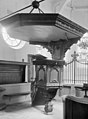 Interieur, preekstoel - Brakel - 20039510 - RCE.jpg 884 × 1,200; 183 KB
-
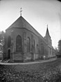
 Kerk en Het Spijker vanuit het zuiden - Brakel - 20039522 - RCE.jpg 1,200 × 804; 265 KB
-
 Koor - Brakel - 20039508 - RCE.jpg 1,200 × 984; 358 KB
-
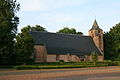
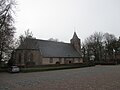
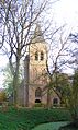
 NH Kerk, Brakel.jpg 3,376 × 2,579; 3.07 MB
-
 Noordgevel - Brakel - 20039530 - RCE.jpg 1,186 × 1,200; 437 KB
-
 Noordgevel - Brakel - 20039531 - RCE.jpg 1,197 × 1,200; 341 KB
-
 Noordgevel - Brakel - 20039532 - RCE.jpg 1,195 × 1,200; 358 KB
-
 Noordoostgevel - Brakel - 20039506 - RCE.jpg 891 × 1,200; 242 KB
-
 Orgel - Brakel - 20039527 - RCE.jpg 948 × 1,200; 185 KB
-
 Overzicht exterieur - Brakel - 20039528 - RCE.jpg 1,200 × 1,200; 483 KB
-
 Overzicht exterieur - Brakel - 20039529 - RCE.jpg 1,181 × 1,200; 492 KB
-
 PKN-N-H Martinus Brakel 2.jpg 4,000 × 3,000; 3.74 MB
-
 PKN-N-H Martinus Brakel.jpg 3,000 × 4,000; 4.82 MB
-
 Preekstoel - Brakel - 20039526 - RCE.jpg 1,200 × 956; 213 KB
-
 Rijksmonument-10067-20111014202000.jpg 2,592 × 1,936; 1.71 MB
-
 Toren - Brakel - 20039507 - RCE.jpg 860 × 1,200; 136 KB
-
 Toren Kerk, Brakel.jpg 2,153 × 3,611; 4.32 MB
-
 Tufsteen, detail - Brakel - 20359629 - RCE.jpg 784 × 1,200; 253 KB
-
 Tufsteen, verschil oud en nieuw - Brakel - 20359626 - RCE.jpg 1,200 × 851; 276 KB
-
 Venster van "Caerl Pieck" - Brakel - 20039512 - RCE.jpg 862 × 1,200; 218 KB
-
 Venster van "De Heerlickheyt Braeckel" - Brakel - 20039514 - RCE.jpg 887 × 1,200; 142 KB
-
 Venster van "De Stadt Boemel", 1647 - Brakel - 20039515 - RCE.jpg 874 × 1,200; 161 KB
-
 Venster van "De Stadt Nijmeghen" - Brakel - 20039517 - RCE.jpg 885 × 1,200; 154 KB
-
 Venster van "De Stadt Tiell", 1647 - Brakel - 20039516 - RCE.jpg 880 × 1,200; 142 KB
-
 Venster van "Jacob Pieck" - Brakel - 20039513 - RCE.jpg 863 × 1,200; 162 KB
-
 Vensters van het "Quartier van Nijmeghen", 1647 - Brakel - 20039511 - RCE.jpg 878 × 1,200; 125 KB
-
 Zicht op de kerktoren - Brakel - 20039505 - RCE.jpg 875 × 1,200; 287 KB
-
 Zicht vanuit het noorden - Brakel - 20325858 - RCE.jpg 1,200 × 858; 155 KB
-
 Zicht vanuit het zuidoosten - Brakel - 20327459 - RCE.jpg 990 × 1,200; 184 KB
-
 Zuidgevel - Brakel - 20039533 - RCE.jpg 1,197 × 1,200; 450 KB


_-_Brakel_-_20039504_-_RCE.jpg)


