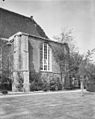
Category:Nederlands Hervormde Kerk, Sommelsdijk
| Object location | | View all coordinates using: OpenStreetMap |
|---|
church building in Goeree-Overflakkee, Netherlands .jpg) | |||||
| Upload media | |||||
| Instance of | |||||
|---|---|---|---|---|---|
| Location | Sommelsdijk, South Holland, Netherlands | ||||
| Street address |
| ||||
| Located on street |
| ||||
| Heritage designation |
| ||||
 | |||||
|
This is a category about rijksmonument number 29841
|
| Address |
|
Media in category "Nederlands Hervormde Kerk, Sommelsdijk"
The following 106 files are in this category, out of 106 total.
-
 Banken in de dooptuin - Sommelsdijk - 20202649 - RCE.jpg 1,188 × 1,200; 267 KB
-
 Banken in de dooptuin - Sommelsdijk - 20202650 - RCE.jpg 1,192 × 1,200; 252 KB
-
 Banken noordzijde schip - Sommelsdijk - 20202659 - RCE.jpg 1,195 × 1,200; 248 KB
-
 Dak noordportaal - Sommelsdijk - 20202641 - RCE.jpg 1,200 × 1,195; 350 KB
-
 Dak noordportaal - Sommelsdijk - 20202642 - RCE.jpg 1,200 × 1,192; 350 KB
-
 Dakvoet en tongewelf zuidzijde - Sommelsdijk - 20202636 - RCE.jpg 1,181 × 1,200; 304 KB
-
 Dakvoet en tongewelf zuidzijde - Sommelsdijk - 20202637 - RCE.jpg 1,200 × 1,195; 314 KB
-
 Dakvoet en tongewelf zuidzijde - Sommelsdijk - 20202638 - RCE.jpg 1,200 × 1,188; 292 KB
-
 Exterieur - Sommelsdijk - 20202602 - RCE.jpg 948 × 1,200; 282 KB
-
 Exterieur koormuur - Sommelsdijk - 20202609 - RCE.jpg 1,200 × 954; 290 KB
-
 Exterieur noordwand - Sommelsdijk - 20202603 - RCE.jpg 1,200 × 962; 276 KB
-
 Exterieur noordwand - Sommelsdijk - 20202606 - RCE.jpg 952 × 1,200; 272 KB
-
 Exterieur noordwand koormuur - Sommelsdijk - 20202604 - RCE.jpg 958 × 1,200; 254 KB
-
 Exterieur restauratie zuid-west zijde - Sommelsdijk - 20202639 - RCE.jpg 960 × 1,200; 276 KB
-
 Exterieur restauratie zuidzijde - Sommelsdijk - 20202640 - RCE.jpg 1,200 × 952; 252 KB
-
 Exterieur vanuit het zuid-westen - Sommelsdijk - 20202601 - RCE.jpg 950 × 1,200; 201 KB
-
 Exterieur zuidwand - Sommelsdijk - 20202607 - RCE.jpg 1,200 × 964; 295 KB
-
 Exterieur zuidwand koormuur - Sommelsdijk - 20202608 - RCE.jpg 954 × 1,200; 331 KB
-
 Galmgaten in toren interieur - Sommelsdijk - 20202625 - RCE.jpg 1,187 × 1,200; 259 KB
-
 Herenbank noordtransept - Sommelsdijk - 20202655 - RCE.jpg 1,200 × 954; 129 KB
-
 Herenbank zuidertransept - Sommelsdijk - 20202656 - RCE.jpg 1,200 × 961; 134 KB
-
 Ingang noordgevel - Sommelsdijk - 20202682 - RCE.jpg 965 × 1,200; 282 KB
-
 Ingang noordwand - Sommelsdijk - 20202605 - RCE.jpg 957 × 1,200; 317 KB
-
-

-

-

-
 Interieur detail raam noordgevel - Sommelsdijk - 20202645 - RCE.jpg 1,197 × 1,200; 299 KB
-
 Interieur deurschildering onder orgel noordzijde - Sommelsdijk - 20202665 - RCE.jpg 1,190 × 1,200; 222 KB
-
 Interieur e.a. fundering preekstoel tegen oostgevel - Sommelsdijk - 20202674 - RCE.jpg 1,195 × 1,200; 331 KB
-
 Interieur funderingen kolom zuidzijde - Sommelsdijk - 20202671 - RCE.jpg 1,186 × 1,200; 488 KB
-
 Interieur funderingen kolommen schip - Sommelsdijk - 20202670 - RCE.jpg 1,197 × 1,200; 362 KB
-
 Interieur gewelf naar het westen - Sommelsdijk - 20202689 - RCE.jpg 1,200 × 953; 158 KB
-
 Interieur gewelf portaal noordgevel - Sommelsdijk - 20202643 - RCE.jpg 1,200 × 1,197; 287 KB
-
 Interieur muurschildering onder orgel - Sommelsdijk - 20202676 - RCE.jpg 1,190 × 1,200; 345 KB
-
 Interieur muurschildering onder orgel - Sommelsdijk - 20202677 - RCE.jpg 1,183 × 1,200; 190 KB
-
 Interieur naar het noord-westen - Sommelsdijk - 20202687 - RCE.jpg 1,200 × 951; 163 KB
-
 Interieur naar het noorden - Sommelsdijk - 20202686 - RCE.jpg 1,200 × 953; 179 KB
-
 Interieur naar het oosten - Sommelsdijk - 20202611 - RCE.jpg 1,200 × 948; 146 KB
-
 Interieur naar het oosten - Sommelsdijk - 20202685 - RCE.jpg 1,200 × 951; 150 KB
-
 Interieur naar het westen - Sommelsdijk - 20202610 - RCE.jpg 1,200 × 956; 145 KB
-
 Interieur naar het westen - Sommelsdijk - 20202688 - RCE.jpg 1,200 × 954; 156 KB
-
 Interieur opgegraven kolom fragment - Sommelsdijk - 20202669 - RCE.jpg 1,200 × 1,197; 490 KB
-
 Interieur opgegraven kolom west-zijde schip - Sommelsdijk - 20202673 - RCE.jpg 1,195 × 1,200; 349 KB
-
 Interieur opgraving viering kolom noord-zijde - Sommelsdijk - 20202672 - RCE.jpg 1,198 × 1,200; 451 KB
-
 Interieur raam noordgevel - Sommelsdijk - 20202644 - RCE.jpg 1,192 × 1,200; 305 KB
-
 Interieur toren - Sommelsdijk - 20202619 - RCE.jpg 1,190 × 1,200; 382 KB
-
 Interieur toren - Sommelsdijk - 20202620 - RCE.jpg 1,179 × 1,200; 372 KB
-
 Interieur toren - Sommelsdijk - 20202622 - RCE.jpg 1,197 × 1,200; 403 KB
-
 Interieur toren - Sommelsdijk - 20202623 - RCE.jpg 1,190 × 1,200; 436 KB
-
 Interieur toren detail klokkenstoel - Sommelsdijk - 20202621 - RCE.jpg 1,190 × 1,200; 272 KB
-
 Interieur, aanzicht orgel, orgelnummer 1384 - Sommelsdijk - 20349294 - RCE.jpg 814 × 1,200; 142 KB
-
 Interieur, gewelfschildering - Sommelsdijk - 20202678 - RCE.jpg 1,197 × 1,200; 255 KB
-
 Interieur, gewelfschildering - Sommelsdijk - 20202679 - RCE.jpg 1,195 × 1,200; 264 KB
-
 Interieur, gewelfschildering - Sommelsdijk - 20358376 - RCE.jpg 785 × 1,200; 161 KB
-
 Interieur, gewelfschildering - Sommelsdijk - 20359106 - RCE.jpg 1,200 × 783; 150 KB
-
 Interieur, preekstoel met dooptuin - Sommelsdijk - 20202691 - RCE.jpg 1,200 × 949; 162 KB
-
 Interieur, schildering deur onder orgel - Sommelsdijk - 20359262 - RCE.jpg 1,200 × 788; 205 KB
-
 Interieur, schildering deur onder orgel - Sommelsdijk - 20359263 - RCE.jpg 1,200 × 785; 165 KB
-
 Interieur, schildering deur orgel - Sommelsdijk - 20359107 - RCE.jpg 783 × 1,200; 151 KB
-
 Interieur, Schildering onder orgel - Sommelsdijk - 20359103 - RCE.jpg 1,200 × 783; 205 KB
-
 Interieur, Schildering onder orgel - Sommelsdijk - 20359104 - RCE.jpg 1,200 × 786; 210 KB
-
 Interieur, Schildering onder orgel - Sommelsdijk - 20359105 - RCE.jpg 1,200 × 786; 137 KB
-

-
 Kerkbanken middenschip - Sommelsdijk - 20202658 - RCE.jpg 1,197 × 1,200; 210 KB
-
 Kroon(lamp) - Sommelsdijk - 20202661 - RCE.jpg 1,197 × 1,200; 189 KB
-
 Kroon(lamp) - Sommelsdijk - 20202662 - RCE.jpg 1,195 × 1,200; 187 KB
-
 Lezenaar van de preekstoel - Sommelsdijk - 20202653 - RCE.jpg 1,200 × 1,192; 326 KB
-
 Lezenaar van het doophek - Sommelsdijk - 20202654 - RCE.jpg 1,200 × 1,188; 283 KB
-
 Memorietafel - Sommelsdijk - 20202663 - RCE.jpg 953 × 1,200; 162 KB
-
 Noord-oost gevel toren - Sommelsdijk - 20202616 - RCE.jpg 927 × 1,200; 188 KB
-
 Noordgevel - Sommelsdijk - 20202680 - RCE.jpg 953 × 1,200; 209 KB
-
 Noordgevel - Sommelsdijk - 20202681 - RCE.jpg 951 × 1,200; 215 KB
-
 Oostgevel - Sommelsdijk - 20202683 - RCE.jpg 1,200 × 926; 366 KB
-
 Orgel - Sommelsdijk - 20202690 - RCE.jpg 954 × 1,200; 173 KB
-
 Orgel-front - Sommelsdijk - 20202612 - RCE.jpg 958 × 1,200; 162 KB
-
 Overzicht kerkbanken middenschip - Sommelsdijk - 20202657 - RCE.jpg 1,200 × 1,200; 242 KB
-
 Preekstoel - Sommelsdijk - 20202652 - RCE.jpg 948 × 1,200; 165 KB
-
 Preekstoel - Sommelsdijk - 20202692 - RCE.jpg 958 × 1,200; 169 KB
-
 Preekstoel met dooptuin - Sommelsdijk - 20202648 - RCE.jpg 1,200 × 955; 175 KB
-
 Preekstoel met dooptuin en noord-transept - Sommelsdijk - 20202651 - RCE.jpg 1,200 × 948; 170 KB
-
 Raam in toren, interieur - Sommelsdijk - 20202624 - RCE.jpg 1,194 × 1,200; 217 KB
-
 Reproductie, interieur naar het oosten gezien - Sommelsdijk - 20202646 - RCE.jpg 1,197 × 1,200; 397 KB
-
 Reproductie, orgel - Sommelsdijk - 20202647 - RCE.jpg 1,200 × 1,200; 404 KB
-
-
 RM29841 Sommelsdijk - Marktveld (hardstenen portaal).jpg 1,944 × 2,592; 1.47 MB
-
 RM29841 Sommelsdijk - Marktveld (kerk).jpg 1,944 × 2,592; 1.12 MB
-
 Sommelsdijk-karke.jpg 300 × 400; 85 KB
-

-
 Toren, na afhakken beklamping - Sommelsdijk - 20202626 - RCE.jpg 1,190 × 1,200; 430 KB
-
 Toren, na afhakken beklamping - Sommelsdijk - 20202627 - RCE.jpg 1,192 × 1,200; 407 KB
-
 Toren, na afhakken beklamping - Sommelsdijk - 20202628 - RCE.jpg 1,185 × 1,200; 454 KB
-
 Toren, na afhakken beklamping - Sommelsdijk - 20202629 - RCE.jpg 1,195 × 1,200; 411 KB
-
 Toren, na afhakken beklamping - Sommelsdijk - 20202630 - RCE.jpg 1,178 × 1,200; 420 KB
-
 Toren, na afhakken beklamping - Sommelsdijk - 20202631 - RCE.jpg 1,184 × 1,200; 395 KB
-
 Toren, na afhakken beklamping - Sommelsdijk - 20202632 - RCE.jpg 1,186 × 1,200; 416 KB
-
 Toren, na afhakken beklamping - Sommelsdijk - 20202633 - RCE.jpg 1,197 × 1,200; 398 KB
-
 Toren, na afhakken beklamping - Sommelsdijk - 20202634 - RCE.jpg 1,200 × 1,192; 376 KB
-
 Toren, na afhakken beklamping - Sommelsdijk - 20202635 - RCE.jpg 1,186 × 1,200; 401 KB
-
 Voet toren zuidzijde - Sommelsdijk - 20202618 - RCE.jpg 955 × 1,200; 340 KB
-
 Westgevel - Sommelsdijk - 20202614 - RCE.jpg 1,200 × 955; 309 KB
-
 Zijpaneel van banken noordtransept - Sommelsdijk - 20202660 - RCE.jpg 1,192 × 1,200; 222 KB
-
 Zuid-oost gevel toren - Sommelsdijk - 20202615 - RCE.jpg 959 × 1,200; 281 KB
-
 Zuidgevel - Sommelsdijk - 20202613 - RCE.jpg 1,200 × 948; 256 KB
-
 Zuidgevel - Sommelsdijk - 20202684 - RCE.jpg 1,200 × 958; 277 KB
-
 Zuidgevel toren - Sommelsdijk - 20202617 - RCE.jpg 959 × 1,200; 226 KB


_-_Sommelsdijk_-_20202661_-_RCE.jpg)
_-_Sommelsdijk_-_20202662_-_RCE.jpg)


.jpg)
.jpg)

_en_Petronella_Borre_(1578-1653)_-_W.V._Lelij_in_Loco_delin._27_oct_1752.jpg)


