Category:Neet Covered Bridge
| Camera location | | View all coordinates using: OpenStreetMap |
|---|
place in Indiana listed on National Register of Historic Places  | |||||
| Upload media | |||||
| Instance of | |||||
|---|---|---|---|---|---|
| Location | Parke County, Indiana | ||||
| Crosses |
| ||||
| Heritage designation |
| ||||
| Inception |
| ||||
 | |||||
Media in category "Neet Covered Bridge"
The following 10 files are in this category, out of 10 total.
-
 Burr Arch 034.jpg 2,576 × 1,932; 1.43 MB
-
 Burr Arch 823.jpg 2,576 × 1,932; 1.52 MB
-
 Burr Arch 825.jpg 2,576 × 1,932; 1.49 MB
-
 Neet Bridge 21816.jpg 2,576 × 1,932; 1.65 MB
-
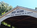
 Neet Bridge Face.jpg 2,816 × 2,112; 4.71 MB
-
 Neet Bridge Inside.jpg 3,467 × 2,919; 6.23 MB
-
 Neet CB 757.jpg 2,576 × 1,932; 1.43 MB
-
 Neet CB 815.jpg 2,576 × 1,932; 1.4 MB
-
 Neet Covered Bridge.jpg 2,816 × 2,112; 2.56 MB
-
 Truss 22010.jpg 1,932 × 2,576; 1.4 MB


