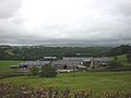
Category:Nether Wyresdale
English: Nether Wyresdale is a civil parish in Lancashire, England. In 2001 the parish had a population of 613.> (→Nether Wyresdale)
Polski: Nether Wyresdale – wieś w Anglii, w hrabstwie Lancashire, w dystrykcie Wyre. Leży 63 km na północny zachód od miasta Manchester i 323 km na północny zachód od Londynu. (→Nether Wyresdale)
civil parish in Lancashire, UK | |||||
| Upload media | |||||
| Instance of | |||||
|---|---|---|---|---|---|
| Location | Wyre, Lancashire, North West England, England | ||||
 | |||||
Subcategories
This category has the following 3 subcategories, out of 3 total.
H
- Harrisend Fell (24 F)
S
- Street, Lancashire (4 F)
Media in category "Nether Wyresdale"
The following 200 files are in this category, out of 375 total.
(previous page) (next page)-
 A bend in the road (road junction) near Fell End - geograph.org.uk - 4695150.jpg 4,592 × 3,056; 7.67 MB
-
 A cattle grid near Lane Head - geograph.org.uk - 4694704.jpg 4,141 × 2,757; 7.59 MB
-
 A cyclist stops for a well-earned butty on Harrisend Fell - geograph.org.uk - 4705040.jpg 4,592 × 3,056; 5.44 MB
-
 A footbridge over Grizedale Brook - geograph.org.uk - 4946810.jpg 4,592 × 3,056; 7.73 MB
-
 A frisky goat herd at Syke's Farm - geograph.org.uk - 2376917.jpg 1,600 × 1,198; 471 KB
-
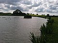
 A stagnant pond by the Wyre - geograph.org.uk - 2565449.jpg 640 × 480; 152 KB
-
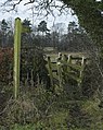
 A stile on the path to Syke's Farm - geograph.org.uk - 2376906.jpg 1,600 × 1,198; 396 KB
-
 A tree near the Fell End bridleway - geograph.org.uk - 2980665.jpg 640 × 480; 112 KB
-
 A weir on the River Wyre taken from Street Bridge - geograph.org.uk - 4694077.jpg 4,449 × 2,961; 7.62 MB
-
 Access to Nicky Nook Fell - geograph.org.uk - 4695375.jpg 4,470 × 2,430; 5.99 MB
-
 Along the Scorton Millennium Way - geograph.org.uk - 2137882.jpg 640 × 426; 292 KB
-
 An iced up Bantons Lake and Island - geograph.org.uk - 2800815.jpg 4,320 × 2,432; 4.06 MB
-
 An unnamed bridge - geograph.org.uk - 4689028.jpg 4,592 × 2,250; 7.87 MB
-
 Angler's Cottage, Wyresdale Park - geograph.org.uk - 2341718.jpg 640 × 480; 188 KB
-

-
 Barn in field near Bland's Cottage - geograph.org.uk - 1092814.jpg 640 × 425; 81 KB
-
 Barrow-in-Furness and Walney Island - geograph.org.uk - 5461907.jpg 3,264 × 2,448; 3.54 MB
-
 Bay View Farm - geograph.org.uk - 4435401.jpg 5,183 × 2,949; 1.81 MB
-
 Bench Mark on gatepost, Scorton - geograph.org.uk - 2459507.jpg 640 × 480; 78 KB
-
 Benchmark on the cross base, Cross Hill - geograph.org.uk - 2565422.jpg 640 × 480; 185 KB
-
 Blackpool, from over the M6 - geograph.org.uk - 5462013.jpg 3,264 × 2,448; 3.37 MB
-
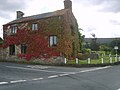
 Bland's Cottage near Scorton - geograph.org.uk - 1092811.jpg 640 × 425; 109 KB
-
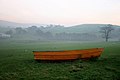 Boat on Grazing Land - geograph.org.uk - 1179135.jpg 640 × 426; 53 KB
-
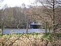 Boathouse on Scorton Lake - geograph.org.uk - 1235940.jpg 640 × 480; 136 KB
-
 Bobbin Mill House near Scorton - geograph.org.uk - 1092965.jpg 640 × 425; 88 KB
-
 Bowland - among the bluebells - geograph.org.uk - 2575537.jpg 640 × 428; 193 KB
-

-
 Bridge over M6 at Scorton - geograph.org.uk - 1956955.jpg 3,264 × 2,448; 1.36 MB
-
 Bridge over the M6 - geograph.org.uk - 3121042.jpg 4,608 × 3,456; 3.47 MB
-
 Bridge over the Wyre, Lower Dolphinholme - geograph.org.uk - 2565286.jpg 640 × 480; 115 KB
-
 Bridge over Tithe Barn Brook - geograph.org.uk - 999135.jpg 640 × 426; 160 KB
-
 Bridge, Street - geograph.org.uk - 3276374.jpg 640 × 397; 299 KB
-
 Bridleway Crosses Ford - geograph.org.uk - 1150684.jpg 640 × 426; 177 KB
-
 Bridleway to Lane Head - geograph.org.uk - 1150686.jpg 640 × 426; 180 KB
-
 Bridleway to Slean End - geograph.org.uk - 1303798.jpg 640 × 426; 182 KB
-
 Cairn by footpath on Harrisend Fell - geograph.org.uk - 6220649.jpg 4,032 × 3,024; 2.81 MB
-
 Cairn on Harrisend Fell - geograph.org.uk - 3003677.jpg 640 × 480; 102 KB
-
 Cairn on point 283m, Harrisend Fell - geograph.org.uk - 2346970.jpg 640 × 426; 224 KB
-
 Cattle grid at Lane Head - geograph.org.uk - 4516677.jpg 1,024 × 768; 371 KB
-
 Cattle grid on Harrisend Fell Road - geograph.org.uk - 2302465.jpg 640 × 426; 268 KB
-
 Cattle grid southeast of Crosshill Farm - geograph.org.uk - 2025624.jpg 665 × 480; 154 KB
-
 Cattle lounging above Fell End - geograph.org.uk - 2980696.jpg 640 × 480; 101 KB
-
 Cleveley Bridge near Scorton - geograph.org.uk - 1092813.jpg 640 × 425; 101 KB
-
 Cleveley Bridge over the River Wyre - geograph.org.uk - 1298439.jpg 640 × 479; 128 KB
-
 Clock, St Peter's Church - geograph.org.uk - 2452178.jpg 640 × 481; 89 KB
-
 Cross Hill Farm - geograph.org.uk - 1150709.jpg 640 × 345; 75 KB
-
 Crosshill Farm - geograph.org.uk - 4435455.jpg 4,649 × 2,758; 1.99 MB
-
 Crosshill Four Lane Ends - geograph.org.uk - 2025621.jpg 640 × 480; 134 KB
-
 Crosshill Four Lane Ends - geograph.org.uk - 2565431.jpg 640 × 480; 117 KB
-
 Detail, St Peter's Church - geograph.org.uk - 2452179.jpg 480 × 640; 93 KB
-
 Detail, water valve hatch - geograph.org.uk - 2565318.jpg 640 × 438; 197 KB
-
 Dolphinholme House - geograph.org.uk - 2565288.jpg 640 × 480; 74 KB
-
 Dolphinholme Mill - geograph.org.uk - 3103902.jpg 2,816 × 2,112; 2.94 MB
-
 Drainage channel east of Scorton Lake - geograph.org.uk - 1773165.jpg 2,592 × 1,944; 1.64 MB
-
 Drowned forest of dead trees near Scorton - geograph.org.uk - 4516253.jpg 1,024 × 768; 294 KB
-
 Elaborate Stile - geograph.org.uk - 1144682.jpg 504 × 334; 237 KB
-
 Entrance to Crosshill Farm - geograph.org.uk - 2025623.jpg 640 × 466; 184 KB
-
 Entrance to Potter's Hill New Wood - geograph.org.uk - 1144787.jpg 504 × 335; 294 KB
-
 Evening Light on Stake House - geograph.org.uk - 5244813.jpg 2,535 × 1,173; 870 KB
-
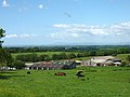
 Farm Buildings, Sands Bottom - geograph.org.uk - 930616.jpg 640 × 480; 69 KB
-
 Farm Road to Fell End - geograph.org.uk - 1004686.jpg 640 × 480; 118 KB
-
 Farmland at Woodacre - geograph.org.uk - 4594915.jpg 640 × 425; 121 KB
-
 Farmland west of Scorton - geograph.org.uk - 3814369.jpg 640 × 471; 49 KB
-
 Fell End - geograph.org.uk - 4435389.jpg 5,184 × 3,112; 1.93 MB
-
 Fell End - geograph.org.uk - 5147125.jpg 5,179 × 3,089; 1.95 MB
-
 Fell End - geograph.org.uk - 5147369.jpg 5,184 × 3,456; 1.73 MB
-
 Fell End farm and Harrisend Fell - geograph.org.uk - 1144756.jpg 504 × 335; 177 KB
-
 Fell End farmstead - geograph.org.uk - 4516645.jpg 1,024 × 768; 248 KB
-
 Field, Crosshill Four Lane Ends - geograph.org.uk - 3272717.jpg 640 × 480; 306 KB
-
 Footbridge across Park Brook - geograph.org.uk - 1298475.jpg 640 × 479; 169 KB
-
 Footbridge on Grizedale Brook at Pedder's Wood - geograph.org.uk - 4516507.jpg 1,024 × 768; 355 KB
-
 Footbridge over Park Brook - geograph.org.uk - 2919736.jpg 1,600 × 1,200; 751 KB
-
 Footbridge over the M6 - geograph.org.uk - 3121047.jpg 4,608 × 2,642; 2.09 MB
-
 Footbridge, M6 - geograph.org.uk - 4510888.jpg 640 × 400; 25 KB
-
 Footpath by Grizedale Brook - geograph.org.uk - 3046279.jpg 4,320 × 3,240; 4.65 MB
-
 Footpath down from Nicky Nook - geograph.org.uk - 1144815.jpg 504 × 335; 268 KB
-
-
 Footpath in Potters Hill New Wood - geograph.org.uk - 1144664.jpg 504 × 332; 254 KB
-
 Footpath off Tinker's Lane - geograph.org.uk - 4698277.jpg 4,592 × 3,056; 6.16 MB
-
 Footpath on Harrisend Fell - geograph.org.uk - 2302470.jpg 640 × 426; 334 KB
-
 Footpath southwest of Street Bridge - geograph.org.uk - 2025614.jpg 480 × 640; 134 KB
-
 Footpath to The Wagon Road, Street - geograph.org.uk - 1093001.jpg 640 × 425; 137 KB
-
 Ford - panoramio.jpg 2,816 × 2,112; 1,016 KB
-
 Ford and Footbridge - geograph.org.uk - 1174560.jpg 640 × 426; 128 KB
-
 Ford at Syke's Farm - geograph.org.uk - 4251432.jpg 3,872 × 2,592; 4.36 MB
-
 Ford at Woodacre - geograph.org.uk - 4250776.jpg 3,872 × 2,592; 4.82 MB
-
 Former Chapel - geograph.org.uk - 1463877.jpg 640 × 480; 72 KB
-
 Forton Services - geograph.org.uk - 4435386.jpg 5,026 × 3,045; 2.04 MB
-
 Four Lane Ends - geograph.org.uk - 1463884.jpg 640 × 549; 81 KB
-
 Foxhouses Brook - geograph.org.uk - 1150576.jpg 640 × 426; 167 KB
-
 Foxhouses Brook - geograph.org.uk - 4435375.jpg 5,071 × 3,142; 1.79 MB
-
 From Fell End to Grizedale Bridge - geograph.org.uk - 3103869.jpg 2,816 × 2,112; 3.38 MB
-
 From Long Lane - geograph.org.uk - 1479690.jpg 480 × 640; 135 KB
-
 Gate on permissive path at Fell End farm - geograph.org.uk - 2376924.jpg 1,600 × 1,198; 477 KB
-
 Gateway for path to Grizedale Bridge - geograph.org.uk - 1298607.jpg 640 × 479; 154 KB
-
 Gateway, private road to Wyresdale Park - geograph.org.uk - 2341715.jpg 640 × 480; 170 KB
-
 Gateways near Fell End - geograph.org.uk - 5582402.jpg 1,280 × 850; 796 KB
-
 Get Off My Bridleway - geograph.org.uk - 1179153.jpg 640 × 426; 70 KB
-
 Grazing land, Scorton - geograph.org.uk - 5582194.jpg 1,280 × 720; 491 KB
-
 Grazing near Fell End - geograph.org.uk - 5582424.jpg 1,280 × 720; 454 KB
-
 Grazing south of Scorton - geograph.org.uk - 3814372.jpg 640 × 465; 55 KB
-
 Grize Dale - geograph.org.uk - 1779985.jpg 1,600 × 1,200; 563 KB
-
 Grize Dale - geograph.org.uk - 5147372.jpg 5,184 × 3,163; 1.66 MB
-
 Grizedale Brook - geograph.org.uk - 2980362.jpg 640 × 480; 157 KB
-
 Grizedale Brook - geograph.org.uk - 5243774.jpg 3,264 × 1,836; 2.34 MB
-
 Grizedale Intake - geograph.org.uk - 2191396.jpg 2,560 × 1,920; 1.57 MB
-
 Grizedale Intake - geograph.org.uk - 2346986.jpg 640 × 426; 345 KB
-
 Grizedale Reservoir - geograph.org.uk - 2123219.jpg 2,560 × 1,920; 1.69 MB
-
 Grizedale Reservoir - geograph.org.uk - 4940426.jpg 4,592 × 3,056; 7.02 MB
-
 Grizedale Reservoir - geograph.org.uk - 5147111.jpg 5,165 × 3,202; 1.83 MB
-
 Grizedale Reservoir - geograph.org.uk - 5582395.jpg 1,280 × 1,024; 940 KB
-
 Half dead tree - geograph.org.uk - 872413.jpg 640 × 480; 93 KB
-
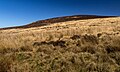
 Harrisend Fell - geograph.org.uk - 3273246.jpg 640 × 480; 263 KB
-
 Harrisend Fell - geograph.org.uk - 3273248.jpg 640 × 480; 289 KB
-
 Harrisend Fell - geograph.org.uk - 4435440.jpg 5,184 × 3,102; 1.73 MB
-
 Harrisend Fell - geograph.org.uk - 4435456.jpg 4,754 × 3,141; 1.7 MB
-
 Harrisend Fell - geograph.org.uk - 5024374.jpg 1,280 × 960; 949 KB
-
 Heather, Hayshaw Fell - geograph.org.uk - 1462089.jpg 640 × 480; 120 KB
-
 High Pressure Gas Pipe - geograph.org.uk - 4435342.jpg 4,894 × 2,931; 1.92 MB
-

-
 House and garden - geograph.org.uk - 3814371.jpg 640 × 460; 67 KB
-
 House at Four Lane Ends, Crosshill - geograph.org.uk - 1092959.jpg 640 × 425; 79 KB
-
 House on Station Lane - geograph.org.uk - 3814366.jpg 640 × 495; 64 KB
-

-
-
 Lambing time - geograph.org.uk - 2919722.jpg 1,600 × 1,200; 500 KB
-
 Lane and House near Cliftons - geograph.org.uk - 1298329.jpg 640 × 480; 107 KB
-
 Lane Head Development - geograph.org.uk - 1150694.jpg 640 × 426; 74 KB
-
 Lane leading to the ford at Syke's Farm - geograph.org.uk - 1092862.jpg 640 × 435; 115 KB
-
 Large Wind Turbine - geograph.org.uk - 2919763.jpg 1,600 × 1,200; 255 KB
-
 Lea Green Farm near Scorton - geograph.org.uk - 1092866.jpg 640 × 420; 79 KB
-
 Lodge, Scorton - geograph.org.uk - 5146667.jpg 640 × 449; 248 KB
-
 Looking north at the M6 - geograph.org.uk - 5841498.jpg 1,024 × 768; 391 KB
-

-
 Low water level at Grizedale Reservoir - geograph.org.uk - 2980617.jpg 640 × 480; 144 KB
-
 Lower Slopes of Harrison End Fell - geograph.org.uk - 5243781.jpg 3,264 × 1,836; 2.55 MB
-

-
 M6 Footbridge, Woodacre Great Wood - geograph.org.uk - 4032987.jpg 640 × 427; 227 KB
-
 M6 northbound - geograph.org.uk - 4173470.jpg 5,184 × 3,456; 2.21 MB
-
 M6 northbound - geograph.org.uk - 4257596.jpg 640 × 448; 30 KB
-
 M6 northbound - geograph.org.uk - 4257598.jpg 640 × 443; 34 KB
-
 M6 northbound - geograph.org.uk - 4257601.jpg 640 × 509; 42 KB
-
 M6 northbound at Scorton - geograph.org.uk - 2708668.jpg 3,012 × 2,177; 877 KB
-
 M6 Scorton - geograph.org.uk - 2475501.jpg 640 × 456; 50 KB
-
 M6 south near Lea Green - geograph.org.uk - 3341769.jpg 640 × 481; 36 KB
-

-
 M6 southbound near Park Wood - geograph.org.uk - 3342951.jpg 640 × 480; 39 KB
-
 M6 Southbound, Bridge Near Lea Green - geograph.org.uk - 2683622.jpg 640 × 480; 131 KB
-
 M6 Wyresdale Park - geograph.org.uk - 2475512.jpg 640 × 480; 61 KB
-
 M6, northbound - geograph.org.uk - 4510903.jpg 640 × 383; 32 KB
-
 M6, northbound - geograph.org.uk - 4510909.jpg 640 × 374; 21 KB
-
 M6, Snowhill Lane Bridge, Scorton - geograph.org.uk - 2683628.jpg 640 × 480; 142 KB
-
 Marker posts on Nicky Nook - geograph.org.uk - 2376948.jpg 640 × 479; 72 KB
-
 Meadow at Street - geograph.org.uk - 5403986.jpg 640 × 480; 314 KB
-
 Memorial seat on track to Grizedale - geograph.org.uk - 1298622.jpg 640 × 479; 107 KB
-
 Memorial Seat, Grizedale - geograph.org.uk - 1009268.jpg 640 × 426; 168 KB
-
 Moor's edge - geograph.org.uk - 3273242.jpg 640 × 480; 257 KB
-
 Moorland above Sykes Farm - geograph.org.uk - 3103881.jpg 2,816 × 2,112; 3.43 MB
-
 Moorland road - geograph.org.uk - 5024371.jpg 1,280 × 958; 764 KB
-
 Motorway bridge in the early morning - geograph.org.uk - 1867465.jpg 1,593 × 1,199; 285 KB
-
 Mucky Picture on Wyre Way - geograph.org.uk - 1009140.jpg 640 × 480; 143 KB
-
 Nether Wyresdale , Grassy Field - geograph.org.uk - 6300476.jpg 6,000 × 4,000; 5.51 MB
-
 Nether Wyresdale , M6 Motorway - geograph.org.uk - 6300473.jpg 6,000 × 4,000; 5.18 MB
-
 Nether Wyresdale , M6 Motorway - geograph.org.uk - 6300475.jpg 6,000 × 4,000; 5.19 MB
-
 Nether Wyresdale , M6 Motorway - geograph.org.uk - 6300479.jpg 6,000 × 4,000; 5.55 MB
-
 Nether Wyresdale, UK - panoramio (1).jpg 3,264 × 2,448; 2.3 MB
-
 Nether Wyresdale, UK - panoramio (10).jpg 3,264 × 2,448; 2.31 MB
-
 Nether Wyresdale, UK - panoramio (11).jpg 3,264 × 2,448; 2.17 MB
-
 Nether Wyresdale, UK - panoramio (12).jpg 3,264 × 2,448; 2.24 MB
-
 Nether Wyresdale, UK - panoramio (13).jpg 3,264 × 2,448; 2.26 MB
-
 Nether Wyresdale, UK - panoramio (14).jpg 3,264 × 2,448; 2.28 MB
-
 Nether Wyresdale, UK - panoramio (2).jpg 3,264 × 2,448; 1,020 KB
-
 Nether Wyresdale, UK - panoramio (3).jpg 3,264 × 2,448; 1.91 MB
-
 Nether Wyresdale, UK - panoramio (4).jpg 3,264 × 2,448; 2.02 MB
-
 Nether Wyresdale, UK - panoramio (5).jpg 3,264 × 2,448; 1.94 MB
-
 Nether Wyresdale, UK - panoramio (6).jpg 3,264 × 2,448; 2.25 MB
-
 Nether Wyresdale, UK - panoramio (7).jpg 3,264 × 2,448; 2.02 MB
-
 Nether Wyresdale, UK - panoramio (8).jpg 3,264 × 2,448; 2.12 MB
-
 Nether Wyresdale, UK - panoramio (9).jpg 3,264 × 2,448; 2 MB
-
 Nether Wyresdale, UK - panoramio.jpg 3,264 × 2,448; 2.25 MB
-
 New building at Street - geograph.org.uk - 2025618.jpg 640 × 480; 127 KB
-
 New cottages at Taylor's farm - geograph.org.uk - 2565398.jpg 640 × 480; 108 KB
-
 Nicky Nook - geograph.org.uk - 1029816.jpg 640 × 428; 50 KB
-
 Nicky nook - geograph.org.uk - 2413196.jpg 3,872 × 2,592; 2.63 MB
-
 Nicky Nook - geograph.org.uk - 3258274.jpg 1,600 × 1,200; 1.13 MB
-
 Nicky Nook toward Grizedale Fell - geograph.org.uk - 1637916.jpg 640 × 428; 68 KB
-
 No Through Shed - geograph.org.uk - 1174547.jpg 640 × 426; 121 KB
-
 Northbound M6, Scorton - geograph.org.uk - 3924222.jpg 640 × 480; 263 KB
-
 Northbound M6, Snowhill Lane Bridge - geograph.org.uk - 3924214.jpg 640 × 480; 286 KB
-
 Old gatepost, bridleway to Fell End - geograph.org.uk - 2980675.jpg 640 × 480; 85 KB
-
 Old Gateposts in Wyresdale Park - geograph.org.uk - 1174164.jpg 640 × 426; 158 KB
-

-
 Ordnance Survey Cut Mark - geograph.org.uk - 3934241.jpg 640 × 480; 90 KB
-
 Ordnance Survey Cut Mark - geograph.org.uk - 3934244.jpg 640 × 480; 104 KB
-
 Outdoor toilet by ruined cottage - geograph.org.uk - 2565390.jpg 480 × 640; 189 KB
-
 Outflow, Breast Moss Hole - geograph.org.uk - 1032089.jpg 640 × 480; 68 KB
-
 Park Brook near Scorton - geograph.org.uk - 2452172.jpg 640 × 480; 89 KB
-
 Park Brook near Scorton - geograph.org.uk - 2452174.jpg 640 × 482; 88 KB
-
 Park Gate Bridge - geograph.org.uk - 2452175.jpg 640 × 481; 68 KB
-
 Park Gate Bridge - geograph.org.uk - 4691541.jpg 4,294 × 2,522; 6.54 MB
_near_Fell_End_-_geograph.org.uk_-_4695150.jpg)


.jpg)
.jpg)
.jpg)
.jpg)
.jpg)
.jpg)
.jpg)
.jpg)
.jpg)
.jpg)
.jpg)
.jpg)
.jpg)
.jpg)


