Category:New Cut (Bristol)
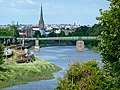
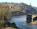
English: The River Avon in the New Cut, Bristol.
The New Cut is an artificial channel completed in 1809, re-routing the River Avon south of the new Bristol Floating Harbour.
part of the river Avon in Bristol, England, UK  | |||||
| Upload media | |||||
| Instance of | |||||
|---|---|---|---|---|---|
| Part of | |||||
| Location | City of Bristol, South West England, England | ||||
| Inception |
| ||||
| Tributary | |||||
 | |||||
Subcategories
This category has the following 5 subcategories, out of 5 total.
A
- Ashton Avenue Bridge (25 F)
B
G
- Gaol Ferry Bridge (18 F)
L
- Langton Street Bridge (20 F)
V
- Vauxhall Bridge (Bristol) (11 F)
Media in category "New Cut (Bristol)"
The following 49 files are in this category, out of 49 total.
-
 2023-09-14 Avon (New Cut) 01.jpg 6,000 × 4,000; 5.87 MB
-
 2023-09-14 Avon (New Cut) 02.jpg 6,000 × 4,000; 4.38 MB
-
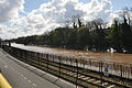
 Almost disused rail line along the New Cut, Bristol - geograph.org.uk - 2230521.jpg 3,897 × 2,923; 5.55 MB
-

-

-
 Avon New Cut at low tide - from Vauxhall Bridge - geograph.org.uk - 2230312.jpg 3,955 × 2,966; 5.11 MB
-
 Avon New Cut at Vauxhall Bridge from Ashton Bridge - geograph.org.uk - 2230321.jpg 4,000 × 3,000; 5.18 MB
-
 Avon New Cut, Bristol, England Sep2015 arp.jpg 4,000 × 3,000; 2.2 MB
-
-

-
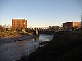 Bristol MMB W7 Cumberland Basin.jpg 2,304 × 1,728; 1.88 MB
-
 Bristol MMB «V3 Cumberland Basin.jpg 4,500 × 2,943; 5.78 MB
-
 Bristol MMB «V6 Bond Warehouses.jpg 4,389 × 2,784; 4.18 MB
-
 Chocblockpath.jpg 350 × 452; 209 KB
-
 Ferry plying the New Cut in Bristol - geograph.org.uk - 2235729.jpg 3,820 × 2,680; 3.9 MB
-
 Footbridge over the New Cut in Bristol (2246).jpg 4,288 × 2,848; 6.08 MB
-
 Footbridge over the New Cut in Bristol (2247).jpg 4,288 × 2,848; 5.81 MB
-
 Footbridge over the New Cut in Bristol (2251).jpg 4,288 × 2,848; 6.74 MB
-

-
 Looking across the New Cut - geograph.org.uk - 243907.jpg 640 × 480; 147 KB
-
 Malago ouflow, Avon New Cut, Bristol - geograph.org.uk - 1568902.jpg 640 × 438; 99 KB
-
 New Cut - geograph.org.uk - 1650654.jpg 640 × 426; 78 KB
-
 New Cut 01.jpg 480 × 640; 72 KB
-
 New Cut 02.jpg 640 × 480; 108 KB
-
 New Cut, Bristol, 1966 - geograph.org.uk - 3303762.jpg 512 × 640; 99 KB
-
 Pleasant prospect of Avon New Cut from above Ashton Bridge - geograph.org.uk - 2258160.jpg 3,716 × 2,674; 5.71 MB
-
-
 River Avon (New Cut) looking up river - geograph.org.uk - 210920.jpg 480 × 640; 102 KB
-
 River Avon from Bedminster Bridge - geograph.org.uk - 182046.jpg 480 × 640; 116 KB
-
 River Avon near Totterdown Basin - geograph.org.uk - 372093.jpg 640 × 480; 84 KB
-
 River Avon, Bristol - geograph.org.uk - 3456970.jpg 640 × 480; 83 KB
-
 River Avon, New Cut, Bristol - geograph.org.uk - 639330.jpg 640 × 480; 81 KB
-
 Rock outcropping, New Cut, Bedminster.jpg 4,000 × 3,000; 4.04 MB
-

-

-
-

-
 The New Cut - East from Vauxhall Bridge, Bristol - geograph.org.uk - 2232872.jpg 3,911 × 2,933; 4.39 MB
-
 The New Cut - geograph.org.uk - 372039.jpg 640 × 480; 75 KB
-
 The New Cut in Bristol (2245).jpg 4,288 × 2,848; 6.38 MB
-
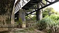
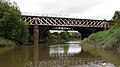
 The Railway Bridge across the New Cut - geograph.org.uk - 606565.jpg 640 × 481; 199 KB
-
 The River Avon from Langton Street Bridge - geograph.org.uk - 2452144.jpg 1,500 × 1,000; 196 KB
-
 The River Avon from Langton Street Bridge - geograph.org.uk - 2452145.jpg 1,500 × 1,000; 198 KB
-
 Towards Banana Bridge, Bristol - geograph.org.uk - 3878323.jpg 800 × 531; 99 KB
-
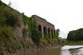
 Underfall - Portbury seen from a distance.JPG 1,366 × 910; 295 KB
-

-
-
 Wreck of the Glenbervie, West Indiaman at Bristol ILN 1849-0106-0016.jpg 930 × 690; 468 KB
-
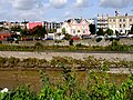
 General Hospital - geograph.org.uk - 372025.jpg 640 × 480; 101 KB
_01.jpg)
_02.jpg)


.jpg)
.jpg)
.jpg)


_looking_up_river_-_geograph.org.uk_-_210920.jpg)


.jpg)


