Category:New York State Route 25B
 | number: | (twenty-five) |
|---|---|---|
| State highways in New York (state): | 5 · 7 · 8 · 10 · 12 · 13 · 14 · 15 · 16 · 17 · 18 · 19 · 21 · 22 · 23 · 24 · 25 · 26 · 27 · 28 · 29 · 30 · 31 · 32 · 33 · 34 · 35 · 36 · 37 · 38 · 39 · 40 · 41 · 42 · 43 · 45 |
State highway on Long Island in New York, US  | |||||
| Upload media | |||||
| Instance of | |||||
|---|---|---|---|---|---|
| Location | New York | ||||
| Transport network | |||||
| Owned by | |||||
| Maintained by | |||||
| Length |
| ||||
| |||||
English: Media related to New York State Route 25B, a state highway in Queens and Nassau counties, New York.
Subcategories
This category has the following 3 subcategories, out of 3 total.
Media in category "New York State Route 25B"
The following 11 files are in this category, out of 11 total.
-
 East Williston LIRR Station Clock.JPG 4,000 × 3,000; 2.46 MB
-
 East Williston Station; Looking North.JPG 4,000 × 3,000; 2.63 MB
-
 Fading NY 25B shield in Queens.JPG 1,600 × 1,200; 271 KB
-
 LIRR Reflectors at Grade Crossing and East Williston LIRR Station.jpg 2,769 × 1,160; 1.44 MB
-
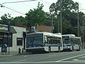
 MTA Hillside Av East 02.jpg 2,000 × 1,500; 684 KB
-
 MTA Hillside Av East 03.jpg 5,152 × 3,864; 7.73 MB
-
 MTA Hillside Av East 04.jpg 2,000 × 1,501; 714 KB
-
 MTA Hillside Av East 05.jpg 3,300 × 2,475; 1.74 MB
-
 MTA Hillside Av East 06.jpg 4,000 × 3,000; 2.26 MB
-
 New York State Route 25B Map.svg 1,027 × 609; 675 KB
-
 NY-25B.svg 750 × 600; 7 KB


