Category:Newbiggin-by-the-Sea
town in Northumberland, United Kingdom  | |||||
| Upload media | |||||
| Instance of | |||||
|---|---|---|---|---|---|
| Location | Newbiggin by the Sea, Northumberland, North East England, England | ||||
 | |||||
English: Newbiggin-by-the-Sea is a small town in Northumberland, England, lying on the North Sea coast. Once an important port for shipping grain and a coal mining town, it is still a small fishing port making use of traditional coble boats.
Italiano: Newbiggin-by-the-Sea è un paese di 7.100 abitanti della contea del Northumberland, in Inghilterra.
Nederlands: Newbiggin-by-the-Sea is een plaats in het bestuurlijke gebied Wansbeck, in het Engelse graafschap Northumberland. De plaats telt 7.100 inwoners.
Română: Newbiggin-by-the-Sea este un oraş şi o staţiune turistică litorală în comitatul Northumberland, regiunea North East, Anglia. Oraşul se află în districtul Wansbeck.
Subcategories
This category has the following 6 subcategories, out of 6 total.
A
P
R
W
Media in category "Newbiggin-by-the-Sea"
The following 200 files are in this category, out of 328 total.
(previous page) (next page)-
 "Couple" on the breakwater, Newbiggin-by-the-Sea - geograph.org.uk - 4953039.jpg 2,048 × 1,536; 867 KB
-
 "Orchard End" - geograph.org.uk - 3014279.jpg 640 × 480; 148 KB
-
 "The all weather sledge" - geograph.org.uk - 3014270.jpg 640 × 480; 135 KB
-
 "The delivery boy" - geograph.org.uk - 3014275.jpg 640 × 480; 158 KB
-
 "The puncture" - geograph.org.uk - 3014282.jpg 640 × 480; 133 KB
-
 "Waiting for the train that never comes" - geograph.org.uk - 3014272.jpg 640 × 480; 147 KB
-
 2013-07-25 Ichthyaetus melanocephalus, Newbiggin, Northumberland 1.jpg 3,200 × 2,400; 3.58 MB
-
 2013-07-25 Ichthyaetus melanocephalus, Newbiggin, Northumberland 2.jpg 3,200 × 2,400; 2.79 MB
-
 2013-07-25 Ichthyaetus melanocephalus, Newbiggin, Northumberland 3.jpg 3,200 × 2,400; 3.19 MB
-
 2013-07-25 Ichthyaetus melanocephalus, Newbiggin, Northumberland 4.jpg 3,200 × 2,400; 3.1 MB
-
 2013-07-25 Ichthyaetus melanocephalus, Newbiggin, Northumberland 5.jpg 3,200 × 2,400; 3.02 MB
-
 2016-10-31 Ichthyaetus melanocephalus, Newbiggin, Northumberland 1.jpg 4,000 × 3,000; 6.56 MB
-
 2016-10-31 Ichthyaetus melanocephalus, Newbiggin, Northumberland 2.jpg 3,600 × 2,700; 5.15 MB
-
 2016-10-31 Ichthyaetus melanocephalus, Newbiggin, Northumberland 3.jpg 3,600 × 2,700; 3.67 MB
-
 A miner's coal cart on Collingwood Road - geograph.org.uk - 3320381.jpg 800 × 600; 131 KB
-

-
 A small protected sandy bay - geograph.org.uk - 4175264.jpg 1,600 × 1,096; 279 KB
-

-
 A view across Newbiggin bay - geograph.org.uk - 3182137.jpg 1,975 × 1,920; 1.35 MB
-
 A189 Bridge over the River Wansbeck - geograph.org.uk - 4382645.jpg 3,264 × 2,448; 3.01 MB
-
 A189 heading south - geograph.org.uk - 3407114.jpg 640 × 480; 41 KB
-
 A189 passing a Premier Inn - geograph.org.uk - 5834816.jpg 1,024 × 749; 86 KB
-
 Admiralty Chart No 1192 Hartlepool to St. Abb's Head, Published 1879.jpg 11,117 × 16,245; 59.14 MB
-
 Alcan Lynemouth power station - geograph.org.uk - 2894825.jpg 3,008 × 2,000; 1.57 MB
-
 Approaching Woodburn - geograph.org.uk - 4175312.jpg 1,600 × 1,255; 257 KB
-
 Arable field near Newbiggin - geograph.org.uk - 4948674.jpg 2,048 × 1,536; 1.18 MB
-
 Arable land and caravans - geograph.org.uk - 4953121.jpg 2,048 × 1,536; 1.08 MB
-
 Ash lagoon access, Lynemouth Power Station - geograph.org.uk - 5662080.jpg 2,000 × 1,500; 379 KB
-
 Attlee Cottages Newbiggin-by-the-sea - geograph.org.uk - 1536522.jpg 640 × 480; 65 KB
-
 B1334 towards Newbiggin-By-The-Sea - geograph.org.uk - 3047929.jpg 640 × 480; 70 KB
-
 Back across the bay - geograph.org.uk - 3182130.jpg 2,560 × 1,568; 1.54 MB
-
-
 Beach at Newbiggin-by-the-Sea - geograph.org.uk - 4841645.jpg 1,024 × 678; 164 KB
-
 Beach beside Newbiggin Moor - geograph.org.uk - 4799015.jpg 1,600 × 1,176; 208 KB
-

-

-
 Beach, Newbiggin Bay - geograph.org.uk - 3048746.jpg 640 × 480; 45 KB
-
 Beacon Point Newbiggin-by -the Sea - geograph.org.uk - 1536501.jpg 640 × 480; 54 KB
-
 Benches at Newbiggin - geograph.org.uk - 590886.jpg 640 × 399; 66 KB
-
 Biomass silos, Lynemouth Power Station - geograph.org.uk - 5662100.jpg 2,000 × 1,500; 403 KB
-
 Boats at Newbiggin - geograph.org.uk - 4179828.jpg 640 × 428; 88 KB
-
 Boats on the River Wansbeck - geograph.org.uk - 5924642.jpg 640 × 414; 48 KB
-
 Bowls club, Newbiggin-by-the-Sea - geograph.org.uk - 4953062.jpg 2,048 × 1,536; 1.08 MB
-
 Breakwater, Newbiggin Bay - geograph.org.uk - 1777783.jpg 640 × 480; 90 KB
-
 Breakwaters at Newbiggin Bay - geograph.org.uk - 5925846.jpg 640 × 406; 65 KB
-
 Bridge for railway to Alcan Works - geograph.org.uk - 2879611.jpg 2,918 × 2,189; 997 KB
-

-
 Cafe Riviera, Newbiggin-by-the-Sea - geograph.org.uk - 358861.jpg 640 × 469; 116 KB
-

-
 Car park at Newbiggin Point - geograph.org.uk - 4057026.jpg 640 × 345; 33 KB
-
 Caravan site, Newbiggin - geograph.org.uk - 3396389.jpg 1,181 × 785; 638 KB
-
 Caravan Site, Newbiggin by the Sea - geograph.org.uk - 560718.jpg 640 × 480; 60 KB
-
 Caravans on the coast - geograph.org.uk - 4953108.jpg 2,048 × 1,536; 942 KB
-
 Central Parkway, Newbiggin-by-the-Sea - geograph.org.uk - 3320262.jpg 800 × 600; 174 KB
-
 Central Parkway, Newbiggin-by-the-Sea - geograph.org.uk - 4841679.jpg 1,024 × 678; 109 KB
-
 Church Point, Newbiggin-by-the-Sea - geograph.org.uk - 4598963.jpg 4,608 × 3,456; 3.02 MB
-

-
 Cliff Top View - geograph.org.uk - 4429769.jpg 274 × 206; 9 KB
-
 Cliffs South of Newbiggin - geograph.org.uk - 946739.jpg 640 × 480; 99 KB
-
 Coast and caravans at Newbiggin Point - geograph.org.uk - 4954570.jpg 2,048 × 1,536; 874 KB
-
 Coast north of Newbiggin Point - geograph.org.uk - 3738773.jpg 1,600 × 1,116; 271 KB
-
 Coastal footpath on Newbiggin Links - geograph.org.uk - 4953093.jpg 2,048 × 1,536; 1.11 MB
-
 Coble fishing boats - geograph.org.uk - 1216238.jpg 640 × 480; 54 KB
-
 Cobles at Newbiggin - geograph.org.uk - 4841660.jpg 1,024 × 678; 171 KB
-
 Cobles safely above high tide - geograph.org.uk - 6080000.jpg 1,600 × 972; 270 KB
-

-
 Couple on the breakwater - geograph.org.uk - 4824166.jpg 1,600 × 1,102; 305 KB
-
 Couple sculpture, Newbiggin-by-the-Sea - geograph.org.uk - 4954545.jpg 1,536 × 2,048; 1.06 MB
-
 Couple, by artist Sean Henry - geograph.org.uk - 5925387.jpg 640 × 428; 54 KB
-
 Couple, Newbiggin-By-The-Sea - geograph.org.uk - 3048755.jpg 1,216 × 784; 111 KB
-
 Cycle and footpath - geograph.org.uk - 3268225.jpg 480 × 640; 318 KB
-
 Cycle and pedestrian path - geograph.org.uk - 4702406.jpg 1,200 × 1,513; 471 KB
-
 Cycle track towards Lynemouth - geograph.org.uk - 3048811.jpg 640 × 480; 68 KB
-
 Cyclepath to Woodhorn - geograph.org.uk - 4842564.jpg 1,024 × 678; 143 KB
-
 Delis Carrs at Newbiggin Point - geograph.org.uk - 2879415.jpg 2,918 × 2,189; 945 KB
-
 Descending to Newbiggin Bay - geograph.org.uk - 947188.jpg 640 × 480; 74 KB
-
 Disused Post Office, Newbiggin-by-the-Sea - geograph.org.uk - 5101960.jpg 1,024 × 682; 171 KB
-
 Disused road near Woodhorn - geograph.org.uk - 5924492.jpg 640 × 430; 88 KB
-
 Disused road to Woodhorn - geograph.org.uk - 5924482.jpg 640 × 445; 74 KB
-
 Dunes at the mouth of the River Wansbeck - geograph.org.uk - 4175248.jpg 1,600 × 1,079; 238 KB
-
 East Lea Estate, Newbiggin - geograph.org.uk - 1191011.jpg 640 × 480; 64 KB
-
 East Lea, Newbiggin-by-the-Sea - geograph.org.uk - 5662054.jpg 2,000 × 1,500; 305 KB
-
 Elizabeth II Postbox, Front Street - geograph.org.uk - 5101961.jpg 682 × 1,024; 161 KB
-

-
 England Coast Path at Newbiggin Moor - geograph.org.uk - 5925862.jpg 640 × 426; 75 KB
-

-

-

-

-
 Entrance to the Allotments - geograph.org.uk - 2452302.jpg 480 × 640; 77 KB
-
 Eroding cliffs at Newbiggin Links - geograph.org.uk - 4953103.jpg 2,048 × 1,536; 1.1 MB
-
 Erosion at Beacon Point - geograph.org.uk - 4799023.jpg 1,600 × 1,221; 359 KB
-
 Erosion at Beacon Point - geograph.org.uk - 4799030.jpg 1,600 × 1,119; 237 KB
-

-
 Farmland and wind turbine off the A189 - geograph.org.uk - 3407110.jpg 1,024 × 770; 86 KB
-
 Farmland near Newbiggin by the Sea - geograph.org.uk - 3048708.jpg 640 × 458; 68 KB
-
 Farmland near Newbiggin-By-The-Sea - geograph.org.uk - 3047928.jpg 640 × 480; 69 KB
-
-
 Flooded road - geograph.org.uk - 2291778.jpg 4,000 × 3,000; 5.1 MB
-

-
 Flying a drone on Newbiggin Point - geograph.org.uk - 4823342.jpg 1,600 × 1,257; 323 KB
-
 Footpath approaching Lynemouth Power Station - geograph.org.uk - 5662077.jpg 2,000 × 1,500; 390 KB
-

-
 Footpath between Ashington and Newbiggin-by-the-Sea - geograph.org.uk - 4948681.jpg 1,536 × 2,048; 960 KB
-
 Forever looking out to sea - geograph.org.uk - 5865304.jpg 640 × 480; 221 KB
-
 From Spital Point to Newbiggin Point - geograph.org.uk - 3564128.jpg 3,648 × 2,736; 4.77 MB
-
 Front Street, Newbiggin by the Sea - geograph.org.uk - 1459216.jpg 640 × 480; 81 KB
-
 Front Street, Newbiggin-by-the-Sea - geograph.org.uk - 5662040.jpg 2,000 × 1,500; 358 KB
-
 George VI Postbox, High Street - geograph.org.uk - 5101969.jpg 682 × 1,024; 226 KB
-
 Golf course and power station - geograph.org.uk - 5662070.jpg 2,000 × 1,500; 256 KB
-
 Hawks Cliff near Newbiggin-by-the-Sea - geograph.org.uk - 5924910.jpg 640 × 459; 115 KB
-
 Health Centre, Newbiggin-by-the-Sea - geograph.org.uk - 4952976.jpg 2,048 × 1,536; 923 KB
-
-
 High Street, Newbiggin-By-The-Sea - geograph.org.uk - 3048764.jpg 640 × 480; 70 KB
-
 High Street, Newbiggin-by-the-Sea - geograph.org.uk - 5101972.jpg 1,024 × 682; 177 KB
-
 Hirst Middle School Fields - geograph.org.uk - 69525.jpg 640 × 480; 63 KB
-
 House at Woodhorn - geograph.org.uk - 4175237.jpg 1,600 × 1,178; 295 KB
-
 Houses on Woodhorn Road - geograph.org.uk - 3048774.jpg 640 × 384; 55 KB
-
 Houses, Newbiggin-By-The-Sea - geograph.org.uk - 3048771.jpg 640 × 480; 79 KB
-
 How does it DO that^ - geograph.org.uk - 5289791.jpg 1,445 × 2,035; 1.78 MB
-
 Hully Rocks at Newbiggin Bay - geograph.org.uk - 5925397.jpg 640 × 480; 99 KB
-
 Last pub before Norway - geograph.org.uk - 1536466.jpg 640 × 480; 65 KB
-
 Launching the boat - geograph.org.uk - 3014285.jpg 640 × 480; 50 KB
-
 Lifeboat House and launching ramp - geograph.org.uk - 3738762.jpg 1,600 × 1,022; 208 KB
-
 Lifeboat Newbggin by the sea - geograph.org.uk - 537389.jpg 640 × 480; 78 KB
-
 Lifeboat on the beach - geograph.org.uk - 3182080.jpg 2,560 × 1,920; 1.63 MB
-
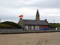
 Lifeboat Station, Newbiggin - geograph.org.uk - 5101964.jpg 1,024 × 682; 147 KB
-

-
 Lifeboat Station, Newbiggin-by-the-Sea - geograph.org.uk - 4954551.jpg 2,048 × 1,536; 789 KB
-
 Local shops, Newbiggin-by-the-Sea - geograph.org.uk - 4952990.jpg 2,048 × 1,536; 879 KB
-
 Looking back to Newbiggin Point - geograph.org.uk - 4821493.jpg 1,600 × 1,200; 287 KB
-
 Looking from Beacon End towards Delis Carrs - geograph.org.uk - 4821424.jpg 1,600 × 1,200; 375 KB
-
 Looking north along the cliff bottom, Newbiggin Links - geograph.org.uk - 4953117.jpg 2,048 × 1,536; 954 KB
-
 Looking north from Beacon End - geograph.org.uk - 4821429.jpg 1,600 × 1,130; 317 KB
-
 Looking out to sea past the Couple, Newbiggin-by-the-Sea - geograph.org.uk - 4954549.jpg 2,048 × 1,536; 971 KB
-
 Looking over Beacon End and Delis Carrs - geograph.org.uk - 4821507.jpg 1,600 × 1,200; 465 KB
-
 Looking over Mary's Dub - geograph.org.uk - 4821502.jpg 1,600 × 1,288; 332 KB
-
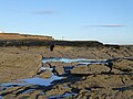
 Low cliffs at Beacon Point - geograph.org.uk - 5925933.jpg 640 × 480; 75 KB
-
 Low tide in Newbiggin Bay - geograph.org.uk - 5865300.jpg 640 × 480; 241 KB
-

-
 Lynemouth aluminium smelter - geograph.org.uk - 3268091.jpg 640 × 480; 270 KB
-
 Lynemouth Power Station - geograph.org.uk - 2988999.jpg 4,320 × 3,240; 4.73 MB
-
 Lynemouth power station - geograph.org.uk - 4179819.jpg 640 × 428; 92 KB
-
 Lynemouth Power Station - geograph.org.uk - 5662083.jpg 2,000 × 1,500; 325 KB
-
 Lynemouth Power Station - geograph.org.uk - 5925978.jpg 640 × 464; 71 KB
-
 Lynemouth Smelter - geograph.org.uk - 1636364.jpg 640 × 480; 57 KB
-
 Lynemouth Windfarm - geograph.org.uk - 4702263.jpg 1,600 × 1,154; 150 KB
-
 Lynemouth Windfarm - geograph.org.uk - 4702293.jpg 1,600 × 1,154; 233 KB
-
 Mare and foal on Newbiggin Moor - geograph.org.uk - 3138171.jpg 1,600 × 1,115; 207 KB
-
 Mary's Dub - geograph.org.uk - 4821491.jpg 1,600 × 1,200; 372 KB
-
 Mary's Dub at Newbiggin Point - geograph.org.uk - 2879401.jpg 3,648 × 2,736; 1.65 MB
-
 Meldon Terrace, Newbiggin-by-the-Sea - geograph.org.uk - 4953123.jpg 2,048 × 1,536; 982 KB
-
 Memorial Park gate, Newbiggin-by-the-Sea - geograph.org.uk - 4948704.jpg 2,048 × 1,536; 1.11 MB
-
 Memorial Park, Newbiggin-by-the-Sea - geograph.org.uk - 4948705.jpg 2,048 × 1,536; 1.36 MB
-
 Mineral railway line bridge - geograph.org.uk - 4702422.jpg 1,600 × 1,149; 245 KB
-
 Modern houses above the beach - geograph.org.uk - 5865282.jpg 640 × 480; 284 KB
-
 Mouth of the River Wansbeck - geograph.org.uk - 4175255.jpg 1,600 × 1,022; 225 KB
-
 Multi-use route to Lynemouth - geograph.org.uk - 2875510.jpg 3,648 × 2,736; 3.79 MB
-
 NCN signpost and windmill - geograph.org.uk - 4179821.jpg 640 × 428; 110 KB
-

-
 New houses on William Hopkinson Way - geograph.org.uk - 3320273.jpg 800 × 600; 105 KB
-

-
 Newbiggin Bay - geograph.org.uk - 1458356.jpg 640 × 360; 58 KB
-
 Newbiggin Bay - geograph.org.uk - 1777779.jpg 640 × 480; 62 KB
-
 Newbiggin Bay - geograph.org.uk - 298886.jpg 640 × 480; 52 KB
-
 Newbiggin Bay - geograph.org.uk - 3014287.jpg 480 × 640; 74 KB
-
 Newbiggin Bay - geograph.org.uk - 348022.jpg 640 × 476; 66 KB
-
 Newbiggin Bay - geograph.org.uk - 3738043.jpg 1,600 × 1,113; 256 KB
-
 Newbiggin Bay - geograph.org.uk - 4057015.jpg 640 × 480; 66 KB
-
 Newbiggin Bay - geograph.org.uk - 4953052.jpg 2,048 × 1,536; 926 KB
-
 Newbiggin bay - geograph.org.uk - 537321.jpg 640 × 480; 65 KB
-
 Newbiggin bay - geograph.org.uk - 537353.jpg 640 × 480; 79 KB
-
 Newbiggin Bay - geograph.org.uk - 5865286.jpg 640 × 480; 255 KB
-
 Newbiggin Bay from Church Point - geograph.org.uk - 4163217.jpg 4,000 × 2,248; 3.65 MB
-
 Newbiggin by the Sea, UK - panoramio.jpg 6,000 × 4,000; 11.51 MB
-
 Newbiggin Golf Club - geograph.org.uk - 4799020.jpg 1,600 × 1,200; 243 KB
-
 Newbiggin Golf Club - geograph.org.uk - 5662067.jpg 2,000 × 1,500; 439 KB
-
 Newbiggin Maritime Centre - geograph.org.uk - 2879390.jpg 3,648 × 2,736; 2.15 MB
-
 Newbiggin Maritime Centre, Newbiggin-by-the-Sea - geograph.org.uk - 4954561.jpg 2,048 × 1,536; 841 KB
-
 Newbiggin Moor Golf Links - geograph.org.uk - 5925949.jpg 640 × 402; 42 KB
-
 Newbiggin Point - geograph.org.uk - 3228567.jpg 3,264 × 2,448; 1.58 MB
-
 Newbiggin Point - geograph.org.uk - 348015.jpg 640 × 471; 64 KB
-
 Newbiggin Point - geograph.org.uk - 3564107.jpg 3,648 × 2,736; 3.58 MB
-
 Newbiggin Point - geograph.org.uk - 3738782.jpg 1,600 × 1,103; 232 KB
-

-
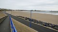
 Newbiggin Promenade - geograph.org.uk - 5865310.jpg 640 × 480; 261 KB
-
 Newbiggin sea front - geograph.org.uk - 5865307.jpg 640 × 480; 223 KB
-
 Newbiggin-by-the-sea (Northumberland, England).jpg 3,264 × 1,836; 723 KB
-
 Newbiggin-by-the-Sea - geograph.org.uk - 3564121.jpg 3,648 × 2,736; 4.61 MB
-
 Newbiggin-by-The-Sea - geograph.org.uk - 4179833.jpg 640 × 428; 75 KB
-
 Newbiggin-by-The-Sea through hole in Spital Point - geograph.org.uk - 5289813.jpg 3,264 × 2,448; 2.3 MB
-

-
 Ocean View, (that's the name of the short street) - geograph.org.uk - 4032244.jpg 1,600 × 1,200; 387 KB
-
 Off Woodhorn Lane - geograph.org.uk - 4179823.jpg 640 × 428; 77 KB
-
 Old Cable House Sign - geograph.org.uk - 888569.jpg 426 × 640; 57 KB
-
 Old World War II pillbox at Spital Point - geograph.org.uk - 5865292.jpg 640 × 480; 270 KB
-
 On Mary's Dub - geograph.org.uk - 4824390.jpg 1,600 × 1,200; 396 KB
-
 Ordnance Survey Cut Mark - geograph.org.uk - 4710582.jpg 480 × 640; 143 KB
-
 Ordnance Survey Cut Mark - geograph.org.uk - 4710587.jpg 480 × 640; 104 KB
-
 Ordnance Survey Cut Mark - geograph.org.uk - 4710596.jpg 640 × 480; 91 KB


.jpg)


_towards_Newbiggin-By-The-Sea_-_geograph.org.uk_-_3048721.jpg)
_-_geograph.org.uk_-_4032244.jpg)


