Category:Newchapel, Surrey
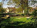
English: Newchapel is a village in Surrey, England. It lies on the A22 between Godstone and East Grinstead. It is the location of the London England Temple of The Church of Jesus Christ of Latter-day Saints known as the Mormon Church. The temple, only open to followers of that religious group, has a visitors' centre where the beliefs of the Mormons are explained; visitors can also stroll in the grounds. The closest villages are Lingfield, Felbridge, Copthorne and Blindley Heath.
village in Surrey, England, United Kingdom | |||||
| Upload media | |||||
| Instance of | |||||
|---|---|---|---|---|---|
| Location | |||||
 | |||||
Subcategories
This category has the following 2 subcategories, out of 2 total.
B
L
- London England Temple (1 P, 8 F)
Media in category "Newchapel, Surrey"
The following 16 files are in this category, out of 16 total.
-
 Barns at Meadhurst Farm, Newchapel, Surrey - geograph.org.uk - 1930722.jpg 3,872 × 2,592; 2.49 MB
-
 Bridleway Through the Woods, Newchapel, Surrey - geograph.org.uk - 2607382.jpg 3,051 × 2,025; 7.76 MB
-
 Bridleway Through the Woods, Newchapel, Surrey - geograph.org.uk - 2607387.jpg 1,865 × 2,802; 5.84 MB
-
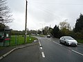 Eastbourne Road (A22), Newchapel - geograph.org.uk - 2334764.jpg 4,320 × 3,240; 4.06 MB
-
 Eastbourne Road (A22), Newchapel - geograph.org.uk - 2334778.jpg 4,320 × 3,240; 4.47 MB
-
 Footpath adjacent to British Wildlife Centre - geograph.org.uk - 3485962.jpg 4,000 × 3,000; 3.53 MB
-
 Footpath at Newchapel, Surrey - geograph.org.uk - 1931376.jpg 2,592 × 3,872; 4.75 MB
-
 Gate House Farm - geograph.org.uk - 196737.jpg 640 × 480; 169 KB
-
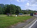 Junction of the A22 and B2028, Newchapel - geograph.org.uk - 2459258.jpg 1,600 × 1,200; 600 KB
-
 Layby on Eastbourne Road, Newchapel - geograph.org.uk - 2601029.jpg 1,600 × 1,200; 214 KB
-
 Newchapel Road (B2028), Surrey - geograph.org.uk - 210168.jpg 640 × 480; 135 KB
-
 Shawlands, Newchapel, Surrey - geograph.org.uk - 2045116.jpg 4,592 × 3,056; 4.79 MB
-
 Sheep at Newchapel, Surrey - geograph.org.uk - 2045140.jpg 4,592 × 3,056; 4.48 MB
-
 The Blacksmith Head, Newchapel - geograph.org.uk - 3690974.jpg 800 × 532; 208 KB
-
 View Towards Shawlands, Newchapel, Surrey - geograph.org.uk - 1931383.jpg 3,872 × 2,592; 5.18 MB
-
 West Park Road, Newchapel - geograph.org.uk - 2458629.jpg 1,600 × 1,200; 580 KB


,_Newchapel_-_geograph.org.uk_-_2334764.jpg)
,_Newchapel_-_geograph.org.uk_-_2334778.jpg)


,_Surrey_-_geograph.org.uk_-_210168.jpg)


