Category:Newton Flotman
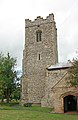
English: Newton Flotman is a village and civil parish in the English county of Norfolk. It lies north of Tasburgh and south of Swainsthorpe, and the River Tas flows through it.
village in the United Kingdom | |||||
| Upload media | |||||
| Instance of | |||||
|---|---|---|---|---|---|
| Location | South Norfolk, Norfolk, East of England, England | ||||
| Area |
| ||||
 | |||||
Subcategories
This category has the following 3 subcategories, out of 3 total.
Media in category "Newton Flotman"
The following 131 files are in this category, out of 131 total.
-
 13 feet headroom - geograph.org.uk - 4356066.jpg 1,005 × 768; 554 KB
-
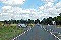
 A140 - geograph.org.uk - 4272784.jpg 640 × 359; 63 KB
-

-
 A140 Ipswich Road, Newton Flotman - geograph.org.uk - 4227536.jpg 3,068 × 2,257; 1.33 MB
-
 A140 Ipswich Road, Swainsthorpe - geograph.org.uk - 4227275.jpg 3,072 × 2,304; 1.9 MB
-
 A140, Newton Flotman - geograph.org.uk - 4272772.jpg 640 × 430; 52 KB
-
 A140, Newton Flotman - geograph.org.uk - 5877245.jpg 1,024 × 684; 216 KB
-
 A140, northbound - geograph.org.uk - 4272778.jpg 640 × 370; 57 KB
-
 Access road to Waterside Gardens - geograph.org.uk - 6278771.jpg 800 × 574; 142 KB
-
 Alan King Playing Field - geograph.org.uk - 4227624.jpg 3,072 × 2,304; 1.97 MB
-
 Barley View Barn, Greenways - geograph.org.uk - 4357331.jpg 1,024 × 768; 300 KB
-
 Brick Kiln Lane, Swainsthorpe - geograph.org.uk - 4227198.jpg 2,856 × 2,145; 2.87 MB
-
 Brick Kiln Lane, Swainsthorpe - geograph.org.uk - 4227270.jpg 3,072 × 2,304; 1.43 MB
-

-
 Church Road sign - geograph.org.uk - 4227649.jpg 3,072 × 2,304; 3.22 MB
-
 Church Road ^ St.Mary's Church - geograph.org.uk - 4227570.jpg 3,072 × 2,304; 1.89 MB
-
 Church Road, Newton Flotman - geograph.org.uk - 4227596.jpg 3,072 × 2,205; 1.79 MB
-
 Church Road, Newton Flotman - geograph.org.uk - 4227640.jpg 3,072 × 2,304; 1.87 MB
-
 Close view of Brick Kiln Lane railway bridge - geograph.org.uk - 4356068.jpg 1,024 × 768; 538 KB
-
 Cottage with painted birds - geograph.org.uk - 4356029.jpg 1,254 × 1,089; 794 KB
-
 Cottages old and new in Old Street - geograph.org.uk - 1756170.jpg 640 × 444; 100 KB
-
 Crop field south of Brickkiln Lane - geograph.org.uk - 4590918.jpg 640 × 480; 120 KB
-
 Cut Mark Newton Flotman St Marys Church - geograph.org.uk - 6022060.jpg 640 × 640; 203 KB
-
 Electricity pylon, Newton Flotman - geograph.org.uk - 276019.jpg 480 × 640; 71 KB
-

-
 Entering Newton Flotman on the A140 Ipswich Road - geograph.org.uk - 4227560.jpg 3,072 × 2,304; 1.85 MB
-
 Entering Newton Flotman, A140 - geograph.org.uk - 4272770.jpg 640 × 380; 57 KB
-
 Entrance to New Crane's Farm - geograph.org.uk - 4357326.jpg 1,024 × 768; 480 KB
-
 Farmland near Mulbarton - geograph.org.uk - 4406414.jpg 2,592 × 1,944; 1.78 MB
-
 Farmland near New Crane's Farm - geograph.org.uk - 4710458.jpg 640 × 399; 41 KB
-
 Field boundary hedge by Monk's Farm - geograph.org.uk - 4217934.jpg 640 × 480; 224 KB
-
 Field gate by Monk's Farm - geograph.org.uk - 4217926.jpg 640 × 480; 213 KB
-
 Fields north of Newton Flotman - geograph.org.uk - 4217921.jpg 640 × 480; 225 KB
-
 Flooded Ford at Shotesham Mill - geograph.org.uk - 3841763.jpg 3,872 × 2,592; 4.84 MB
-
 Flooded road at Mill Lane ford - geograph.org.uk - 4356115.jpg 1,024 × 768; 533 KB
-
 Flooded road at Mill Lane ford - geograph.org.uk - 4356123.jpg 1,024 × 768; 531 KB
-

-
 Ford at Shotesham Mill - geograph.org.uk - 2922790.jpg 3,872 × 2,592; 2.4 MB
-
 Ford on the River Tas - geograph.org.uk - 2143282.jpg 640 × 480; 163 KB
-
 Ford on the River Tas - geograph.org.uk - 2143284.jpg 480 × 640; 168 KB
-
 Ford on the River Tas - geograph.org.uk - 2143288.jpg 640 × 480; 169 KB
-
 Gate and Field Scene - geograph.org.uk - 349676.jpg 640 × 480; 138 KB
-
 Gate into a pasture by Monk's Farm - geograph.org.uk - 4217932.jpg 640 × 480; 249 KB
-
 Greenways near New Crane's Farm - geograph.org.uk - 4357330.jpg 1,024 × 768; 552 KB
-
 Greer House - geograph.org.uk - 6278779.jpg 800 × 580; 113 KB
-
 Grove Way sign - geograph.org.uk - 4227606.jpg 3,011 × 2,262; 3.37 MB
-
 House in Church Road - geograph.org.uk - 1415616.jpg 640 × 480; 93 KB
-

-
 Level crossing at Newton Flotman - geograph.org.uk - 276011.jpg 640 × 479; 121 KB
-
 Level crossing at Newton Greenways - geograph.org.uk - 4356030.jpg 1,024 × 768; 418 KB
-
 Medieval bridge over the River Tas - geograph.org.uk - 1756235.jpg 640 × 480; 140 KB
-
 Mill Lane - geograph.org.uk - 4590920.jpg 640 × 480; 99 KB
-
 Mill Lane, Shotesham - geograph.org.uk - 4356130.jpg 1,024 × 768; 592 KB
-
 Monk's Farm - geograph.org.uk - 1416081.jpg 640 × 480; 103 KB
-
 Mulbarton Lane - geograph.org.uk - 1415681.jpg 640 × 480; 108 KB
-
 New mast beside the railway line - geograph.org.uk - 4217924.jpg 480 × 640; 180 KB
-
 Newton Flotman St Mary's church - geograph.org.uk - 2212651.jpg 640 × 480; 161 KB
-
 Newton Flotman Village Centre - geograph.org.uk - 4227632.jpg 3,072 × 2,304; 1.96 MB
-
 Newton Flotman Village Centre sign - geograph.org.uk - 4227618.jpg 2,223 × 2,967; 4.05 MB
-
 Newton Flotman Village Name sign - geograph.org.uk - 4227562.jpg 2,304 × 3,072; 3.78 MB
-
 Newton Flotman village sign - geograph.org.uk - 4356053.jpg 1,008 × 768; 217 KB
-
 Northbound A140 - geograph.org.uk - 5877248.jpg 1,024 × 684; 178 KB
-
 Old bridge over the River Tas - geograph.org.uk - 1756232.jpg 640 × 480; 126 KB
-
 Old Bridge sign on Brick Kiln Lane - geograph.org.uk - 4227254.jpg 3,072 × 2,304; 1.86 MB
-
 Old John - geograph.org.uk - 6278789.jpg 800 × 585; 107 KB
-
 Old John - geograph.org.uk - 6278790.jpg 800 × 603; 119 KB
-
 Old signpost without signs - geograph.org.uk - 1415702.jpg 480 × 640; 159 KB
-
 Path to Monk's Farm - geograph.org.uk - 1416105.jpg 640 × 480; 116 KB
-
 Ploughed field by The Firs - geograph.org.uk - 4217930.jpg 640 × 480; 225 KB
-
 Post Office Telephones access cover - geograph.org.uk - 6278775.jpg 800 × 606; 251 KB
-
 Pound Lane sign - geograph.org.uk - 4227544.jpg 2,930 × 2,201; 1.97 MB
-
 Pound Lane, Newton Flotman - geograph.org.uk - 4227542.jpg 3,072 × 2,227; 1.52 MB
-
 Public footpath to Greenways - geograph.org.uk - 1416091.jpg 640 × 480; 97 KB
-
 Public footpath to Mulbarton - geograph.org.uk - 1416088.jpg 640 × 480; 125 KB
-
 Pumping station - geograph.org.uk - 1415629.jpg 640 × 480; 126 KB
-
 Railway bridge 342 - geograph.org.uk - 1415691.jpg 640 × 480; 124 KB
-
 Railway bridge 342 - geograph.org.uk - 4217915.jpg 640 × 480; 255 KB
-
 Railway Bridge 343 - geograph.org.uk - 1818593.jpg 1,600 × 1,200; 780 KB
-
 Railway bridge near Newton Greenways - geograph.org.uk - 4356045.jpg 1,024 × 751; 614 KB
-
 Railway bridge near Newton Greenways - geograph.org.uk - 4356060.jpg 1,024 × 768; 427 KB
-
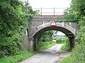
 Railway Bridge on Brick Kiln Lane - geograph.org.uk - 4227244.jpg 3,072 × 2,304; 1.95 MB
-
 Railway Bridge on Brick Kiln Lane - geograph.org.uk - 4227267.jpg 3,072 × 2,304; 2.68 MB
-

-
 River across the road - geograph.org.uk - 927359.jpg 640 × 480; 144 KB
-
 Serpentine wall at Monk's Farm - geograph.org.uk - 4357335.jpg 1,024 × 768; 380 KB
-
 Shotesham Mill Ford - geograph.org.uk - 4934155.jpg 2,100 × 1,400; 5.14 MB
-
 Shotesham Mill ford - geograph.org.uk - 6112915.jpg 3,456 × 2,592; 3.94 MB
-
 Shotesham Mill ford - geograph.org.uk - 6112917.jpg 3,456 × 2,592; 3.72 MB
-
 Sign to Newton Greenway - geograph.org.uk - 4272774.jpg 640 × 409; 70 KB
-
 Sloes in hedgerow - geograph.org.uk - 4217936.jpg 607 × 640; 377 KB
-
 St Mary, Newton Flotman, Norfolk - East end - geograph.org.uk - 2014327.jpg 1,000 × 679; 139 KB
-
 St Mary, Newton Flotman, Norfolk - Font - geograph.org.uk - 2014335.jpg 614 × 1,000; 117 KB
-
 St Mary, Newton Flotman, Norfolk - geograph.org.uk - 1924021.jpg 1,000 × 737; 162 KB
-
 St Mary, Newton Flotman, Norfolk - geograph.org.uk - 1924022.jpg 1,000 × 585; 151 KB
-
 St Mary, Newton Flotman, Norfolk - geograph.org.uk - 1924024.jpg 1,000 × 617; 166 KB
-
 St Mary, Newton Flotman, Norfolk - geograph.org.uk - 1924026.jpg 650 × 1,000; 174 KB
-
 St Mary, Newton Flotman, Norfolk - Organ - geograph.org.uk - 2014333.jpg 635 × 1,000; 121 KB
-
 St Mary, Newton Flotman, Norfolk - Sanctuary - geograph.org.uk - 2014329.jpg 1,000 × 678; 158 KB
-
 St Mary, Newton Flotman, Norfolk - Wall monument - geograph.org.uk - 2014332.jpg 1,000 × 715; 124 KB
-

-
 St Mary, Newton Flotman, Norfolk - Window - geograph.org.uk - 2014336.jpg 1,000 × 671; 210 KB
-
 St.Mary's Church sign - geograph.org.uk - 4227581.jpg 2,241 × 2,992; 3.02 MB
-
 St.Mary's Church, Newton Flotman - geograph.org.uk - 4227586.jpg 3,072 × 2,304; 1.86 MB
-
 Stables on Greenways - geograph.org.uk - 1416076.jpg 640 × 497; 66 KB
-
 Static caravan behind padlocked gate - geograph.org.uk - 1415660.jpg 640 × 480; 112 KB
-
 The downline at Newton Greenways - geograph.org.uk - 4356032.jpg 1,024 × 768; 374 KB
-
 The former Relish bar and restaurant - geograph.org.uk - 6278784.jpg 800 × 571; 125 KB
-
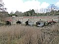 The four arches of Newton Flotman bridge - geograph.org.uk - 4356058.jpg 1,024 × 768; 469 KB
-
 The Relish - geograph.org.uk - 1756176.jpg 640 × 490; 108 KB
-
 The Relish bar and restaurant - geograph.org.uk - 1756177.jpg 640 × 583; 117 KB
-
 The River Tas in Newton Flotman - geograph.org.uk - 6278768.jpg 800 × 583; 156 KB
-
 This way to London - geograph.org.uk - 1415671.jpg 640 × 480; 125 KB
-
 This way to Monk's Farm - geograph.org.uk - 1416123.jpg 640 × 480; 115 KB
-
 This way to Norwich - geograph.org.uk - 1415668.jpg 640 × 504; 95 KB
-
 To Flordon on Flordon Road - geograph.org.uk - 3180837.jpg 640 × 480; 290 KB
-
 To Kenningham Hall on Mulbarton Lane - geograph.org.uk - 1415693.jpg 640 × 480; 110 KB
-
 To Newton Flotman on Flordon Road - geograph.org.uk - 3180835.jpg 640 × 480; 287 KB
-
 Track off Ipswich Road - geograph.org.uk - 4600704.jpg 640 × 468; 83 KB
-
 Track to Woodlands - geograph.org.uk - 1416115.jpg 640 × 480; 128 KB
-
 Trees by the A140 - geograph.org.uk - 4272776.jpg 640 × 401; 78 KB
-
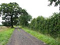
 Unnamed lane to Newton Flotman - geograph.org.uk - 4217918.jpg 640 × 480; 253 KB
-
 View along Greenways - geograph.org.uk - 4217925.jpg 640 × 480; 171 KB
-

-
 View north-east along Greenways - geograph.org.uk - 1416061.jpg 640 × 480; 101 KB
-
 View north-west along Church Road - geograph.org.uk - 1415635.jpg 640 × 480; 137 KB
-
 View south-east along Mulbarton Lane - geograph.org.uk - 1415694.jpg 640 × 480; 105 KB
-
 View towards Duffields' Animal Feeds - geograph.org.uk - 6278767.jpg 800 × 566; 124 KB
-
 View towards The Firs - geograph.org.uk - 4248807.jpg 640 × 480; 205 KB
-
 Village sign at Newton Flotman - geograph.org.uk - 4356050.jpg 768 × 1,024; 352 KB
-
 Waterside Gardens (road name sign) - geograph.org.uk - 6278773.jpg 800 × 573; 175 KB
-
 Weathered Sign - geograph.org.uk - 357215.jpg 640 × 480; 138 KB


_-_geograph.org.uk_-_6278773.jpg)
