Category:Noord-Scharwoude
| Object location | | View all coordinates using: OpenStreetMap |
|---|
farm village in the Netherlands    | |||||
| Upload media | |||||
| Instance of | |||||
|---|---|---|---|---|---|
| Location |
| ||||
| Population |
| ||||
 | |||||
Subcategories
This category has the following 3 subcategories, out of 3 total.
Media in category "Noord-Scharwoude"
The following 20 files are in this category, out of 20 total.
-
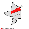 Map - NL - Langedijk - Wijk 00 - Buurt 01 Noord-Scharwoude.svg 375 × 375; 11 KB
-
 Noord Scharwoude wapen.svg 462 × 555; 114 KB
-
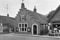
 Aanzicht - Noord-Scharwoude - 20169319 - RCE.jpg 1,200 × 805; 233 KB
-
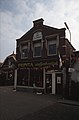
 De Stier Noord-Scharwoude 2.JPG 4,000 × 3,000; 4.53 MB
-
 De Stier Noord-Scharwoude.JPG 4,000 × 3,000; 4.77 MB
-
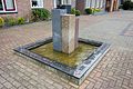 Fontein bij katholieke kerk, Noord-Scharwoude.jpg 5,472 × 3,648; 15.05 MB
-
 Foto's van vroeger 039.jpg 4,000 × 3,000; 4.35 MB
-

-
-
 Gemeente Noord-Scharwoude (19134097362).jpg 3,222 × 2,466; 2.64 MB
-
 Geoffrey Donaldson Instituut.jpg 2,448 × 3,264; 1.76 MB
-
Jean Louis Pisuisse- Het land van Noord Scharwouw (1919).oga 2 min 48 s; 2.56 MB
-
 Kaart van deel Noordholland boven Alkmaar. 1603.jpg 1,828 × 937; 1.4 MB
-
 Molen van de polder Geestmerambacht - Noord-Scharwoude - 20169321 - RCE.jpg 874 × 1,200; 201 KB
-
 Noord-Scharwoude 12-2-13 003.jpg 3,000 × 4,000; 2.47 MB
-
 Noord-Scharwoude 12-2-13 010.jpg 4,000 × 3,000; 2.85 MB
-
 Noord-Scharwoude 1865 (26693852515).jpg 3,222 × 2,466; 1.61 MB
-
-
 Vooraanzicht - Noord-Scharwoude - 20169320 - RCE.jpg 1,200 × 810; 221 KB
-
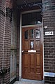
 Zij- en voorgevel nr. 2809 en afb. 7 - Noord-Scharwoude - 20477426 - RCE.jpg 1,200 × 900; 214 KB


.jpg)


.jpg)
_Tussen_ongeveer_de_jaren_1960_en_1990_heeft_de_Afdeling_Mo_-_RAA-DMGA-01863_-_RAA_Elsinga.jpg)

