Category:Noorderhaven 48 (Groningen)
| Object location | | View all coordinates using: OpenStreetMap |
|---|
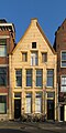
building in Groningen, Netherlands  | |||||
| Upload media | |||||
| Instance of | |||||
|---|---|---|---|---|---|
| Location | Groningen, Netherlands | ||||
| Street address |
| ||||
| Heritage designation |
| ||||
 | |||||
|
This is a category about rijksmonument number 18598
|
| Address |
|
Media in category "Noorderhaven 48 (Groningen)"
The following 5 files are in this category, out of 5 total.
-
 20130501 Noorderhaven 48 Groningen NL.jpg 2,700 × 5,400; 3.61 MB
-
 Groningen Noorderhaven 48.jpg 2,448 × 3,264; 3.97 MB
-
 Voorgevel - Groningen - 20094076 - RCE.jpg 801 × 1,200; 216 KB
-
 Voorgevel - Groningen - 20094077 - RCE.jpg 808 × 1,200; 251 KB
-
 Voorgevels - Groningen - 20094075 - RCE.jpg 808 × 1,200; 243 KB


