Category:North and South Wheatley
English: North and South Wheatley is a civil parish in the Bassetlaw district, in the county of Nottinghamshire, England.
civil parish in Bassetlaw, Nottinghamshire, England  | |||||
| Upload media | |||||
| Instance of | |||||
|---|---|---|---|---|---|
| Location | Bassetlaw, Nottinghamshire, East Midlands, England | ||||
 | |||||
Subcategories
This category has the following 2 subcategories, out of 2 total.
N
S
Media in category "North and South Wheatley"
The following 165 files are in this category, out of 165 total.
-
 800 years of contrast - geograph.org.uk - 4190094.jpg 1,280 × 960; 235 KB
-
 A different gate - geograph.org.uk - 4309122.jpg 4,000 × 2,248; 3.66 MB
-

-
 A view of North Wheatley - geograph.org.uk - 4340166.jpg 4,818 × 3,728; 5.13 MB
-
 A620 crossing old Haughtgate Hill - geograph.org.uk - 5483064.jpg 5,188 × 2,638; 1.46 MB
-
 A620 North Wheatley bypass - geograph.org.uk - 4235332.jpg 1,280 × 960; 493 KB
-
 A620 straight west of Bole Fields - geograph.org.uk - 4577434.jpg 640 × 294; 113 KB
-
 Approaching North Wheatley - geograph.org.uk - 4310343.jpg 800 × 600; 122 KB
-
 Approaching Wheatley Wood Farm - geograph.org.uk - 2082332.jpg 900 × 679; 422 KB
-
 Barn on Low Street - geograph.org.uk - 4190168.jpg 1,280 × 965; 226 KB
-
 Barn on Low Street - geograph.org.uk - 4190174.jpg 1,280 × 1,085; 259 KB
-
 Bench mark, The Old Hall, North Wheatley - geograph.org.uk - 4235357.jpg 1,280 × 960; 438 KB
-
 Big Bales in the distance - geograph.org.uk - 2052411.jpg 640 × 414; 65 KB
-
 Blue Stocking Lane (track) - geograph.org.uk - 2688435.jpg 640 × 480; 90 KB
-
 Bonfire aftermath at the Sun Inn - geograph.org.uk - 4241702.jpg 1,280 × 960; 392 KB
-
 Bridleway on Haughgate Hill - geograph.org.uk - 3838377.jpg 3,776 × 2,520; 4.11 MB
-
 Broad beans by the path - geograph.org.uk - 5483104.jpg 5,376 × 3,024; 3.19 MB
-
 Bungalow on Retford Road - geograph.org.uk - 2688450.jpg 640 × 480; 60 KB
-
 Car park and polytunnel off Wood Lane - geograph.org.uk - 3188605.jpg 1,024 × 768; 135 KB
-
 Caravans for fruit pickers - geograph.org.uk - 5483492.jpg 800 × 600; 100 KB
-
 Caravans for migrant workers - geograph.org.uk - 4026793.jpg 1,024 × 768; 202 KB
-
 Church path - geograph.org.uk - 4974373.jpg 1,024 × 683; 289 KB
-
 Cottam Power Station in the distance - geograph.org.uk - 1131951.jpg 640 × 427; 47 KB
-
 Cross Roads at North Wheatley - geograph.org.uk - 4235335.jpg 1,280 × 960; 335 KB
-
 Crossroads at North Wheatley - geograph.org.uk - 4325337.jpg 640 × 376; 82 KB
-
 Date stone on The Old Hall (geograph 4191203).jpg 1,280 × 960; 289 KB
-
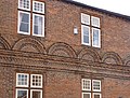 Decorative brickwork on The Old Hall - geograph.org.uk - 4191205.jpg 1,280 × 970; 399 KB
-

-
 Doorway of The Old Hall (geograph 4191211).jpg 960 × 1,280; 229 KB
-
 Down the tunnel - geograph.org.uk - 483320.jpg 640 × 427; 116 KB
-
 Dual carriageway North Wheatley A620 - geograph.org.uk - 3979861.jpg 1,024 × 768; 190 KB
-
 Entering North Wheatley - geograph.org.uk - 3838314.jpg 3,776 × 2,520; 4.17 MB
-
 Entering North Wheatley - geograph.org.uk - 5029287.jpg 4,835 × 3,582; 3.5 MB
-
 Entrance to Wheatley Grange Farm - geograph.org.uk - 5483145.jpg 5,376 × 3,024; 2.62 MB
-
 Farm buildings on Low Street - geograph.org.uk - 4190149.jpg 1,280 × 960; 265 KB
-
 Farm track from Wheatley Grange - geograph.org.uk - 2082310.jpg 900 × 675; 431 KB
-
 Farm track towards Wheatley Wood Farm - geograph.org.uk - 2082318.jpg 900 × 520; 292 KB
-
 Farmhouse, South Wheatley - geograph.org.uk - 3188792.jpg 1,024 × 768; 239 KB
-
 Farmland near Wheatley Grange - geograph.org.uk - 2082289.jpg 900 × 621; 316 KB
-
 Farmland off Blue Stocking Lane - geograph.org.uk - 2688437.jpg 640 × 480; 57 KB
-
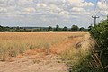 Farmland on a hot day - geograph.org.uk - 2534402.jpg 640 × 427; 70 KB
-
 Farmland Wheatley Field - geograph.org.uk - 2688445.jpg 640 × 480; 67 KB
-
 Farmland, Haughgate Hill - geograph.org.uk - 2688459.jpg 640 × 480; 73 KB
-
 Field by Northfield Leys Road - geograph.org.uk - 5483091.jpg 5,376 × 3,024; 2.88 MB
-
 Field entrance and a long line of bales - geograph.org.uk - 2082321.jpg 900 × 401; 262 KB
-
 Field of barley below Wheatley Grange - geograph.org.uk - 5483219.jpg 800 × 600; 158 KB
-
 Field path leading from S Wheatley to N Wheatley - geograph.org.uk - 6335325.jpg 5,184 × 2,920; 4.56 MB
-
 Fields nr Wheatley Grange - geograph.org.uk - 2534393.jpg 640 × 381; 96 KB
-
 Fingerpost at North Wheatley - geograph.org.uk - 4235333.jpg 960 × 1,280; 279 KB
-
 Fingerpost at North Wheatley crossroads - geograph.org.uk - 4191213.jpg 960 × 1,280; 378 KB
-

-
 Footpath to Clayworth Woodhouse - geograph.org.uk - 4026771.jpg 1,024 × 768; 212 KB
-
 Footpath to Field Farm - geograph.org.uk - 4842817.jpg 1,600 × 1,200; 535 KB
-
 Forge Cottage, Low Street - geograph.org.uk - 4190164.jpg 1,280 × 960; 372 KB
-
 Gainsborough Road (A620) - geograph.org.uk - 3512026.jpg 640 × 480; 68 KB
-
 Gainsborough Road A620 North Wheatley - geograph.org.uk - 3980039.jpg 1,024 × 768; 145 KB
-
 Goacher's Lane - geograph.org.uk - 3188620.jpg 1,024 × 768; 231 KB
-
 Going up in the world - geograph.org.uk - 5483504.jpg 800 × 600; 138 KB
-
 Green space at Top Street - geograph.org.uk - 4235353.jpg 1,280 × 1,280; 450 KB
-
 Haughgate Hill (Roman Road) - geograph.org.uk - 2688458.jpg 640 × 480; 86 KB
-
 Haughgate Hill - geograph.org.uk - 2045216.jpg 640 × 426; 116 KB
-
 Haughgate Hill - geograph.org.uk - 2453227.jpg 640 × 427; 80 KB
-
 Haughgate Hill - geograph.org.uk - 5483070.jpg 5,376 × 3,024; 2.29 MB
-
 Haughgate Hill - geograph.org.uk - 5727751.jpg 5,568 × 3,712; 6.41 MB
-
 Haughgate Hill leaving North Wheatley - geograph.org.uk - 3838351.jpg 3,776 × 2,520; 3.88 MB
-
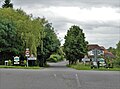
 Haughgate Hill road junction - geograph.org.uk - 3003484.jpg 640 × 454; 89 KB
-
 Haughgate Hill towards Clayworth - geograph.org.uk - 2688463.jpg 640 × 480; 62 KB
-
 Hay bales ^ farmland S of South Wheatley - geograph.org.uk - 6335319.jpg 5,184 × 2,920; 5.55 MB
-
 Humid Afternoon - geograph.org.uk - 2534383.jpg 640 × 427; 123 KB
-
 Lay by and lane restriction ahead - geograph.org.uk - 4577553.jpg 640 × 282; 104 KB
-
 Left hand bend with road junction to left - geograph.org.uk - 4241699.jpg 1,280 × 960; 472 KB
-
 Looking up Church Hill - geograph.org.uk - 4235365.jpg 1,280 × 879; 275 KB
-
 Low Road, North Wheatley - geograph.org.uk - 4861177.jpg 640 × 460; 374 KB
-
 Low Street - geograph.org.uk - 2453348.jpg 640 × 427; 96 KB
-
 Methodist Chapel, Low Street - geograph.org.uk - 4190155.jpg 1,280 × 951; 231 KB
-
 Middle Hill Road - geograph.org.uk - 5483056.jpg 5,376 × 3,024; 3.47 MB
-
 Middle Hill Road - geograph.org.uk - 5483205.jpg 600 × 800; 198 KB
-

-
 Middlefield Road, North Wheatley - geograph.org.uk - 4190222.jpg 1,280 × 960; 414 KB
-
 Mist makers - geograph.org.uk - 3188781.jpg 1,024 × 768; 63 KB
-
 Muspit Lane - geograph.org.uk - 4026831.jpg 1,024 × 768; 183 KB
-
 Muspit Lane - geograph.org.uk - 4842828.jpg 1,600 × 1,200; 500 KB
-
 New use for an old trough - geograph.org.uk - 2741355.jpg 1,024 × 768; 242 KB
-
 Norman chancel arch - geograph.org.uk - 2463250.jpg 427 × 640; 143 KB
-
 North and South Wheatley Post Office - geograph.org.uk - 4310346.jpg 800 × 600; 133 KB
-
 North Wheatley - geograph.org.uk - 4235380.jpg 1,280 × 1,280; 434 KB
-
 North Wheatley Boarding Kennels - geograph.org.uk - 4842790.jpg 1,600 × 1,200; 513 KB
-
 North Wheatley Boarding Kennels - geograph.org.uk - 5483075.jpg 5,376 × 3,024; 2.69 MB
-
 North Wheatley Boarding Kennels - geograph.org.uk - 5483216.jpg 800 × 600; 147 KB
-
 North Wheatley from Muspit Lane - geograph.org.uk - 4309123.jpg 3,986 × 2,222; 4.93 MB
-
 North Wheatley from Muspit Lane - geograph.org.uk - 4309124.jpg 3,942 × 2,138; 4.56 MB
-
 North Wheatley P.O. postbox ref DN22 18 - geograph.org.uk - 4191219.jpg 960 × 1,280; 391 KB
-
 North Wheatley Recreation Ground - geograph.org.uk - 4235369.jpg 960 × 1,280; 146 KB
-
 North Wheatley village sign - geograph.org.uk - 4190107.jpg 1,280 × 960; 423 KB
-
 North Wheatley Village sign, Notts - geograph.org.uk - 6335323.jpg 5,184 × 2,920; 5.94 MB
-
 North Wheatley, Low Road - geograph.org.uk - 4861180.jpg 640 × 455; 338 KB
-
 North Wheatley, Top Street postbox ref DN22 210 - geograph.org.uk - 4241705.jpg 1,280 × 960; 544 KB
-
 Northfield Leys Road - geograph.org.uk - 2045230.jpg 640 × 426; 94 KB
-
 Northfield Leys Road - geograph.org.uk - 2741353.jpg 1,024 × 768; 150 KB
-
 Northfield Leys Road - geograph.org.uk - 4552300.jpg 3,776 × 2,520; 4 MB
-
 Northfield Leys Road - geograph.org.uk - 4842782.jpg 1,600 × 1,200; 995 KB
-
-
 Oilseed rape crop off Gainsborough Road - geograph.org.uk - 3512023.jpg 640 × 480; 113 KB
-
 Old bonfire near South Wheatley - geograph.org.uk - 4309118.jpg 4,000 × 2,248; 5.61 MB
-

-
 On Haughgate Hill - geograph.org.uk - 5029286.jpg 5,184 × 3,888; 4.32 MB
-
 On Muspit Way, nearing South Wheatley - geograph.org.uk - 4309125.jpg 1,280 × 950; 1.09 MB
-
 Outbuilding at Corner Farm - geograph.org.uk - 4190144.jpg 1,280 × 955; 475 KB
-
 Polytunnel of strawberries - geograph.org.uk - 5483226.jpg 800 × 600; 166 KB
-
 Polytunnels at Wheatley Wood Farm - geograph.org.uk - 5483486.jpg 800 × 600; 116 KB
-
 Polytunnels at Wheatley Wood Farm - geograph.org.uk - 5483500.jpg 800 × 336; 65 KB
-
 Polytunnels by Walk Lane - geograph.org.uk - 4026780.jpg 1,024 × 768; 147 KB
-
 Polytunnels by Walk Lane - geograph.org.uk - 5483490.jpg 800 × 600; 86 KB
-
 Polytunnels full of strawberries - geograph.org.uk - 5483132.jpg 5,376 × 3,024; 2.45 MB
-
 Power lines over a field of barley - geograph.org.uk - 5483217.jpg 600 × 800; 76 KB
-
 Ready for the big blaze - geograph.org.uk - 4235338.jpg 1,280 × 874; 353 KB
-
 Road blocks or failed curling stones^ - geograph.org.uk - 5483094.jpg 5,376 × 3,024; 3.28 MB
-
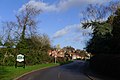
 Road junction by the Pub - geograph.org.uk - 2052430.jpg 640 × 427; 63 KB
-
 Ruins of St Helen's Church, S Wheatley - geograph.org.uk - 6335326.jpg 5,184 × 2,920; 6.18 MB
-
 Seat on Muspit Lane, with a view of North Wheatley - geograph.org.uk - 3838298.jpg 3,776 × 2,520; 4.03 MB
-
 Sharp bend on Wheatley bypass - geograph.org.uk - 4577548.jpg 640 × 324; 167 KB
-
 Small section of polytunnels by Wheatley Wood Farm - geograph.org.uk - 5483140.jpg 5,376 × 3,024; 1.96 MB
-
 Small wooden shelter by a hedge - geograph.org.uk - 4309886.jpg 800 × 600; 133 KB
-

-
 South Wheatley village sign - geograph.org.uk - 4190079.jpg 1,280 × 960; 344 KB
-

-
 Straight ahead - geograph.org.uk - 1131944.jpg 640 × 427; 66 KB
-

-
 Sturton Road and Church Hill - geograph.org.uk - 3188736.jpg 1,024 × 768; 167 KB
-
 The A620 Gainsborough Road near North Wheatley - geograph.org.uk - 3979854.jpg 1,024 × 768; 128 KB
-
 The Old Hall, North Wheatley - geograph.org.uk - 4191216.jpg 1,280 × 917; 258 KB
-
 The Old Hall, North Wheatley - geograph.org.uk - 4191221.jpg 1,280 × 904; 337 KB
-
 The Old Plough, Top Street - geograph.org.uk - 3188612.jpg 1,024 × 768; 125 KB
-
 The Old School, Middlefield Road - geograph.org.uk - 4191198.jpg 1,280 × 953; 342 KB
-
 The road at Haughgate hill. - geograph.org.uk - 5226939.jpg 640 × 480; 64 KB
-

-

-
 The Sun Inn, North Wheatley - geograph.org.uk - 4235341.jpg 1,280 × 896; 204 KB
-
 The Sun Inn, North Wheatley - geograph.org.uk - 4842800.jpg 1,600 × 1,200; 430 KB
-
 The Trent valley way footpath. - geograph.org.uk - 5226940.jpg 640 × 480; 75 KB
-
 The Trent Valley Way on the watershed - geograph.org.uk - 4552341.jpg 3,776 × 2,520; 3.94 MB
-
 Top of Top Street, North Wheatley - geograph.org.uk - 4235345.jpg 1,280 × 960; 332 KB
-
 Top Street, North Wheatley - geograph.org.uk - 3838338.jpg 3,776 × 2,520; 4.24 MB
-
 Track to Wheatley Field House - geograph.org.uk - 2688447.jpg 640 × 480; 123 KB
-

-
 Vehicle access block on Northfield Leys Road - geograph.org.uk - 4552307.jpg 3,776 × 2,520; 4.29 MB
-
 View from South Wheatley churchyard - geograph.org.uk - 4190082.jpg 1,280 × 786; 213 KB
-
 View towards Haughgate House - geograph.org.uk - 2741348.jpg 1,024 × 768; 192 KB
-
 View towards Low Street - geograph.org.uk - 4190120.jpg 1,280 × 817; 223 KB
-
 View towards North Wheatley - geograph.org.uk - 4027270.jpg 1,024 × 768; 183 KB
-
 View towards North Wheatley - geograph.org.uk - 4310185.jpg 4,000 × 2,248; 6.09 MB
-

-
 Walk Lane - geograph.org.uk - 5483151.jpg 5,376 × 3,024; 2.6 MB
-
 Walk Lane - geograph.org.uk - 5483488.jpg 800 × 600; 131 KB
-
 Wesleyan Chapel, North Wheatley - geograph.org.uk - 4842806.jpg 1,600 × 1,200; 440 KB
-
 West Burton Power Station - geograph.org.uk - 2463255.jpg 640 × 427; 63 KB
-
 Westlands Farm shop entrance - geograph.org.uk - 4577928.jpg 640 × 324; 69 KB
-

-
 Wheatley Road - geograph.org.uk - 2453233.jpg 640 × 427; 91 KB
-
 Wild roses on the Trent Valley Way - geograph.org.uk - 4552349.jpg 3,776 × 2,520; 4.28 MB
-
 Wind damaged wheat - geograph.org.uk - 5483100.jpg 5,376 × 3,024; 3.64 MB
-
-
 Wood Lane - geograph.org.uk - 3188593.jpg 1,024 × 768; 232 KB
-
 Wood lane looking towards the fruit farm - geograph.org.uk - 2534407.jpg 640 × 422; 131 KB
-


_-_geograph.org.uk_-_2688435.jpg)


.jpg)


.jpg)


_-_geograph.org.uk_-_3512026.jpg)


_-_geograph.org.uk_-_2688458.jpg)


_-_geograph.org.uk_-_6335329.jpg)


