Category:Northcott, Torridge
settlement and civil parish in Devon, England, UK  | |||||
| Upload media | |||||
| Instance of | |||||
|---|---|---|---|---|---|
| Location | Torridge, Devon, South West England, England | ||||
 | |||||
Media in category "Northcott, Torridge"
The following 23 files are in this category, out of 23 total.
-
 Beeches in Northcott Wood - geograph.org.uk - 610157.jpg 480 × 640; 131 KB
-
 Boyton Mill - geograph.org.uk - 3445236.jpg 622 × 466; 122 KB
-
 Boyton Mill - geograph.org.uk - 606413.jpg 476 × 640; 133 KB
-
 Boyton Mill - geograph.org.uk - 610262.jpg 480 × 640; 104 KB
-
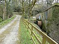
 Bridleway past Boyton Mill - geograph.org.uk - 610308.jpg 640 × 480; 139 KB
-
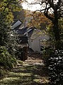
 Entrance to Chapmans Well - geograph.org.uk - 3130267.jpg 640 × 445; 49 KB
-
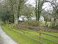
 Farmland near Higher Northcott - geograph.org.uk - 606283.jpg 640 × 480; 46 KB
-
 Footpath past Mount Pleasant - geograph.org.uk - 609963.jpg 640 × 480; 133 KB
-
 Footpath to Boytonbridge - geograph.org.uk - 610146.jpg 640 × 480; 137 KB
-
 Footpath to Boytonbridge - geograph.org.uk - 610165.jpg 640 × 480; 141 KB
-
 Lane above Boyton Mill - geograph.org.uk - 609651.jpg 640 × 472; 119 KB
-
 Lower Northcott - geograph.org.uk - 609632.jpg 640 × 476; 93 KB
-
 Meadow by the Tamar - geograph.org.uk - 610135.jpg 640 × 480; 89 KB
-
 Northcott Wood - geograph.org.uk - 610057.jpg 640 × 480; 85 KB
-
 River Tamar - geograph.org.uk - 610084.jpg 640 × 480; 142 KB
-
 River Tamar - geograph.org.uk - 610094.jpg 640 × 480; 80 KB
-
 River Tamar at Northcott Wood - geograph.org.uk - 606368.jpg 640 × 480; 120 KB
-
 Sheep near Boyton Mill - geograph.org.uk - 610183.jpg 640 × 430; 100 KB
-
 Tamar valley from below Northcott - geograph.org.uk - 609740.jpg 640 × 480; 105 KB
-
 Track to Boyton Mill - geograph.org.uk - 610198.jpg 480 × 640; 126 KB
-
 Valley by Peek Moor Cross - geograph.org.uk - 1672390.jpg 1,024 × 682; 206 KB
-
 Waterwheel, Boyton Mill - geograph.org.uk - 3445227.jpg 693 × 519; 151 KB
-
 Waterwheel, Boyton Mill - geograph.org.uk - 610291.jpg 480 × 640; 105 KB


