Category:Northeastern Manitoulin and the Islands
municipality in Ontario, Canada  | |||||
| Upload media | |||||
| Instance of |
| ||||
|---|---|---|---|---|---|
| Location | Manitoulin District, Ontario, Canada | ||||
| Inception |
| ||||
| official website | |||||
 | |||||
Subcategories
This category has the following 2 subcategories, out of 2 total.
L
T
Media in category "Northeastern Manitoulin and the Islands"
The following 19 files are in this category, out of 19 total.
-
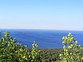 10 Mile Point - panoramio (1).jpg 3,264 × 2,448; 1.57 MB
-
 10 Mile Point - panoramio.jpg 2,448 × 3,264; 1.6 MB
-
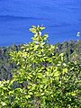
 Cup and Saucer Lookup Trail - panoramio.jpg 3,000 × 2,000; 1.73 MB
-
 Cup and Saucer Trail (3882211251).jpg 3,648 × 2,736; 5.61 MB
-
 Cup and Saucer Trail (3882215901).jpg 3,648 × 2,736; 5.94 MB
-
 Cup and Saucer Trail (3883007840).jpg 3,648 × 2,736; 5.21 MB
-
 CupandSaucerManitoulin23.jpg 300 × 236; 12 KB
-
 Highway 6 - Northeastern Manitoulin and the Islands, Ontario, Canada - October 11, 2023 01.jpg 5,341 × 8,012; 25.49 MB
-
 Highway 6 - Northeastern Manitoulin and the Islands, Ontario, Canada - October 11, 2023 02.jpg 5,504 × 8,256; 27.57 MB
-
 Highway 6 - Northeastern Manitoulin and the Islands, Ontario, Canada - October 11, 2023 03.jpg 8,256 × 5,504; 26.51 MB
-
-

-

-

-

-
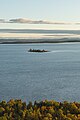
 Sheguindah Bay - Northeastern Manitoulin and the Islands, Ontario, Canada - October 11, 2023 04.jpg 16,536 × 7,636; 67.07 MB
-
 Sheguindah Bay - Northeastern Manitoulin and the Islands, Ontario, Canada - October 11, 2023 05.jpg 20,028 × 7,379; 70.84 MB
-

-

.jpg)


.jpg)
.jpg)
.jpg)


.jpg)


