Category:Northmoor, Oxfordshire
village and civil parish in West Oxfordshire, England, UK  | |||||
| Upload media | |||||
| Instance of | |||||
|---|---|---|---|---|---|
| Location | West Oxfordshire, Oxfordshire, South East England, England | ||||
| Different from | |||||
| official website | |||||
 | |||||
English: Northmoor is a village and civil parish in West Oxfordshire, southeast of Witney. Northmoor is in the valley of the River Thames, which bounds the parish to the east and south, and is close to the River Windrush which forms part of the parish's western boundary.
Subcategories
This category has the following 8 subcategories, out of 8 total.
H
- Hart's Weir footbridge (4 F)
M
- Moreton, West Oxfordshire (7 F)
N
R
- Rectory Farm, Northmoor (2 F)
- The Red Lion, Northmoor (5 F)
V
- Northmoor Village Hall (3 F)
Media in category "Northmoor, Oxfordshire"
The following 200 files are in this category, out of 298 total.
(previous page) (next page)-
 A type 24 - geograph.org.uk - 1929885.jpg 1,024 × 683; 277 KB
-
 A view to the next - geograph.org.uk - 1469475.jpg 640 × 427; 90 KB
-
 A view upstream, River Thames, Bablock Hythe - geograph.org.uk - 1985881.jpg 1,440 × 1,080; 848 KB
-
 A415 passes The Rose Revived - geograph.org.uk - 3066100.jpg 3,236 × 2,425; 1.31 MB
-
 Across the River Thames - geograph.org.uk - 5073661.jpg 2,592 × 1,944; 1.45 MB
-
 Across the Thames at Bablock Hythe - geograph.org.uk - 1985892.jpg 1,440 × 918; 877 KB
-

-

-
 Aerial view of Northmoor Lock near Appleton - geograph.org.uk - 3447959.jpg 4,288 × 2,848; 6.27 MB
-
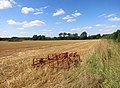 After the Harvest - geograph.org.uk - 4097141.jpg 3,836 × 2,808; 3.41 MB
-
 Almost hidden - geograph.org.uk - 1928228.jpg 1,024 × 683; 314 KB
-
 An old friend - geograph.org.uk - 1929789.jpg 1,024 × 683; 172 KB
-
 Bablock Hythe - geograph.org.uk - 5669853.jpg 640 × 427; 201 KB
-
 Bablockhythe Caravan Park - geograph.org.uk - 5110246.jpg 4,000 × 3,000; 4.76 MB
-
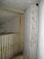
 Back of the pillbox - geograph.org.uk - 1943915.jpg 1,024 × 683; 245 KB
-
 Below Northmoor Lock - geograph.org.uk - 2436625.jpg 1,024 × 680; 218 KB
-
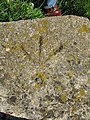
 Benchmark on a corner - geograph.org.uk - 1945307.jpg 1,024 × 768; 342 KB
-
 Benchmark on footbridge opposite Water Furze - geograph.org.uk - 4817399.jpg 683 × 1,024; 329 KB
-
 Benchmark on Moreton Farm - geograph.org.uk - 4882774.jpg 683 × 1,024; 258 KB
-
 Benchmark on Moreton Lane bridge - geograph.org.uk - 4817890.jpg 683 × 1,024; 216 KB
-
 Benchmark on New Bridge - geograph.org.uk - 4818278.jpg 1,024 × 683; 336 KB
-
 Benchmark on pillbox SE of Moreton - geograph.org.uk - 4817416.jpg 683 × 1,024; 363 KB
-
 Benchmark on St Denys' church, Northmoor - geograph.org.uk - 2586080.jpg 1,704 × 2,304; 2.42 MB
-
 Benchmark on the 'Rose Revived' - geograph.org.uk - 4818095.jpg 683 × 1,024; 241 KB
-
 Bend in the Windrush - geograph.org.uk - 1929785.jpg 1,024 × 683; 217 KB
-
 Boathouse on the River Thames - geograph.org.uk - 5168196.jpg 1,024 × 680; 293 KB
-
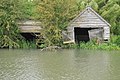 Boathouses on the Thames - geograph.org.uk - 2435243.jpg 1,024 × 680; 249 KB
-
 Boats at Bablockhythe - geograph.org.uk - 909914.jpg 640 × 426; 68 KB
-
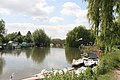 Boats by the river - geograph.org.uk - 1929739.jpg 1,024 × 683; 199 KB
-
 Boats on the river - geograph.org.uk - 1929751.jpg 1,024 × 683; 149 KB
-
 Bridge on Moreton Lane - geograph.org.uk - 1567188.jpg 640 × 480; 104 KB
-
 Bridge over a stream, Bablock Hythe, Oxon - geograph.org.uk - 5711050.jpg 1,024 × 683; 287 KB
-
-
 Bridge over the windrush - geograph.org.uk - 1270159.jpg 640 × 426; 117 KB
-
 Bridges taking A415 over River Windrush - geograph.org.uk - 4817897.jpg 1,024 × 683; 221 KB
-
 Bridle Path at Linch - geograph.org.uk - 5309261.jpg 640 × 427; 122 KB
-
 Butterfly on the ceiling - geograph.org.uk - 1467983.jpg 640 × 480; 62 KB
-
 Camouflaged front - geograph.org.uk - 1928243.jpg 1,024 × 683; 343 KB
-

-

-
 Cattle on the Thames Path - geograph.org.uk - 5168067.jpg 1,024 × 680; 312 KB
-
 Church Road by Watkins Farm - geograph.org.uk - 3906649.jpg 1,500 × 999; 124 KB
-
 Church Road in Northmoor - geograph.org.uk - 3905688.jpg 1,500 × 987; 158 KB
-
 Church Road in Northmoor - geograph.org.uk - 3906631.jpg 1,500 × 999; 210 KB
-
 Clouds over the Thames valley - geograph.org.uk - 1724902.jpg 640 × 480; 53 KB
-
 Confluence of the Windrush and Thames - geograph.org.uk - 2435028.jpg 1,024 × 680; 166 KB
-
 Corrugated sides - geograph.org.uk - 1928215.jpg 1,024 × 683; 307 KB
-
 Covered in nettles - geograph.org.uk - 1467892.jpg 426 × 640; 146 KB
-
 Cow Lane northwest of Manor Farm - geograph.org.uk - 3065970.jpg 3,447 × 2,610; 1.55 MB
-
 Cows in a field beside Moreton Lane - geograph.org.uk - 1569477.jpg 640 × 480; 104 KB
-
 Derelict shed in a field - geograph.org.uk - 1589752.jpg 640 × 427; 65 KB
-

-
 Drain near Northmoor - geograph.org.uk - 5647851.jpg 640 × 427; 295 KB
-
 Drive to Lower Farm - geograph.org.uk - 1589203.jpg 640 × 427; 144 KB
-
 East end of Northmoor - geograph.org.uk - 5688659.jpg 640 × 480; 129 KB
-
 Entrance at Bablock Hythe - geograph.org.uk - 2436904.jpg 1,024 × 680; 233 KB
-
 Entrance by the fence - geograph.org.uk - 1928235.jpg 1,024 × 683; 247 KB
-
 Entrance over the fence - geograph.org.uk - 1928277.jpg 1,024 × 683; 316 KB
-
 Evidence of buildings foundations - geograph.org.uk - 2436902.jpg 1,024 × 680; 253 KB
-
 Farm building, Bablock Hythe - geograph.org.uk - 2436913.jpg 1,024 × 680; 228 KB
-
 Fell in the river - geograph.org.uk - 3079384.jpg 1,024 × 683; 240 KB
-

-
 Ferry winding gear, Bablock Hythe, Oxon - geograph.org.uk - 5708336.jpg 1,024 × 668; 267 KB
-
 Ferryman Farmhouse, Northmoor - geograph.org.uk - 5688618.jpg 640 × 480; 90 KB
-
 Ferryman Inn, Bablock Hythe - geograph.org.uk - 2436906.jpg 1,024 × 680; 170 KB
-
 Field at Northmoor - geograph.org.uk - 5656029.jpg 640 × 427; 257 KB
-
 Flag irises on the bank of the Thames - geograph.org.uk - 2435248.jpg 1,024 × 680; 215 KB
-
 Flood Markers at Northmoor Lock - geograph.org.uk - 5649980.jpg 640 × 431; 215 KB
-

-
 Footbridge Near River Thames - geograph.org.uk - 5655660.jpg 640 × 427; 312 KB
-
 Footbridge on the Thames Path - geograph.org.uk - 5168213.jpg 800 × 531; 150 KB
-
 Footpath across the field - geograph.org.uk - 1929774.jpg 1,024 × 683; 165 KB
-
 Footpath to the bridge - geograph.org.uk - 1929770.jpg 1,024 × 683; 178 KB
-
 Footpath to the Thames Path - geograph.org.uk - 3906945.jpg 1,500 × 999; 311 KB
-
 Footpath to West End - geograph.org.uk - 3906948.jpg 1,500 × 999; 236 KB
-
 For Sale - geograph.org.uk - 1467842.jpg 640 × 427; 94 KB
-
 Front churchyard, St Denys' Church, Northmoor - geograph.org.uk - 1985998.jpg 1,440 × 1,080; 1.12 MB
-
 Gate and kissing gate - geograph.org.uk - 1467920.jpg 640 × 427; 126 KB
-
 Gate on the Thames Path - geograph.org.uk - 3906953.jpg 1,500 × 999; 281 KB
-
 Granary at Rectory Farm, Northmoor - geograph.org.uk - 5688647.jpg 640 × 480; 124 KB
-
 Harts Footbridge - geograph.org.uk - 2059920.jpg 640 × 356; 53 KB
-
 Heading downstream - geograph.org.uk - 1945296.jpg 1,024 × 683; 261 KB
-
 Heading east out of Northmoor - geograph.org.uk - 5688654.jpg 640 × 480; 86 KB
-
 House at Northmoor Lock - geograph.org.uk - 2436618.jpg 1,024 × 680; 182 KB
-
 House in Northmoor - geograph.org.uk - 5312151.jpg 640 × 427; 84 KB
-
 Houses on Chapel Lane - geograph.org.uk - 5307895.jpg 640 × 427; 98 KB
-
 In Memory - geograph.org.uk - 1467826.jpg 640 × 427; 134 KB
-
 Inside the pillbox - geograph.org.uk - 1928322.jpg 600 × 800; 84 KB
-
 Interior of St. Denys, Northmoor, Oxfordshire - geograph.org.uk - 2116373.jpg 1,600 × 1,200; 351 KB
-
 Is the Mayflower early this year^ - geograph.org.uk - 5073722.jpg 2,592 × 1,944; 1.58 MB
-
-
 Kissing gate to the next - geograph.org.uk - 1467903.jpg 426 × 640; 134 KB
-
 Looking towards the bridge - geograph.org.uk - 1929731.jpg 1,024 × 683; 216 KB
-
 Looking worse - geograph.org.uk - 1929800.jpg 1,024 × 683; 139 KB
-
 Lost in the reeds - geograph.org.uk - 1465968.jpg 640 × 427; 102 KB
-
 Lunchtime drink - geograph.org.uk - 1929758.jpg 1,024 × 683; 190 KB
-
 Meadow near Northmoor Lock - geograph.org.uk - 2436622.jpg 1,024 × 680; 228 KB
-
 Minor road to Standlake - geograph.org.uk - 3908279.jpg 1,500 × 999; 97 KB
-
 Minor road to Standlake - geograph.org.uk - 3908280.jpg 1,500 × 999; 120 KB
-
 Minor road to Standlake - geograph.org.uk - 3908281.jpg 1,500 × 999; 161 KB
-
 Minor road to Standlake - geograph.org.uk - 3908284.jpg 1,500 × 999; 192 KB
-
 Minor road to Stanton Harcourt - geograph.org.uk - 3906954.jpg 1,500 × 999; 252 KB
-
 Moat at Manor Farm - geograph.org.uk - 5312148.jpg 640 × 427; 129 KB
-
 Moated manor House - geograph.org.uk - 5309302.jpg 640 × 427; 102 KB
-
 Moreton Farm - geograph.org.uk - 4882790.jpg 1,024 × 683; 135 KB
-
 Moreton Lane - geograph.org.uk - 1567183.jpg 640 × 480; 104 KB
-
 Moreton Lane, Northmoor - geograph.org.uk - 5298839.jpg 4,869 × 3,000; 3.36 MB
-
 Morland brewery sign - geograph.org.uk - 5164021.jpg 531 × 800; 93 KB
-
 Mosaic by the footpath - geograph.org.uk - 1929763.jpg 1,024 × 683; 281 KB
-
 Narrow road in the Thames floodplain - geograph.org.uk - 1724889.jpg 640 × 480; 77 KB
-

-
 Narrowboat on the River Thames near Moreton - geograph.org.uk - 5107506.jpg 3,264 × 2,448; 3.42 MB
-
 New Farmhouse, Northmoor - geograph.org.uk - 3448079.jpg 4,288 × 2,848; 5.52 MB
-
 New path - geograph.org.uk - 1467882.jpg 640 × 427; 85 KB
-
 Newbridge - geograph.org.uk - 2435030.jpg 1,024 × 680; 146 KB
-
 Newbridge bridge - geograph.org.uk - 5073753.jpg 2,592 × 1,944; 1.63 MB
-
 Newbridge on the River Thames - geograph.org.uk - 3449046.jpg 4,288 × 2,848; 4.21 MB
-
 Newbridge over the River Thames - geograph.org.uk - 5164014.jpg 531 × 800; 132 KB
-
 Next one in the distance - geograph.org.uk - 1929826.jpg 1,024 × 683; 145 KB
-
 Door and loophole - geograph.org.uk - 1467994.jpg 480 × 640; 104 KB
-
 In the back - geograph.org.uk - 1467973.jpg 640 × 427; 114 KB
-
 Kingfisher on the bridge - geograph.org.uk - 1270171.jpg 640 × 426; 108 KB
-
 Looking at the front - geograph.org.uk - 1468014.jpg 640 × 427; 130 KB
-
 Side on shot - geograph.org.uk - 1467963.jpg 640 × 427; 123 KB
-
 Northmoor - geograph.org.uk - 5647841.jpg 640 × 427; 200 KB
-
 Northmoor Lock - geograph.org.uk - 2436615.jpg 1,024 × 680; 195 KB
-
 Northmoor Lock - geograph.org.uk - 5649979.jpg 640 × 427; 220 KB
-
 Northmoor Lock - geograph.org.uk - 747673.jpg 640 × 480; 87 KB
-
 Northmoor Lock - geograph.org.uk - 910037.jpg 640 × 426; 79 KB
-
 Northmoor Lock and Weir - geograph.org.uk - 435918.jpg 640 × 416; 62 KB
-
 Northmoor Lock and Weir - geograph.org.uk - 5073646.jpg 2,592 × 1,944; 1.64 MB
-
 Northmoor Lock Weir - geograph.org.uk - 2059916.jpg 640 × 438; 84 KB
-
 Northmoor RectoryFarm granary.JPG 2,350 × 1,880; 2.03 MB
-
 Northmoor RectoryPath 1.jpg 1,940 × 2,910; 2.34 MB
-
 Northmoor RectoryPath 2.jpg 1,970 × 2,955; 2.5 MB
-
 Northmoor Weir - geograph.org.uk - 910032.jpg 640 × 417; 101 KB
-
 Northmoor Weir - geograph.org.uk - 910041.jpg 640 × 413; 100 KB
-
 Notice by the road - geograph.org.uk - 1943960.jpg 533 × 800; 176 KB
-
 Number 226 - geograph.org.uk - 1928247.jpg 533 × 800; 63 KB
-
 Old doorway - geograph.org.uk - 1468057.jpg 640 × 427; 141 KB
-
 Outrage poster - geograph.org.uk - 1843229.jpg 3,008 × 2,000; 1.48 MB
-
 Paddle and rymer weir.jpg 1,600 × 1,200; 1,005 KB
-
 Parapet of bridge on north side of Moreton Lane - geograph.org.uk - 4817894.jpg 1,024 × 683; 213 KB
-
 Path to the Windrush - geograph.org.uk - 1929760.jpg 1,024 × 683; 231 KB
-
 Patrolling the river - geograph.org.uk - 1943967.jpg 1,024 × 683; 155 KB
-
 Pillbox and gate - geograph.org.uk - 1468019.jpg 640 × 427; 101 KB
-
 Pillbox at Newbridge, Oxfordshire - geograph.org.uk - 4514236.jpg 2,736 × 2,736; 2.35 MB
-
 Pillbox by the bank - geograph.org.uk - 1943924.jpg 1,024 × 683; 246 KB
-
 Pillbox by the gate - geograph.org.uk - 1928205.jpg 1,024 × 683; 296 KB
-
 Pillbox by the river - geograph.org.uk - 1929880.jpg 1,024 × 683; 263 KB
-
 Pillbox in the nettles - geograph.org.uk - 1928253.jpg 1,024 × 683; 317 KB
-
-
 Pillbox losing its battle with the River Windrush - geograph.org.uk - 1843213.jpg 3,008 × 2,000; 1.66 MB
-
 Pillbox near Moreton - geograph.org.uk - 2435213.jpg 1,024 × 680; 231 KB
-
 Pillbox near Moreton - geograph.org.uk - 910088.jpg 640 × 426; 93 KB
-

-
 Pillbox near Stonehenge - geograph.org.uk - 1467949.jpg 640 × 427; 133 KB
-
 Pillbox on the banks of the River Windrush at Newbridge - geograph.org.uk - 1841418.jpg 3,008 × 2,000; 1.67 MB
-
 Pillbox on the Redline Stop - geograph.org.uk - 5168077.jpg 800 × 531; 132 KB
-
 Pinnocks Farm, Northmoor - geograph.org.uk - 5298869.jpg 1,600 × 1,238; 784 KB
-
 Pistol loophole - geograph.org.uk - 1928329.jpg 600 × 800; 77 KB
-
 Plaque by the bush - geograph.org.uk - 1467834.jpg 640 × 427; 112 KB
-
 Pointing to a rivet - geograph.org.uk - 1945317.jpg 600 × 800; 219 KB
-

-
 Pylons over Moreton Lane - geograph.org.uk - 1567291.jpg 480 × 640; 75 KB
-
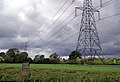 Pylons, Northmoor - geograph.org.uk - 910022.jpg 640 × 437; 66 KB
-
 Rainbow Footbridge over the River Thames - geograph.org.uk - 3450149.jpg 4,288 × 2,848; 4.9 MB
-
 Red Lion Cottages on Standlake Road - geograph.org.uk - 5668694.jpg 640 × 480; 94 KB
-
 Revisit to a pillbox - geograph.org.uk - 1945303.jpg 1,024 × 768; 341 KB
-
 River Thames - geograph.org.uk - 3269916.jpg 1,024 × 768; 161 KB
-
 River Thames - geograph.org.uk - 5669858.jpg 640 × 427; 219 KB
-
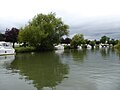
 River Thames and Bablock Hythe Caravan Park - geograph.org.uk - 1985840.jpg 1,440 × 1,080; 929 KB
-

-
 River Thames at Newbridge - geograph.org.uk - 2500352.jpg 1,024 × 664; 286 KB
-
 River Thames at Newbridge - geograph.org.uk - 2500486.jpg 1,024 × 673; 137 KB
-
 River Thames at Newbridge, Oxfordshire - geograph.org.uk - 2116368.jpg 1,200 × 1,600; 494 KB
-
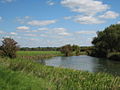
 River Thames at Northmoor - geograph.org.uk - 5649971.jpg 640 × 427; 234 KB
-
 River Thames at Northmoor - geograph.org.uk - 747682.jpg 640 × 480; 75 KB
-
 River Thames below Eaton Plantation - geograph.org.uk - 2436629.jpg 1,024 × 680; 225 KB
-
 River Thames Near Appleton - geograph.org.uk - 5655655.jpg 640 × 427; 232 KB
-
 River Thames near Bablock Hythe - geograph.org.uk - 2436634.jpg 1,024 × 680; 267 KB
-
 River Thames near Moreton - geograph.org.uk - 2435209.jpg 1,024 × 680; 180 KB
-
 River Thames near Moreton - geograph.org.uk - 2435217.jpg 1,024 × 680; 209 KB
-
 River Thames near Northmoor Lock - geograph.org.uk - 2435246.jpg 1,024 × 680; 235 KB
-
 River Windrush near Newbridge, Oxfordshire - geograph.org.uk - 1841412.jpg 3,008 × 2,000; 1.53 MB
-
 Riverbank near the pillbox - geograph.org.uk - 1943931.jpg 1,024 × 683; 214 KB
-
 Road junction west of Northmoor - geograph.org.uk - 1569507.jpg 640 × 480; 85 KB
-
 Road sign, Bablock Hythe - geograph.org.uk - 2436910.jpg 680 × 1,024; 254 KB
-
 Road to Church Farm - geograph.org.uk - 1569471.jpg 640 × 480; 104 KB
-

-
 Road to Stanton Harcourt - geograph.org.uk - 1569511.jpg 640 × 480; 91 KB
-
 Road to Witney - geograph.org.uk - 1943937.jpg 1,024 × 683; 168 KB
-
 Rose by the road - geograph.org.uk - 1943951.jpg 1,024 × 683; 214 KB
-
 Rose Revived (1), Kingston Road, Newbridge - geograph.org.uk - 2501412.jpg 1,024 × 671; 238 KB
-

-
 Rose Revived (3), Kingston Road, Newbridge - geograph.org.uk - 2501432.jpg 1,024 × 676; 217 KB
-

-

-

-
 Round another bend - geograph.org.uk - 1467797.jpg 640 × 427; 85 KB


,_Kingston_Road,_Newbridge_-_geograph.org.uk_-_2501412.jpg)
_-_sign,_Kingston_Road,_Newbridge_-_geograph.org.uk_-_2501422.jpg)
,_Kingston_Road,_Newbridge_-_geograph.org.uk_-_2501432.jpg)
_-_information_board,_Kingston_Road,_Newbridge_-_geograph.org.uk_-_2501447.jpg)
_-_the_main_entrance,_Kingston_Road,_Newbridge_-_geograph.org.uk_-_2501458.jpg)
_-_Morlands_plaque,_Kingston_Road,_Newbridge_-_geograph.org.uk_-_2501470.jpg)
