Category:Northolt
The town of Northolt, historically in Middlesex, and now in the London Borough of Ealing, United Kingdom. Postal Code UB5
area in the London Borough of Ealing, England, UK | |||||
| Upload media | |||||
| Instance of | |||||
|---|---|---|---|---|---|
| Location | London Borough of Ealing, Greater London, London, England | ||||
 | |||||
Subcategories
This category has the following 7 subcategories, out of 7 total.
C
- Northolt clock tower (4 F)
N
- Northala Fields (51 F)
- Northolt Park railway station (46 F)
- Pubs in Northolt (2 F)
S
- St Mary's Church, Northolt (10 F)
Media in category "Northolt"
The following 83 files are in this category, out of 83 total.
-
 395 bus2 (14100966936).jpg 2,304 × 1,728; 850 KB
-
 4-6 Ealing Road, Northolt - geograph.org.uk - 1312145.jpg 640 × 480; 142 KB
-
 A312 - geograph.org.uk - 5328948.jpg 640 × 364; 52 KB
-
 A40 at Northolt - geograph.org.uk - 1361849.jpg 640 × 424; 79 KB
-
 A40 Western Avenue - geograph.org.uk - 835469.jpg 640 × 480; 69 KB
-
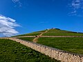
 All four mounds at Northala Fields - geograph.org.uk - 1028874.jpg 640 × 480; 81 KB
-
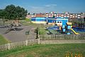
 Belvue Park, Northolt - geograph.org.uk - 174315.jpg 640 × 480; 71 KB
-
 Bread Factory - geograph.org.uk - 173839.jpg 640 × 480; 89 KB
-
 Bridge across the Grand Union Canal - geograph.org.uk - 173850.jpg 640 × 480; 129 KB
-
 Castle Road, Northolt - geograph.org.uk - 3964828.jpg 2,250 × 1,654; 1.45 MB
-
 Cemetery in South Harrow - geograph.org.uk - 99124.jpg 640 × 480; 104 KB
-
 Clare Road, Greenford - geograph.org.uk - 278630.jpg 640 × 480; 110 KB
-

-
 Dolphin Road, Northolt - geograph.org.uk - 1818118.jpg 1,024 × 678; 209 KB
-
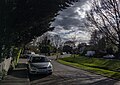
 Down Way, Northolt - geograph.org.uk - 3084867.jpg 1,600 × 1,200; 554 KB
-
 Eastcote Lane at the junction of Eastcote Lane North - geograph.org.uk - 3094464.jpg 1,600 × 1,200; 581 KB
-
 Eastcote Lane, Northolt - geograph.org.uk - 3093658.jpg 1,600 × 1,200; 575 KB
-
 Eastcote Lane, South Harrow - geograph.org.uk - 99125.jpg 640 × 480; 86 KB
-
 Eccentric road restriction on Eastcote Lane - geograph.org.uk - 3093654.jpg 1,600 × 1,200; 569 KB
-
 Elizabeth II postbox on Oldfields Circus, Northolt - geograph.org.uk - 6121917.jpg 2,676 × 4,406; 2.32 MB
-
 George V postbox on Wood End Lane, Northolt - geograph.org.uk - 6121911.jpg 2,700 × 4,996; 3.4 MB
-
 Grand Union at Northolt - geograph.org.uk - 64740.jpg 600 × 450; 66 KB
-
 Hartfield Avenue, Northolt - geograph.org.uk - 3084872.jpg 1,600 × 1,200; 544 KB
-

-
 Hill Rise, Greenford - geograph.org.uk - 278936.jpg 640 × 480; 106 KB
-
 Horseshoe Crescent at the junction of Kensington Road - geograph.org.uk - 3066047.jpg 1,600 × 1,200; 544 KB
-
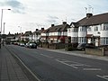
 Houses in Dolphin Road, Northolt - geograph.org.uk - 670549.jpg 640 × 480; 77 KB
-
 Islip Manor Road - geograph.org.uk - 4203900.jpg 3,212 × 2,880; 1.23 MB
-
 Linear moorings on the Paddington Arm - geograph.org.uk - 760828.jpg 640 × 480; 84 KB
-
 London Buses route 282 Northolt.jpg 1,600 × 1,200; 1.06 MB
-
 London Marathon Playingfields Clubhouse - geograph.org.uk - 348357.jpg 640 × 480; 102 KB
-
 London Transport Executive sign opposite Northolt station 2024-04-28 03.jpg 4,608 × 3,456; 6.99 MB
-
 Long Drive, Northolt - geograph.org.uk - 2779042.jpg 640 × 480; 87 KB
-
 Mandeville Road bus 90 termination.jpg 3,894 × 3,024; 4.1 MB
-
 Mandeville Road, Northolt - geograph.org.uk - 2583140.jpg 4,320 × 3,240; 4.45 MB
-
 Mandeville Road, Northolt.jpg 2,304 × 1,728; 808 KB
-
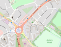 Map of Northolt, London.png 498 × 384; 147 KB
-
 Masjid al-Husainy, Northolt.jpg 3,162 × 1,761; 3.09 MB
-
 Mohammedi Park Masjid Complex - geograph.org.uk - 174311.jpg 640 × 480; 116 KB
-
 Mural under A40 canal bridge - geograph.org.uk - 653819.jpg 640 × 479; 220 KB
-
 Northala Fields 2.jpg 4,032 × 3,024; 4.8 MB
-
 Northala Fields playing area.jpg 6,016 × 4,000; 6.34 MB
-
 Northala Fields ponds.jpg 4,032 × 3,024; 4.06 MB
-
 Northolt - Eastcote Lane North - geograph.org.uk - 2881118.jpg 640 × 480; 209 KB
-
 Northolt fire station - geograph.org.uk - 623755.jpg 640 × 427; 177 KB
-

-
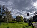
 Northolt Recreation Ground - geograph.org.uk - 72929.jpg 640 × 425; 90 KB
-
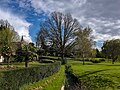
 Northolt Village 2.jpg 3,792 × 2,700; 3.69 MB
-
 Northolt Village 3.jpg 3,954 × 3,024; 4.02 MB
-
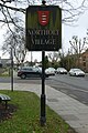 Northolt Village sign.jpg 2,592 × 3,888; 5.43 MB
-
 Northolt Village.jpg 4,032 × 3,024; 4.5 MB
-
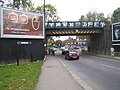 Northolt, Pett's Hill railway bridge - geograph.org.uk - 596249.jpg 640 × 480; 84 KB
-
 Northolt, The Fairway - geograph.org.uk - 2407262.jpg 640 × 480; 112 KB
-
 Oldfield Lane North (2) - geograph.org.uk - 175139.jpg 640 × 480; 97 KB
-
 Oldfield Lane North - geograph.org.uk - 173833.jpg 640 × 480; 104 KB
-
 Oldfield Lane North, Greenford - geograph.org.uk - 278628.jpg 640 × 480; 97 KB
-
 Oldfield Lane North, Greenford - geograph.org.uk - 278635.jpg 640 × 480; 98 KB
-
 Oldfields Circus, Northolt - geograph.org.uk - 23451.jpg 640 × 480; 110 KB
-

-

-
 Poynter Court, Gallery Gardens in November 2022 01.jpg 4,608 × 3,456; 7.29 MB
-
 Poynter Court, Gallery Gardens in November 2022 02.jpg 4,608 × 3,456; 7.17 MB
-
 Poynter Court, Gallery Gardens in November 2022 03.jpg 4,608 × 3,456; 7.3 MB
-
 Ribblesdale Road at the junction of Castle Road - geograph.org.uk - 3964770.jpg 2,304 × 1,728; 826 KB
-
 Roundabout on Whitton Avenue West, Northolt - geograph.org.uk - 3964691.jpg 2,304 × 1,728; 806 KB
-
 Rowdell Road, Northolt - geograph.org.uk - 4208661.jpg 1,600 × 1,200; 449 KB
-
 Russell Road, Northolt - geograph.org.uk - 3964695.jpg 2,304 × 1,728; 818 KB
-
 Shops on Greenford Road - geograph.org.uk - 278413.jpg 640 × 480; 126 KB
-
 Shops on Mandeville Road - geograph.org.uk - 4203934.jpg 1,600 × 1,172; 365 KB
-
 South Harrow, A4090 Alexandra Avenue - geograph.org.uk - 596268.jpg 640 × 480; 110 KB
-
 South Harrow, Park Gates flats - geograph.org.uk - 596266.jpg 640 × 465; 79 KB
-

-
 St Barnabas Church, Northolt Park - geograph.org.uk - 23454.jpg 640 × 480; 63 KB
-
 St Mary, Northolt.jpg 3,024 × 4,032; 6.17 MB
-
 Target Roundabout, Northolt - geograph.org.uk - 18283.jpg 640 × 480; 72 KB
-
 The Roxbourne, South Harrow - geograph.org.uk - 69886.jpg 640 × 427; 132 KB
-
 The Roxbourne, South Ruislip - geograph.org.uk - 69865.jpg 640 × 427; 111 KB
-
 The Roxbourne, South Ruislip - geograph.org.uk - 69881.jpg 640 × 427; 129 KB
-
 West London Mosque - geograph.org.uk - 174312.jpg 640 × 480; 115 KB
-

-
 Wood End Gardens, Northolt - geograph.org.uk - 3964841.jpg 2,304 × 1,728; 826 KB
-
 Wood End Lane, Northolt - geograph.org.uk - 3964699.jpg 2,304 × 1,728; 817 KB
-
 Wood End Way, Northolt - geograph.org.uk - 3964837.jpg 2,304 × 1,728; 818 KB
.jpg)


_-_geograph.org.uk_-_175139.jpg)


