Category:Northwold
village and civil parish in Norfolk, UK  | |||||
| Upload media | |||||
| Instance of | |||||
|---|---|---|---|---|---|
| Location | King's Lynn and West Norfolk, Norfolk, East of England, England | ||||
| Area |
| ||||
 | |||||
Norsk bokmål: Northwold er et kirkesogn og en landsby i England, den ligger 4.8 km fra den nå nedlagte togstasjonen Stoke Ferry som var en den av den berømte tognettverket Great Eastern Railway. Landsbyen ligger 12 km nord for [Brandon], og 153 km fra London. Eleven Wissey renner i gjennom landsbyen. Northwold hører til fylkets Vestlige distrikt.
Subcategories
This category has the following 3 subcategories, out of 3 total.
Media in category "Northwold"
The following 124 files are in this category, out of 124 total.
-
 'The Crown Inn', Northwold - geograph.org.uk - 5311857.jpg 3,456 × 2,592; 3.73 MB
-
 43 High Street, Northwold (geograph 7258029).jpg 1,024 × 768; 271 KB
-
 44 High Street, Northwold (geograph 7258043).jpg 1,024 × 768; 142 KB
-
 47-51 High Street, Northwold (geograph 7258039).jpg 1,024 × 768; 191 KB
-
 A134 towards Northwold - geograph.org.uk - 4576740.jpg 640 × 480; 66 KB
-
 A134, Whittington - geograph.org.uk - 4576738.jpg 640 × 480; 69 KB
-
 Bend on the A134 - geograph.org.uk - 4576787.jpg 640 × 480; 77 KB
-
 Bridge over River Wissey - geograph.org.uk - 855253.jpg 640 × 480; 80 KB
-
 Bridge over the River Wissey - geograph.org.uk - 6177807.jpg 4,608 × 3,456; 4.32 MB
-
 Combat paintball off Methwold Road (B1112) - geograph.org.uk - 4522038.jpg 1,024 × 768; 347 KB
-
 Cottage in High Street, Northwold - geograph.org.uk - 1915106.jpg 640 × 480; 106 KB
-
 Cottages and smashing pumpkins - geograph.org.uk - 5605821.jpg 640 × 360; 99 KB
-
 Cottages in High Street, Northwold - geograph.org.uk - 1915114.jpg 600 × 573; 149 KB
-

-
 Crop field and hedgerow - geograph.org.uk - 4576745.jpg 640 × 480; 82 KB
-
 Crop field beside woodland - geograph.org.uk - 4622663.jpg 640 × 480; 87 KB
-

-
 Crop field off Methwold Road (B1112) - geograph.org.uk - 4576718.jpg 640 × 480; 70 KB
-
 Crop field off Methwold Road (B1112) - geograph.org.uk - 4576726.jpg 640 × 480; 58 KB
-
 Crop field off Thetford Road (A134) - geograph.org.uk - 4576747.jpg 640 × 480; 85 KB
-
 Crop field, Northwold - geograph.org.uk - 4576768.jpg 640 × 480; 79 KB
-
 Cross, Northwold - geograph.org.uk - 4622644.jpg 640 × 480; 64 KB
-

-

-
 Downstream from Northwold Ford - geograph.org.uk - 5605851.jpg 640 × 360; 94 KB
-
 Entering Whittington - geograph.org.uk - 4576741.jpg 640 × 480; 57 KB
-
 Entrance to Combat paintball area - geograph.org.uk - 4522041.jpg 1,024 × 768; 355 KB
-
 Entrance to Winyards - geograph.org.uk - 4522070.jpg 1,024 × 768; 422 KB
-
 Farm road east of Methwold - geograph.org.uk - 397578.jpg 640 × 480; 88 KB
-
 Farm track off Methwold Road (B1112) - geograph.org.uk - 4576725.jpg 640 × 480; 61 KB
-
 Farm track off Thetford Road (A134) - geograph.org.uk - 4576754.jpg 640 × 480; 64 KB
-
 Farm track off Thetford Road (A134) - geograph.org.uk - 4576776.jpg 640 × 480; 68 KB
-
 Farmland near Edgewell - geograph.org.uk - 4576780.jpg 640 × 480; 72 KB
-
 Farmland off the A134 - geograph.org.uk - 4576783.jpg 640 × 480; 78 KB
-
 Farmland off Thetford Road (A134) - geograph.org.uk - 4576764.jpg 640 × 480; 51 KB
-
 Fields between Cranwich and Methwold - geograph.org.uk - 1825575.jpg 640 × 427; 99 KB
-

-
 Ford and Footbridge at Northwold - geograph.org.uk - 3157215.jpg 3,872 × 2,592; 2.39 MB
-
 Former Maltings - geograph.org.uk - 5197177.jpg 1,024 × 683; 141 KB
-
 Glebe Close, Northwold - geograph.org.uk - 4576756.jpg 640 × 480; 64 KB
-
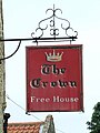
 Hanging sign of 'The Crown Inn', Northwold - geograph.org.uk - 5311859.jpg 3,456 × 2,592; 3.51 MB
-
 High Street in Northwold - geograph.org.uk - 1915100.jpg 640 × 480; 92 KB
-
 High Street in Northwold - geograph.org.uk - 1915103.jpg 640 × 480; 146 KB
-
 High Street through Northwold - geograph.org.uk - 1915105.jpg 640 × 480; 136 KB
-
 High Street, Northwold - geograph.org.uk - 4622656.jpg 640 × 480; 71 KB
-
 High Street, Northwold - geograph.org.uk - 5605855.jpg 640 × 360; 52 KB
-
 High Street, Northwold - geograph.org.uk - 5605857.jpg 640 × 360; 59 KB
-
 High Street, Northwold - geograph.org.uk - 5605860.jpg 640 × 360; 60 KB
-
 House on Thetford Road (A134) - geograph.org.uk - 4576751.jpg 640 × 480; 74 KB
-
 House on Thetford Road (A134) - geograph.org.uk - 4576761.jpg 640 × 480; 70 KB
-
 Index of graves and Transcripts of memorials at Northwold - geograph.org.uk - 5311869.jpg 3,456 × 2,592; 3.87 MB
-

-
 Linden Cottage, Northwold (geograph 7258041).jpg 1,024 × 768; 207 KB
-
 Methwold Road (B1112) - geograph.org.uk - 4576722.jpg 640 × 480; 48 KB
-
 Methwold Road (B1112) - geograph.org.uk - 4576728.jpg 640 × 480; 110 KB
-
 Methwold Road (B1112) - geograph.org.uk - 4576732.jpg 640 × 480; 47 KB
-
 Methwold Road (B1112) - geograph.org.uk - 4576737.jpg 640 × 480; 57 KB
-
 Methwold Road outside Winyards - geograph.org.uk - 4522068.jpg 1,024 × 768; 307 KB
-
 No 96 High Street, Northwold - geograph.org.uk - 5605826.jpg 640 × 360; 53 KB
-
 Northwold cemetery - geograph.org.uk - 5311874.jpg 3,456 × 2,592; 3.86 MB
-
 Northwold Fen looking south east - geograph.org.uk - 564633.jpg 640 × 480; 164 KB
-
 Northwold Ford - geograph.org.uk - 3157224.jpg 3,872 × 2,592; 2.38 MB
-
 Northwold Ford - geograph.org.uk - 3841722.jpg 3,872 × 2,592; 4.78 MB
-
 Northwold High Street from Howell's Lane - geograph.org.uk - 4522073.jpg 1,024 × 768; 337 KB
-

-
 Northwold Road, Methwold - geograph.org.uk - 4522060.jpg 1,024 × 768; 271 KB
-
 Northwold Tile Centre - geograph.org.uk - 4622659.jpg 640 × 480; 56 KB
-
 Northwold village sign in Church Lane - geograph.org.uk - 4354424.jpg 1,024 × 768; 334 KB
-
 Northwold, Comma butterfly - geograph.org.uk - 6260110.jpg 5,664 × 3,776; 3.07 MB
-
 Northwold, Comma butterfly feeding on fallen damsons 1 - geograph.org.uk - 6260093.jpg 5,268 × 3,512; 3.42 MB
-
 Northwold, Comma butterfly feeding on fallen damsons 2 - geograph.org.uk - 6260099.jpg 5,454 × 3,636; 3.7 MB
-
 Northwold, Comma butterfly feeding on fallen damsons 3 - geograph.org.uk - 6260107.jpg 5,725 × 3,817; 5.13 MB
-
 Northwold, early April - geograph.org.uk - 529553.jpg 640 × 480; 83 KB
-
 Northwold, Red Admiral butterfly - geograph.org.uk - 6260102.jpg 5,284 × 3,523; 2.86 MB
-
 Northwold, Red Admiral butterfly - geograph.org.uk - 6260120.jpg 4,103 × 2,736; 2.68 MB
-
 Northwold, Red Admiral butterfly feeding on fallen damsons 1 - geograph.org.uk - 6260097.jpg 5,427 × 3,618; 3.16 MB
-
 Northwold, Red Admiral butterfly feeding on fallen damsons 2 - geograph.org.uk - 6260114.jpg 5,469 × 3,646; 3.94 MB
-
 Northwold.jpg 2,560 × 1,920; 1.11 MB
-

-
 Old Pre-Worboys Sign - geograph.org.uk - 2765627.jpg 1,024 × 768; 311 KB
-
 Old village name sign - geograph.org.uk - 817516.jpg 480 × 640; 127 KB
-

-
 Ordnance Survey Cut Mark - geograph.org.uk - 4293029.jpg 4,000 × 3,000; 3.76 MB
-
 Overgrown and boarded-up - geograph.org.uk - 1915123.jpg 480 × 640; 170 KB
-
 Poppies at the roadside - geograph.org.uk - 4522079.jpg 1,024 × 768; 599 KB
-
 Post Office and shop - geograph.org.uk - 817614.jpg 640 × 480; 79 KB
-

-

-
 Ripening barley - geograph.org.uk - 4522046.jpg 1,024 × 768; 368 KB
-
 River Wissey at Didlington - geograph.org.uk - 1912446.jpg 640 × 480; 106 KB
-
 River Wissey at Northwold - geograph.org.uk - 123948.jpg 640 × 480; 101 KB
-
 Road Junction - geograph.org.uk - 5565103.jpg 1,024 × 768; 246 KB
-
 Sycamore House, Northwold - geograph.org.uk - 5303143.jpg 600 × 640; 281 KB
-
 The B1112 looking northeast - geograph.org.uk - 564929.jpg 640 × 480; 164 KB
-
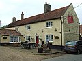 The Crown - geograph.org.uk - 817601.jpg 640 × 480; 93 KB
-
 The Crown - geograph.org.uk - 817603.jpg 480 × 640; 52 KB
-

-

-
 Thetford 12 Miles - geograph.org.uk - 4576770.jpg 640 × 480; 73 KB
-
 Thetford Road (A134) - geograph.org.uk - 4576749.jpg 640 × 480; 55 KB
-
 Thetford Road (A134) - geograph.org.uk - 4576763.jpg 640 × 480; 75 KB
-
 Thetford Road (A134) - geograph.org.uk - 4622660.jpg 640 × 480; 70 KB
-
 Thetford Road (A134) - geograph.org.uk - 4622664.jpg 640 × 480; 91 KB
-
 Traffic jam in Northwold - geograph.org.uk - 5190061.jpg 640 × 480; 61 KB
-
 View northeast to Broom Covert - geograph.org.uk - 564884.jpg 640 × 480; 143 KB
-
 View off the Common Drove, Northwold - geograph.org.uk - 5605835.jpg 640 × 360; 50 KB
-
 View through trees to grassy area Foulden Common - geograph.org.uk - 6160835.jpg 1,024 × 768; 394 KB
-
 View towards top of hill (11m ) - geograph.org.uk - 564732.jpg 640 × 480; 153 KB
-
 Village green in Northwold - geograph.org.uk - 1915111.jpg 640 × 480; 131 KB
-
 West End, Northwold - geograph.org.uk - 4622646.jpg 640 × 480; 70 KB
-
 Whittington Hill - geograph.org.uk - 547276.jpg 640 × 427; 123 KB
-
 Wissey view towards Pump House - geograph.org.uk - 567012.jpg 640 × 480; 168 KB
-
 Bog oak - geograph.org.uk - 566935.jpg 640 × 480; 187 KB
-
 Buxton Plantation - geograph.org.uk - 567032.jpg 640 × 480; 164 KB
-
 Church Lane Cottages - geograph.org.uk - 307624.jpg 640 × 487; 64 KB
-

-
 Cottage in Northwold - geograph.org.uk - 123918.jpg 640 × 480; 145 KB
-
 Ford in Northwold - geograph.org.uk - 123938.jpg 640 × 468; 151 KB
-
 New-build at Little London - geograph.org.uk - 397649.jpg 640 × 480; 121 KB
-
 Northwold - geograph.org.uk - 306444.jpg 640 × 480; 101 KB
-
 Northwold, village sign - geograph.org.uk - 306007.jpg 640 × 480; 119 KB
-
 Power Line at Ferry Drove - geograph.org.uk - 567036.jpg 640 × 444; 122 KB
-
 Primitive Methodist Chapel, Northwold - geograph.org.uk - 123930.jpg 640 × 480; 109 KB
-
 Rush Covert - geograph.org.uk - 397638.jpg 640 × 480; 148 KB

.jpg)
.jpg)
.jpg)


_-_geograph.org.uk_-_4522038.jpg)


_-_geograph.org.uk_-_4576773.jpg)
_-_geograph.org.uk_-_4576718.jpg)
_-_geograph.org.uk_-_4576726.jpg)
_-_geograph.org.uk_-_4576747.jpg)


_-_geograph.org.uk_-_4576725.jpg)
_-_geograph.org.uk_-_4576754.jpg)
_-_geograph.org.uk_-_4576776.jpg)


_-_geograph.org.uk_-_4576764.jpg)


_-_geograph.org.uk_-_4576751.jpg)
_-_geograph.org.uk_-_4576761.jpg)

.jpg)
_-_geograph.org.uk_-_4576722.jpg)
_-_geograph.org.uk_-_4576728.jpg)
_-_geograph.org.uk_-_4576732.jpg)
_-_geograph.org.uk_-_4576737.jpg)


_-_geograph.org.uk_-_2018599.jpg)


_-_geograph.org.uk_-_4576730.jpg)
_-_geograph.org.uk_-_4576735.jpg)


_-_geograph.org.uk_-_4576749.jpg)
_-_geograph.org.uk_-_4576763.jpg)
_-_geograph.org.uk_-_4622660.jpg)
_-_geograph.org.uk_-_4622664.jpg)


_-_geograph.org.uk_-_564732.jpg)


