Category:Nuthampstead
English: Nuthampstead is a small village and parish in North East Hertfordshire located a few miles south of the town of Royston. In the 2001 census the parish had 139 residents.

village in Hertfordshire, England, UK  | |||||
| Upload media | |||||
| Instance of | |||||
|---|---|---|---|---|---|
| Location | North Hertfordshire, Hertfordshire, East of England, England | ||||
 | |||||
Subcategories
This category has the following 2 subcategories, out of 2 total.
R
S
Media in category "Nuthampstead"
The following 58 files are in this category, out of 58 total.
-
 'Private road No access without permission' - geograph.org.uk - 6063638.jpg 1,024 × 768; 266 KB
-
 398th Bomb Group Memorial, Nuthampstead - geograph.org.uk - 2386632.jpg 800 × 600; 100 KB
-
 Barn in Nuthampstead - geograph.org.uk - 6216988.jpg 1,892 × 1,236; 1.42 MB
-
 Bridleway to Cokenach - geograph.org.uk - 5879138.jpg 1,600 × 1,213; 414 KB
-
 Bury End - geograph.org.uk - 5879103.jpg 1,600 × 1,200; 291 KB
-
 Bury Farm - geograph.org.uk - 5879096.jpg 1,600 × 1,200; 373 KB
-
 Entering Nuthampstead - geograph.org.uk - 6063694.jpg 1,024 × 684; 282 KB
-
 Fallow field by Abbotsbury House - geograph.org.uk - 5879892.jpg 1,600 × 1,157; 397 KB
-
 Farmstead in Nuthampstead - geograph.org.uk - 6216989.jpg 1,920 × 1,280; 2.23 MB
-
 Fighter Group Memorial, Nuthampstead - geograph.org.uk - 2386650.jpg 600 × 800; 120 KB
-
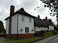
 First (or last) houses in Nuthampstead - geograph.org.uk - 3446979.jpg 4,320 × 3,240; 4.58 MB
-
 Footpath by field boundary - geograph.org.uk - 5879132.jpg 1,600 × 1,200; 562 KB
-
 Footpath from Earl's Wood - geograph.org.uk - 5879085.jpg 1,600 × 1,200; 620 KB
-
 Footpath from Nuthampstead - geograph.org.uk - 5879127.jpg 1,600 × 1,200; 590 KB
-
 Footpath from Smith's End - geograph.org.uk - 5879885.jpg 1,600 × 1,200; 505 KB
-
 Footpath near Nuthampstead - geograph.org.uk - 5879089.jpg 1,600 × 1,175; 581 KB
-
 Footpath to Bell Farm Industrial Park - geograph.org.uk - 5879121.jpg 1,600 × 1,200; 482 KB
-
 Footpath to Messop's Grove - geograph.org.uk - 5879137.jpg 1,600 × 1,200; 496 KB
-
 Footpath to Messop's Grove - geograph.org.uk - 5879848.jpg 1,600 × 1,277; 580 KB
-
 Footpath to Smith's End - geograph.org.uk - 5879144.jpg 1,600 × 1,200; 452 KB
-
 Former RAF Nuthampstead from the air - geograph.org.uk - 2696630.jpg 640 × 480; 132 KB
-
 Former RAF Nuthampstead from the air - geograph.org.uk - 2963911.jpg 640 × 480; 121 KB
-
 Former RAF Nuthampstead from the air - geograph.org.uk - 2963916.jpg 640 × 480; 151 KB
-
 GOC Barley 019 Bell Farm Industrial Park, Nuthampstead (9032552012).jpg 4,288 × 3,216; 3.8 MB
-
 GOC Barley 021 Bury Farm Cottage, Nuthampstead (9030327851).jpg 3,879 × 2,913; 3.63 MB
-
 GOC Barley 022 Bury Cottage, Nuthampstead (9032555010).jpg 4,288 × 3,216; 4.16 MB
-
 GOC Barley 024 Farm buildings at Bury Farm, Nuthampstead (9030331015).jpg 4,288 × 3,216; 3.99 MB
-
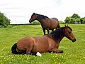 GOC Barley 025 Horses at Bury Farm, Nuthampstead (9030332571).jpg 4,288 × 3,216; 4.19 MB
-
 GOC Barley 037 Barn (9041018414).jpg 3,696 × 2,781; 2.94 MB
-
 Hedgerow in Morrice Green - geograph.org.uk - 6216986.jpg 1,920 × 1,280; 1.61 MB
-
 Hertfordshire Way by Earl's Wood - geograph.org.uk - 5879071.jpg 1,600 × 1,200; 656 KB
-
 Hertfordshire Way near Nuthampstead - geograph.org.uk - 5879110.jpg 1,600 × 1,129; 461 KB
-
 Hertfordshire Way towards Earl's Wood - geograph.org.uk - 5879043.jpg 1,600 × 1,200; 466 KB
-
 Leaving Nuthampstead - geograph.org.uk - 6063701.jpg 1,024 × 684; 272 KB
-
 Line of trees near Morrice Green farm - geograph.org.uk - 3446806.jpg 4,320 × 3,240; 2.92 MB
-
 Minor road between Nuthampstead and Ansty - geograph.org.uk - 3446996.jpg 4,320 × 3,240; 4.4 MB
-
 Nuthampstead Road near Barkway - geograph.org.uk - 6216995.jpg 1,920 × 1,280; 1.46 MB
-
 Outbuilding at Rushingwells - geograph.org.uk - 5879032.jpg 1,600 × 1,200; 421 KB
-
 Park Farm, Nuthampstead - geograph.org.uk - 5462096.jpg 3,264 × 2,448; 3.41 MB
-
 Path from Rushingwells - geograph.org.uk - 5879038.jpg 1,600 × 1,200; 408 KB
-
 Path near Nuthampstead - geograph.org.uk - 6216996.jpg 1,920 × 1,280; 1.56 MB
-
 Pheasant feeder, Nuthampstead 2020-09-02.jpg 2,938 × 2,938; 5.27 MB
-
 Pheasant rearing in a copse - geograph.org.uk - 5879880.jpg 1,600 × 1,147; 579 KB
-
 Pond in Messop's Grove - geograph.org.uk - 5879855.jpg 1,600 × 1,247; 594 KB
-
 RAF Nuthampstead - geograph.org.uk - 5462101.jpg 3,264 × 2,448; 3.3 MB
-
 Ripening wheat - geograph.org.uk - 5879124.jpg 1,600 × 1,200; 544 KB
-
 Road to Bury End - geograph.org.uk - 5879092.jpg 1,600 × 1,149; 333 KB
-
 Row of trees in Morrice Green - geograph.org.uk - 6216987.jpg 1,920 × 1,280; 1.77 MB
-
 Site of Main Runway, Nuthampstead - geograph.org.uk - 2386659.jpg 800 × 600; 113 KB
-
 Taxiway at RAF Nuthampstead - geograph.org.uk - 2386672.jpg 800 × 600; 99 KB
-
 The Grove, by Earl's Wood - geograph.org.uk - 5879077.jpg 1,600 × 1,200; 414 KB
-
 Wheat field by Messop's Grove - geograph.org.uk - 5879850.jpg 1,600 × 1,134; 447 KB
-
 Fishing Pond, Nuthampstead - geograph.org.uk - 202066.jpg 640 × 460; 157 KB
-
 Horses and hay-bales - geograph.org.uk - 284445.jpg 640 × 480; 68 KB
-
 Nuthampstead Shooting Ground - geograph.org.uk - 501785.jpg 640 × 412; 72 KB
-
 Sheepwash Grove, Nuthampstead - geograph.org.uk - 494233.jpg 640 × 480; 99 KB
-
 Small wood near Up End track - geograph.org.uk - 707305.jpg 640 × 426; 112 KB
-
 Thatched cottage in Nuthampstead - geograph.org.uk - 284204.jpg 640 × 480; 67 KB


_houses_in_Nuthampstead_-_geograph.org.uk_-_3446979.jpg)


.jpg)
.jpg)
.jpg)
.jpg)
.jpg)
.jpg)


