Category:Oak Road, Hooton
| Object location | | View all coordinates using: OpenStreetMap |
|---|
Oak Road is a cul de sac near Hooton railway station; it was presumably built to accommodate workers for the nearby waterworks or cattle market.
Media in category "Oak Road, Hooton"
The following 4 files are in this category, out of 4 total.
-
 Post box on Oak Road, Hooton.jpg 2,958 × 4,686; 8.03 MB
-
 Hydrant marker, Oak Road, Hooton.jpg 2,538 × 4,062; 7.63 MB
-
 Oak Road, Hooton.jpg 5,040 × 3,269; 9.72 MB
-
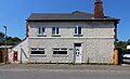 Old Post Office, Oak Road, Hooton.jpg 4,595 × 2,804; 7.67 MB


