Category:Occupied territories of Syria
Media in category "Occupied territories of Syria"
The following 15 files are in this category, out of 15 total.
-
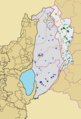
 Demographic map of the Golan Heights - Before 1967 - Legend.png 1,255 × 1,850; 136 KB
-
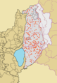
 Demographic map of the Golan Heights - Before 1967.png 1,255 × 1,850; 106 KB
-
 Demographic map of the Golan Heights - Legend.png 1,255 × 1,850; 140 KB
-

-

-
 Demographic map of the Golan Heights.png 1,255 × 1,850; 96 KB
-
 Golan 92.jpg 1,000 × 1,262; 236 KB
-
 Golan Heights administrative Division - Legend.png 1,255 × 1,850; 100 KB
-
 Golan Heights administrative Division.png 1,255 × 1,850; 85 KB
-
 Golan Heights proportion map.jpg 974 × 1,231; 239 KB
-
 Golan location map.PNG 732 × 628; 76 KB
-
 Map of Location of Settlement of Refugees of Afrin District.png 1,648 × 1,288; 74 KB
-
 Shebaa Farms-ar.jpg 800 × 1,220; 337 KB
-
 Syrian localities depopulated during and after the 1967 War - Golan Heights - Legend.png 1,255 × 1,850; 140 KB
-
 Syrian localities depopulated during and after the 1967 War - Golan Heights.png 1,255 × 1,850; 107 KB


