Category:October 2008 in Northumberland
Ceremonial counties of England: Berkshire · Buckinghamshire · Cambridgeshire · Cheshire · Cornwall · Cumbria · Derbyshire · Devon · Dorset · Durham · East Riding of Yorkshire · East Sussex · Essex · Gloucestershire · Greater London · Greater Manchester · Hampshire · Herefordshire · Hertfordshire · Kent · Lancashire · Leicestershire · Lincolnshire · Merseyside · Norfolk · North Yorkshire · Northamptonshire · Northumberland · Nottinghamshire · Oxfordshire · Rutland · Shropshire · Somerset · South Yorkshire · Staffordshire · Suffolk · Surrey · Tyne and Wear · Warwickshire · West Midlands · West Sussex · West Yorkshire · Wiltshire · Worcestershire
City-counties: Bristol ·
Former historic counties:
Other former counties:
City-counties: Bristol ·
Former historic counties:
Other former counties:
Deutsch: Bilder, die im Oktober 2008 in Northumberland aufgenommen worden sind. Bitte beachten Sie, dass dies weder das Datum des Uploads noch das Datum des Scannens eines Fotos ist.
English: Images/pictures taken in Northumberland during October 2008. Note this is not the date of the upload, nor the date a photo was scanned.
Español: Fotografías o imágenes tomadas en Northumberland durante octubre 2008. No es la fecha de subida ni escaneo, sino la fecha en que las fotografías o imágenes se crearon.
Esperanto: Bildoj faritaj en Northumberland en oktobro 2008. Tio ne estas la dato, kiam la bildoj estis alŝutitaj aŭ skanitaj.
Français : Photographies ou images prises en Northumberland durant octobre 2008. Ce n'est pas la date du téléchargement ou du scan.
Galego: Fotografías ou imaxes tomadas en Northumberland durante outubro 2008. Non é a data de subida nin escaneamento, senón a data na que se crearon as fotografías ou imaxes.
Italiano: Fotografie o immagini scattate a Northumberland nel ottobre 2008. Nota bene: la data non si riferisce né a quella di upload né a quella in cui la foto è stata digitalizzata.
Norsk bokmål: Bilder tatt i Northumberland i løpet av oktober 2008. Merk at dette ikke er datoen for opplasting, eller når et bilde har blitt skannet.
Norsk nynorsk: Bilete teke i Northumberland i løpet av oktober 2008. Merk at dette ikkje er datoen for opplasting, eller når eit bilete har vorte skanna.
Русский: Изображения, сделанные в Northumberland в течение октябрь 2008 (не дата загрузки изображения).
Українська: Зображення, зроблені в Northumberland протягом жовтень 2008. Зауважте, що це не дата завантаження чи дата сканування фотографії.
| October 2007 | ← | October 2008 | → | October 2009 | |||||||
| Jan | Feb | Mar | Apr | May | Jun | Jul | Aug | Sep | Oct | Nov | Dec |
| 19 | 46 | 80 | 23 | 26 | 47 | 51 | 50 | 61 | 50 | 50 | 62 |
|---|---|---|---|---|---|---|---|---|---|---|---|
Subcategories
This category has only the following subcategory.
Media in category "October 2008 in Northumberland"
The following 49 files are in this category, out of 49 total.
-

-

-

-
 Bamburgh Castle by Keven Law.jpg 3,808 × 1,882; 1.02 MB
-
 Castlehead Rocks - geograph.org.uk - 995489.jpg 640 × 480; 112 KB
-
 Cottage at Stagshaw - geograph.org.uk - 1052330.jpg 640 × 480; 67 KB
-
 Cottage near Wylam war memorial - geograph.org.uk - 1065847.jpg 640 × 480; 100 KB
-
 Cottages at Stagshaw - geograph.org.uk - 1052332.jpg 640 × 359; 43 KB
-
 Dam at Colt Crag Reservoir - geograph.org.uk - 1008645.jpg 600 × 450; 155 KB
-
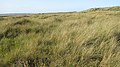
 Dunes, Holy Island - geograph.org.uk - 1001711.jpg 640 × 359; 80 KB
-
 Emmanuel Head and Keel Head - geograph.org.uk - 995507.jpg 640 × 348; 58 KB
-
 Farm wall - geograph.org.uk - 995529.jpg 640 × 480; 111 KB
-
 Fenkle Street, Holy Island - geograph.org.uk - 1001212.jpg 640 × 359; 80 KB
-
 Field of stubble near Walwick - geograph.org.uk - 1018424.jpg 640 × 480; 101 KB
-
 Fields above Moss Kennels - geograph.org.uk - 1018997.jpg 640 × 480; 92 KB
-
 Follow the tractor - geograph.org.uk - 1028034.jpg 640 × 480; 95 KB
-
 Holy Island village hall site - geograph.org.uk - 1001208.jpg 640 × 359; 87 KB
-
 Kielder Head, following the burn - geograph.org.uk - 1188841.jpg 640 × 480; 109 KB
-
 Lindisfarne Castle early evening - geograph.org.uk - 1011017.jpg 640 × 334; 33 KB
-
 Links land, Holy Island - geograph.org.uk - 993746.jpg 640 × 480; 128 KB
-
 Path to Sandham - geograph.org.uk - 995511.jpg 640 × 359; 78 KB
-
 Pilgrim's Way - geograph.org.uk - 993741.jpg 640 × 480; 75 KB
-
 Power line marker - geograph.org.uk - 1001729.jpg 640 × 359; 50 KB
-
 Prudhoe station (2) - geograph.org.uk - 1022429.jpg 640 × 480; 99 KB
-
 Prudhoe station - geograph.org.uk - 1022427.jpg 640 × 480; 77 KB
-
 Road off Holy Island - geograph.org.uk - 1001733.jpg 640 × 359; 64 KB
-
 Road, Holy Island - geograph.org.uk - 1001725.jpg 640 × 359; 53 KB
-
 Salt tolerant plants, Holy Island - geograph.org.uk - 993730.jpg 640 × 480; 108 KB
-

-
 Sandham - geograph.org.uk - 995501.jpg 640 × 359; 81 KB
-
 Sandon Bay, Holy Island - geograph.org.uk - 1007714.jpg 600 × 450; 76 KB
-
 Sheepfold at Sycamore Gap - geograph.org.uk - 1018990.jpg 640 × 480; 116 KB
-
 Shingle Bank, Castle point - geograph.org.uk - 1011939.jpg 640 × 426; 56 KB
-
 Side view. the castle at Lindisfarne - geograph.org.uk - 1011938.jpg 640 × 426; 39 KB
-
 Slack, The Links - geograph.org.uk - 995523.jpg 640 × 359; 88 KB
-
 St Cuthbert's Isle - geograph.org.uk - 1001204.jpg 640 × 359; 94 KB
-
 Teasles, Holy Island - geograph.org.uk - 1001222.jpg 640 × 359; 120 KB
-
 The Castle, Lindisfarne - geograph.org.uk - 1011937.jpg 640 × 426; 54 KB
-
 The causeway - geograph.org.uk - 1001739.jpg 640 × 359; 35 KB
-
 The causeway - geograph.org.uk - 1005798.jpg 640 × 359; 77 KB
-
 The Links - geograph.org.uk - 995519.jpg 640 × 480; 108 KB
-
 The Links, Holy Island - geograph.org.uk - 996683.jpg 640 × 480; 49 KB
-
 The Snook - geograph.org.uk - 1001737.jpg 640 × 359; 97 KB
-
 The waggonway - geograph.org.uk - 996716.jpg 640 × 359; 79 KB
-
 Track, Holy Island - geograph.org.uk - 996695.jpg 640 × 480; 136 KB
-
 Turnstile, Holy Island - geograph.org.uk - 1001209.jpg 640 × 359; 106 KB
-
 Warning sign - geograph.org.uk - 993736.jpg 480 × 640; 112 KB
-
 Waterlogged field - geograph.org.uk - 996693.jpg 640 × 480; 106 KB
-
 Wave cut rocks, Sandham - geograph.org.uk - 995497.jpg 640 × 480; 114 KB
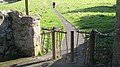
_mounting_steps,_St._Michael%27s_Church,_Warden_-_geograph.org.uk_-_1066985.jpg)
_the_churchyard_and_the_tower_of_St._Mary%27s_Church,_Ovingham_-_geograph.org.uk_-_1051470.jpg)
_the_churchyard_of_St._Mary%27s_Church,_Ovingham_-_geograph.org.uk_-_1051440.jpg)


_-_geograph.org.uk_-_1022429.jpg)


