Category:Office buildings in the London Borough of Croydon

Wikimedia list article | |||||
| Upload media | |||||
| Instance of | |||||
|---|---|---|---|---|---|
| Location |
| ||||
| |||||
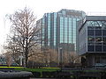
This category is for any photographs of office buildings in the London Borough of Croydon.
Subcategories
This category has the following 9 subcategories, out of 9 total.
A
- Apollo House (Croydon) (1 F)
C
- Council Offices, Purley (4 F)
L
- Lunar House (5 F)
N
- Nestlé Tower (6 F)
- No.1 Croydon (18 F)
R
- Ruskin House, Croydon (4 F)
T
- Taberner House (6 F)
W
- Wrencote House (5 F)
Media in category "Office buildings in the London Borough of Croydon"
The following 52 files are in this category, out of 52 total.
-
 41 Cherry Orchard Road.JPG 2,816 × 2,112; 1.03 MB
-
 69 Park Lane, Croydon - geograph.org.uk - 32577.jpg 640 × 485; 185 KB
-
 AMP House, Dingwall Road (geograph 2632002).jpg 640 × 428; 170 KB
-

-
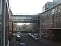 Bridge from Croydon Town Hall to Tabener House from Central Library.JPG 2,816 × 2,112; 835 KB
-
 BT Office, West Croydon - geograph.org.uk - 1228169.jpg 480 × 640; 66 KB
-
 Canary Wharf style entrance in Croydon offices.JPG 2,816 × 2,112; 790 KB
-
 Commercial Union House, Cherry Orchard Road (geograph 2925070).jpg 640 × 549; 206 KB
-

-
 Croydon architecture - geograph.org.uk - 261335.jpg 640 × 480; 98 KB
-
 Croydon Council.JPG 678 × 519; 355 KB
-
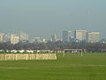
 Croydon skyline 2.jpg 714 × 505; 309 KB
-
 Croydon Skyline From the South - geograph.org.uk - 1159328.jpg 640 × 480; 62 KB
-
 Croydon skyline.JPG 2,816 × 2,112; 795 KB
-
 Delta Point, Wellesley Road, Croydon - geograph.org.uk - 1629611.jpg 640 × 480; 76 KB
-
 Delta Point, Wellesley Road, Croydon - geograph.org.uk - 1629615.jpg 640 × 480; 80 KB
-
 Demolition of Wettern House, Croydon 47050827 bb297b3c63.jpg 500 × 375; 102 KB
-
 Derelict Croydon offices.JPG 2,816 × 2,112; 824 KB
-
 Direct Line Croydon.JPG 2,816 × 2,112; 886 KB
-
 East Croydon offices looking up.JPG 2,816 × 2,112; 907 KB
-
 East Croydon old offices.JPG 2,816 × 2,112; 750 KB
-
 East Croydon station MMB 09 455841.jpg 3,275 × 2,352; 3.03 MB
-
 East Croydon station MMB 11.jpg 3,597 × 2,373; 3.57 MB
-
 Electric House, Croydon.jpg 3,968 × 2,232; 2.54 MB
-
 Electricity building.jpg 3,459 × 2,717; 2.46 MB
-
 Empty old offices George street - panoramio.jpg 3,264 × 2,448; 3.13 MB
-
 Entrance to West Croydon offices.JPG 2,816 × 2,112; 809 KB
-
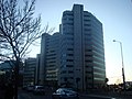
 Green Park House - geograph.org.uk - 1216845.jpg 640 × 480; 86 KB
-
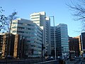
 Green Park House Croydon.JPG 2,816 × 2,112; 952 KB
-

-
 HBOS building Purley - geograph.org.uk - 1763500.jpg 800 × 549; 360 KB
-
 London Road, Croydon - geograph.org.uk - 1263241.jpg 480 × 640; 94 KB
-
 New Croydon offices.JPG 2,816 × 2,112; 973 KB
-
 Office Block at East Croydon - geograph.org.uk - 1270105.jpg 640 × 480; 86 KB
-
 Office Block, Croydon - geograph.org.uk - 1228109.jpg 480 × 640; 95 KB
-
 Office in Lansdowne Road - geograph.org.uk - 1270119.jpg 480 × 640; 120 KB
-
 P1250698 Croydon Council building.jpg 3,364 × 1,421; 502 KB
-
 Prospect West, Croydon - geograph.org.uk - 1629619.jpg 640 × 480; 86 KB
-
 Prospect West, Croydon - geograph.org.uk - 605925.jpg 640 × 480; 421 KB
-
 Round the bend into Wellesley Road - geograph.org.uk - 722842.jpg 640 × 542; 87 KB
-
 Royal Oak office block, Purley Oaks - geograph.org.uk - 933546.jpg 640 × 480; 84 KB
-
 Segas Offices, Croydon.jpg 3,776 × 2,520; 3.51 MB
-
 Segas offices, Croydon; Grade II listed, in September 2019.jpg 2,803 × 2,111; 1,019 KB
-
 Skyline of Croydon.JPG 2,816 × 2,112; 754 KB
-
 Southern House - geograph.org.uk - 1365589.jpg 480 × 640; 76 KB
-
 Street Scene, Wellesley Road, Croydon - geograph.org.uk - 1228191.jpg 640 × 480; 108 KB
-

-
 The Lansdowne Building - geograph.org.uk - 1270429.jpg 480 × 640; 93 KB
-

-
 View Towards Central Croydon - geograph.org.uk - 1516707.jpg 640 × 428; 71 KB
-

-
 West Croydon station MMB 05.jpg 3,513 × 2,470; 2.98 MB


.jpg)


.jpg)


