Category:Ohio State Route 189
 | number: | (one hundred eighty-nine) |
|---|---|---|
| State highways in Ohio: | 170 · 171 · 172 · 173 · 174 · 175 · 176 · 177 · 179 · 180 · 183 · 184 · 185 · 188 · 189 · 190 · 193 · 195 · 196 · 197 · 198 · 199 · 201 · 202 · 203 · 204 · 207 · 208 · 209 |
highway in Ohio  | |||||
| Upload media | |||||
| Instance of | |||||
|---|---|---|---|---|---|
| Location | Ohio | ||||
| Transport network | |||||
| Owned by | |||||
| Maintained by | |||||
| Inception |
| ||||
| Length |
| ||||
| |||||
Media in category "Ohio State Route 189"
The following 9 files are in this category, out of 9 total.
-
 Fort Jennings Memorial Hall.jpg 6,016 × 4,000; 7.25 MB
-
 Fourth from Main, Ft Jennings.jpg 6,016 × 4,000; 6.45 MB
-
 Monterey Township cornfield.jpg 6,016 × 4,000; 6.16 MB
-
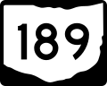 OH-189.svg 750 × 600; 7 KB
-
 Ohio 189 map.svg 1,065 × 628; 400 KB
-
 Ottawa River at Rimer, downstream during flooding.jpg 6,016 × 4,000; 6.45 MB
-
 Ottawa River at Rimer, upstream during flooding.jpg 6,016 × 4,000; 6.38 MB
-
 Rimer 18-R houses.jpg 6,016 × 4,000; 6.11 MB
-
 St Joseph Fort Jennings.jpg 6,016 × 4,000; 6.91 MB


