Category:Old Marston
English: Old Marston is a civil parish located northeast of Oxford city centre, in the Oxford district, in the county of Gloucestershire, England.
civil parish in Oxford, Oxfordshire, England | |||||
| Upload media | |||||
| Instance of | |||||
|---|---|---|---|---|---|
| Location | Oxford, Oxfordshire, South East England, England | ||||
 | |||||
Subcategories
This category has the following 2 subcategories, out of 2 total.
M
O
- Old Marston War Memorial (2 F)
Media in category "Old Marston"
The following 200 files are in this category, out of 210 total.
(previous page) (next page)-
 1906 G.M.T. 1943 - geograph.org.uk - 4831738.jpg 600 × 800; 121 KB
-
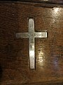
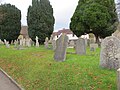
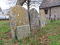
 A cross ^ Tomb - geograph.org.uk - 4830325.jpg 1,024 × 768; 299 KB
-
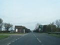
 A40 at B4150 off slip - geograph.org.uk - 4853195.jpg 640 × 480; 40 KB
-
 A40 Northern By-pass Road - geograph.org.uk - 6236979.jpg 1,024 × 684; 235 KB
-
 A40 Northern By-pass Road - geograph.org.uk - 6236980.jpg 1,024 × 684; 315 KB
-
 A40 Northern Bypass Road - geograph.org.uk - 4853194.jpg 640 × 481; 36 KB
-

-

-
 A40 Oxford Ring Road near Marston - geograph.org.uk - 2368251.jpg 640 × 480; 60 KB
-
 A40, Oxford bypass - geograph.org.uk - 5968936.jpg 1,024 × 574; 89 KB
-
 A40, Oxford bypass - geograph.org.uk - 5968942.jpg 1,024 × 558; 111 KB
-
 Across the Back - geograph.org.uk - 4832608.jpg 1,024 × 768; 144 KB
-
 Altar in the South Aisle - geograph.org.uk - 4831644.jpg 1,024 × 768; 123 KB
-
 Another One Gone - geograph.org.uk - 2924729.jpg 1,896 × 1,370; 664 KB
-
 Autumn leaves by St Nicholas church - geograph.org.uk - 2148310.jpg 1,500 × 1,000; 382 KB
-
 Back of the South Aisle - geograph.org.uk - 4831647.jpg 600 × 800; 82 KB
-
 Base of the Tower - geograph.org.uk - 4832684.jpg 600 × 800; 178 KB
-
 Bayswater Brook - geograph.org.uk - 352971.jpg 480 × 640; 285 KB
-
 Benchmark on boundary wall of ^17 Mill Lane - geograph.org.uk - 3288624.jpg 1,024 × 683; 329 KB
-

-
 Benchmark on outbuilding at ^31 Oxford Road - geograph.org.uk - 3288729.jpg 1,024 × 683; 280 KB
-
 Benchmark on seat support beside footpath - geograph.org.uk - 3949691.jpg 693 × 1,024; 283 KB
-
 Benchmark on St Nicholas - geograph.org.uk - 4832686.jpg 600 × 800; 197 KB
-

-
 Benchmark on the tower of St Nicholas Church - geograph.org.uk - 3267473.jpg 683 × 1,024; 314 KB
-
 Benchmark on ^61 Oxford Road - geograph.org.uk - 3288791.jpg 683 × 1,024; 248 KB
-
 Bertrand Rippington Brasnett - geograph.org.uk - 4830232.jpg 600 × 800; 187 KB
-
 Bible by the Cross - geograph.org.uk - 4831737.jpg 1,024 × 768; 155 KB
-
 Bible on the Lectern - geograph.org.uk - 4831739.jpg 1,024 × 768; 148 KB
-
 Blue Plaque on Oxford Road - geograph.org.uk - 4835978.jpg 600 × 800; 181 KB
-
 Bradlands, Old Marston - geograph.org.uk - 5941207.jpg 5,152 × 3,393; 1.83 MB
-
 Broken Cross - geograph.org.uk - 4832923.jpg 600 × 800; 206 KB
-
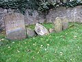
 Broken Headstones - geograph.org.uk - 4832710.jpg 1,024 × 768; 313 KB
-
 Candles by the Stalls - geograph.org.uk - 4831816.jpg 600 × 800; 104 KB
-
 Candles on the Altar - geograph.org.uk - 4830539.jpg 600 × 800; 80 KB
-
 Candles on the Pulpit - geograph.org.uk - 4831747.jpg 600 × 800; 98 KB
-
 Cat on the Path - geograph.org.uk - 4836145.jpg 600 × 800; 164 KB
-
 Cemetery, Old Marston - geograph.org.uk - 338321.jpg 640 × 480; 229 KB
-
 Chancel in St Nicholas - geograph.org.uk - 4830535.jpg 600 × 800; 74 KB
-
 Charles Morris - geograph.org.uk - 4831745.jpg 1,024 × 768; 107 KB
-
 Church Lane - geograph.org.uk - 4835863.jpg 1,024 × 768; 179 KB
-
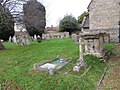
 Churchyard extension - geograph.org.uk - 4828824.jpg 1,024 × 768; 373 KB
-
 City Grounds - geograph.org.uk - 4059431.jpg 1,024 × 768; 199 KB
-
 Climb along Wall - geograph.org.uk - 4013853.jpg 1,024 × 683; 159 KB
-
 Corner of Ponds Lane - geograph.org.uk - 4828653.jpg 1,024 × 768; 184 KB
-
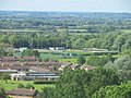
 Court Place Farm stadium - geograph.org.uk - 1245332.jpg 640 × 427; 70 KB
-
 Court Place Farm stadium - geograph.org.uk - 1245334.jpg 640 × 391; 46 KB
-
 Court Place Farm stadium - geograph.org.uk - 1245338.jpg 640 × 427; 80 KB
-
 Court Place, Marston, 1958 - geograph.org.uk - 3732845.jpg 2,388 × 3,214; 2.2 MB
-
 Court ^ Gym - geograph.org.uk - 4013845.jpg 1,024 × 683; 198 KB
-
 Croke Memorial - geograph.org.uk - 4830742.jpg 600 × 800; 103 KB
-
 Croke memorial Detail - geograph.org.uk - 4831642.jpg 1,024 × 768; 136 KB
-
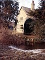
 CromwellsHouse OldMarston.jpg 4,032 × 3,024; 5.98 MB
-
 Crosses in the Churchyard - geograph.org.uk - 4835813.jpg 1,024 × 768; 289 KB
-

-
 Cycle track by the Northern Bypass - geograph.org.uk - 2148305.jpg 1,500 × 1,000; 211 KB
-
 Cycle track by the Northern Bypass - geograph.org.uk - 2148307.jpg 1,500 × 1,000; 207 KB
-
 Damaged Tomb - geograph.org.uk - 4828813.jpg 1,024 × 768; 290 KB
-
 Disturbing the calm - geograph.org.uk - 3918716.jpg 768 × 1,024; 257 KB
-
 Door in the Porch - geograph.org.uk - 4832610.jpg 600 × 800; 117 KB
-
 Elsfield Road - geograph.org.uk - 4836143.jpg 1,024 × 768; 195 KB
-
 Elsfield Road Marston - geograph.org.uk - 4835861.jpg 1,024 × 768; 270 KB
-
 Elsfield Road Sign - geograph.org.uk - 4836144.jpg 1,024 × 768; 220 KB
-
 Entering Oxford on the B4150 - geograph.org.uk - 327342.jpg 640 × 480; 146 KB
-
 Extension on St Nicholas - geograph.org.uk - 4830226.jpg 1,024 × 768; 233 KB
-
 Field by Mill Lane - geograph.org.uk - 2148301.jpg 1,500 × 1,000; 208 KB
-
 Field by Mill Lane, Old Marston - geograph.org.uk - 338752.jpg 640 × 480; 206 KB
-
 Field by the River Cherwell - geograph.org.uk - 2255215.jpg 640 × 480; 92 KB
-
 Field of horses - geograph.org.uk - 5249037.jpg 640 × 427; 90 KB
-
 Finial on a Pew - geograph.org.uk - 4831814.jpg 1,024 × 768; 141 KB
-
 Flags at the Back - geograph.org.uk - 4831817.jpg 600 × 800; 108 KB
-
 Floral tributes to Granny - geograph.org.uk - 338328.jpg 640 × 480; 332 KB
-
 Flowers by the Cross - geograph.org.uk - 4830734.jpg 1,024 × 768; 208 KB
-
 Flowers on the Panel - geograph.org.uk - 4830738.jpg 1,024 × 768; 208 KB
-
 Font at St Nicholas - geograph.org.uk - 4830345.jpg 600 × 800; 101 KB
-
 Font in St Nicholas - geograph.org.uk - 4832604.jpg 600 × 800; 114 KB
-
 Football in the City Stadium - geograph.org.uk - 5459076.jpg 1,500 × 1,286; 197 KB
-
 Football pitches off Marsh Lane - geograph.org.uk - 1087365.jpg 640 × 480; 70 KB
-
 Footpath by Marston Brook - geograph.org.uk - 1936268.jpg 3,872 × 2,592; 6.02 MB
-
 Footpath by the Cherwell - geograph.org.uk - 2148297.jpg 1,500 × 1,000; 409 KB
-
 Footpath by the sports pavilion - geograph.org.uk - 5249038.jpg 640 × 427; 147 KB
-
-
 Footpath through the allotments - geograph.org.uk - 2148276.jpg 1,500 × 1,000; 231 KB
-
 Footpath to Park Farm - geograph.org.uk - 5249045.jpg 640 × 427; 98 KB
-
 Gargoyle on St Nicholas - geograph.org.uk - 4832707.jpg 1,024 × 768; 112 KB
-
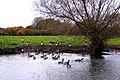 Geese on the Cherwell - geograph.org.uk - 2148290.jpg 1,500 × 1,000; 352 KB
-
 Glass in the Window - geograph.org.uk - 4831741.jpg 600 × 800; 124 KB
-
 Hanging Bell Ropes - geograph.org.uk - 4831650.jpg 1,024 × 768; 188 KB
-
 Heading for the Vicky Arms - geograph.org.uk - 2967061.jpg 1,600 × 1,015; 285 KB
-
 Headstones at St Nicholas - geograph.org.uk - 4832915.jpg 1,024 × 768; 279 KB
-
 Headstones by the Path - geograph.org.uk - 4828808.jpg 1,024 × 768; 271 KB
-
 Headstones by the Wall - geograph.org.uk - 4828810.jpg 1,024 × 768; 305 KB
-
 Headstones in the Corner - geograph.org.uk - 4828829.jpg 1,024 × 768; 330 KB
-
 Headstones on the North Side - geograph.org.uk - 4828826.jpg 1,024 × 768; 315 KB
-
 Horses at Park Farm - geograph.org.uk - 5249046.jpg 640 × 427; 100 KB
-
 House on the Corner - geograph.org.uk - 4832927.jpg 1,024 × 768; 147 KB
-
 Houses in Mill Lane, Old Marston - geograph.org.uk - 338751.jpg 640 × 481; 66 KB
-
 Houses on Oxford Road, New Marston - geograph.org.uk - 6273680.jpg 800 × 600; 120 KB
-
 In Loving Memory - geograph.org.uk - 4832919.jpg 600 × 800; 200 KB
-
 In memory of a Great Man - geograph.org.uk - 4832613.jpg 1,024 × 768; 136 KB
-
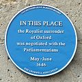
 In This Place - geograph.org.uk - 4828655.jpg 1,024 × 768; 253 KB
-
 Insert in the Stone - geograph.org.uk - 4832914.jpg 600 × 800; 181 KB
-
 Ivy on the Cross - geograph.org.uk - 4835816.jpg 1,024 × 768; 272 KB
-
 Joseph ^ Martha - geograph.org.uk - 4832680.jpg 1,024 × 768; 216 KB
-
 Lieut, Michael Ambrose Morris - geograph.org.uk - 4831743.jpg 1,024 × 768; 135 KB
-
 Little Acreage - geograph.org.uk - 4835860.jpg 1,024 × 768; 173 KB
-
 Looking West - geograph.org.uk - 4830238.jpg 1,024 × 768; 308 KB
-
 Lych Gate to St Nicholas - geograph.org.uk - 4835868.jpg 600 × 800; 159 KB
-
 Marsh Lane - geograph.org.uk - 1936222.jpg 3,704 × 2,480; 3.86 MB
-
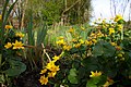 Marsh Marigolds by the Cherwell - geograph.org.uk - 2356440.jpg 1,500 × 1,000; 181 KB
-
 Marston Library - geograph.org.uk - 2924742.jpg 1,964 × 1,396; 650 KB
-
 Marston Roll of Honour - geograph.org.uk - 4830330.jpg 600 × 800; 101 KB
-
 Marston sports ground of Oxford University Sports - geograph.org.uk - 2565776.jpg 2,272 × 1,704; 854 KB
-
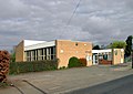
 Marston village hall - geograph.org.uk - 2235479.jpg 640 × 480; 66 KB
-
 Marston Village Hall - geograph.org.uk - 2924761.jpg 1,904 × 1,416; 836 KB
-
 Mill Lane - geograph.org.uk - 4835964.jpg 1,024 × 768; 154 KB
-
 Mill Lane in Marston - geograph.org.uk - 2148287.jpg 1,500 × 978; 167 KB
-
 Mill Lane in Marston - geograph.org.uk - 2148302.jpg 1,500 × 1,000; 242 KB
-
 Mill Lane, Old Marston - geograph.org.uk - 3147964.jpg 1,956 × 1,354; 672 KB
-
 Mill Ponds Lane - geograph.org.uk - 4828648.jpg 1,024 × 768; 159 KB
-
 Mural over the Arch - geograph.org.uk - 4830340.jpg 1,024 × 768; 129 KB
-
 Nave from the Organ Loft - geograph.org.uk - 4831649.jpg 600 × 800; 106 KB
-
 Nave from the Pulpit - geograph.org.uk - 4831813.jpg 1,024 × 768; 154 KB
-
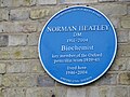 Norman Heatley - geograph.org.uk - 4835982.jpg 1,024 × 768; 183 KB
-
 North end of footpath through Peasmoor Piece - geograph.org.uk - 4657526.jpg 1,024 × 683; 302 KB
-
 North Side of St Nicholas - geograph.org.uk - 4830221.jpg 1,024 × 768; 305 KB
-
 Older Headstones - geograph.org.uk - 4830235.jpg 1,024 × 768; 319 KB
-
 Outbuilding at ^31 Oxford Road - geograph.org.uk - 3288745.jpg 1,024 × 683; 173 KB
-
 Outbuildings of Court Place Farm, 1958 - geograph.org.uk - 3732956.jpg 3,410 × 2,274; 2.47 MB
-
 Overlooking the Allotments - geograph.org.uk - 2924755.jpg 2,048 × 1,536; 1.06 MB
-
 Oxford City Football Club - geograph.org.uk - 1936209.jpg 3,708 × 2,471; 1.22 MB
-
 Oxford Road - geograph.org.uk - 4835967.jpg 1,024 × 768; 171 KB
-
 Oxford Road - geograph.org.uk - 4836146.jpg 1,024 × 768; 179 KB
-
 Oxford Road in Old Marston - geograph.org.uk - 2148281.jpg 1,500 × 983; 310 KB
-
 Oxford Road, Marston - geograph.org.uk - 2924747.jpg 1,786 × 1,506; 859 KB
-
 Oxford Road, New Marston - geograph.org.uk - 6273683.jpg 800 × 600; 134 KB
-
 OXSRAD Mural - geograph.org.uk - 4013842.jpg 1,024 × 683; 106 KB
-
 Parking area on Elsfield Way, Marston - geograph.org.uk - 3093010.jpg 1,594 × 1,165; 455 KB
-
 Path by Marston Brook - geograph.org.uk - 1936276.jpg 3,872 × 2,480; 4.71 MB
-
 Path to St Nicholas - geograph.org.uk - 4828803.jpg 1,024 × 768; 277 KB
-
 Pink Cottage - geograph.org.uk - 4836142.jpg 1,024 × 768; 219 KB
-
 Plaque cromwell.jpg 1,552 × 1,552; 296 KB
-
 Ponds Lane - geograph.org.uk - 4832928.jpg 1,024 × 768; 227 KB
-
 Porch on St Nicholas - geograph.org.uk - 4832615.jpg 600 × 800; 105 KB
-

-
 Pulpit in St Nicholas - geograph.org.uk - 4830347.jpg 600 × 800; 103 KB
-
 River Cherwell at Marston Ferry Road bridge - geograph.org.uk - 3267634.jpg 1,024 × 683; 312 KB
-

-
 River Cherwell opposite University Parks, Oxford - geograph.org.uk - 5480158.jpg 1,600 × 1,064; 570 KB
-
 Rood Screen in St Nicholas - geograph.org.uk - 4830532.jpg 1,024 × 768; 136 KB
-
 Row of Houses - geograph.org.uk - 4836141.jpg 1,024 × 768; 184 KB
-
 Sport for All - geograph.org.uk - 4013798.jpg 1,024 × 683; 114 KB
-
 Sports fields - geograph.org.uk - 5249041.jpg 640 × 427; 78 KB
-
 Squint to the Chancel - geograph.org.uk - 4831646.jpg 600 × 800; 90 KB
-
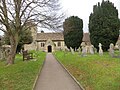
 St Nicholas church on Elsfield Road - geograph.org.uk - 2148312.jpg 1,500 × 984; 237 KB
-
 St Nicholas church tower - geograph.org.uk - 3267476.jpg 683 × 1,024; 155 KB
-
 St Nicholas Church, Marston - geograph.org.uk - 2235482.jpg 640 × 480; 92 KB
-
 St Nicholas Marston - geograph.org.uk - 4835814.jpg 1,024 × 768; 263 KB
-
 St Nicholas Organ Loft - geograph.org.uk - 4830524.jpg 600 × 800; 93 KB
-
 Stubble field, Old Marston - geograph.org.uk - 6273678.jpg 800 × 600; 133 KB
-
 Telephone exchange beside Northern By-Pass Road - geograph.org.uk - 3288576.jpg 1,024 × 683; 169 KB
-
 The A40 Oxford Ring Road at the junction of Mill Lane - geograph.org.uk - 3575734.jpg 1,600 × 1,200; 581 KB
-
 The Bricklayers Arms - geograph.org.uk - 2148308.jpg 1,500 × 986; 201 KB
-
 The Chancel Window - geograph.org.uk - 4830545.jpg 600 × 800; 115 KB
-
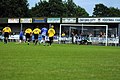
 The City Stadium - geograph.org.uk - 5459064.jpg 1,500 × 993; 243 KB
-
 The City Stadium - geograph.org.uk - 5459065.jpg 1,500 × 979; 203 KB
-
 The City Stadium - geograph.org.uk - 5459070.jpg 1,500 × 987; 153 KB
-
 The City Stadium - geograph.org.uk - 5459072.jpg 1,500 × 991; 195 KB
-
 The Elsfield Road - geograph.org.uk - 4835819.jpg 1,024 × 768; 173 KB
-
 The entrance to the dressing rooms at the City Stadium - geograph.org.uk - 5459062.jpg 1,500 × 1,000; 248 KB
-
 The former White Hart on Oxford Road - geograph.org.uk - 2148285.jpg 1,500 × 976; 306 KB
-
 The Jack Russell on Salford Road - geograph.org.uk - 2148272.jpg 1,500 × 1,000; 146 KB
-
 The main stand at the City Stadium - geograph.org.uk - 5459067.jpg 1,500 × 969; 154 KB
-
 The Marston exit on the A40 Oxford Ring Road - geograph.org.uk - 3575625.jpg 1,600 × 1,200; 545 KB
-
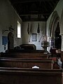
 The Nave in St Nicholas - geograph.org.uk - 4830335.jpg 1,024 × 768; 132 KB
-
 The North Aisle - geograph.org.uk - 4831648.jpg 600 × 800; 68 KB
-
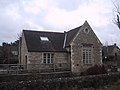
 The Old School - geograph.org.uk - 4835817.jpg 1,024 × 768; 181 KB
-
 The Outdoor Gym - geograph.org.uk - 4013848.jpg 1,024 × 683; 193 KB
-
 The Red Lion on Oxford Road - geograph.org.uk - 2148278.jpg 1,500 × 1,000; 173 KB
-
 The Red Lion, Marston - geograph.org.uk - 2235487.jpg 640 × 352; 46 KB
-
 The River Cherwell - geograph.org.uk - 2148291.jpg 1,500 × 991; 342 KB
-
 The River Cherwell - geograph.org.uk - 6273670.jpg 800 × 600; 135 KB
-
 The River Cherwell at Sunnymead - geograph.org.uk - 2353595.jpg 1,500 × 1,000; 294 KB
-
 The River Cherwell at Sunnymead - geograph.org.uk - 2356441.jpg 1,500 × 1,000; 227 KB
-

-
 The River Cherwell flows under Marston Ferry Bridge - geograph.org.uk - 2148298.jpg 1,500 × 1,000; 327 KB
-
 The South Aisle - geograph.org.uk - 4831643.jpg 600 × 800; 85 KB
-
 The Three Horseshoes on Oxford Road - geograph.org.uk - 2148283.jpg 1,500 × 980; 211 KB
-
 The White Hart 1.jpg 4,000 × 3,000; 5.06 MB
-
 Three in a line - geograph.org.uk - 4830245.jpg 1,024 × 768; 281 KB
-
 Top of the Tower - geograph.org.uk - 4832704.jpg 600 × 800; 97 KB
-
 Towards the Bypass - geograph.org.uk - 4835858.jpg 1,024 × 768; 232 KB
-
 Towards the Nave - geograph.org.uk - 4832607.jpg 1,024 × 768; 151 KB
-
 Tree reflected in wet wheatfield - geograph.org.uk - 351028.jpg 479 × 640; 196 KB
-
 Vase on the Tomb - geograph.org.uk - 4832715.jpg 600 × 800; 217 KB
-
 View along the Aisle - geograph.org.uk - 4831736.jpg 1,024 × 768; 147 KB
-
 Wall at the Gym - geograph.org.uk - 4013850.jpg 1,024 × 683; 151 KB
-
 Water Meadow by the Cherwell - geograph.org.uk - 2968034.jpg 1,024 × 631; 155 KB
-
 Wet field near Marston Common - geograph.org.uk - 352966.jpg 640 × 480; 256 KB
-
 Where Elms Drive meets Cherwell Drive - geograph.org.uk - 1936239.jpg 3,695 × 2,471; 3.33 MB


_-_geograph.org.uk_-_6273679.jpg)


