Category:Old county maps of Cumberland
Ceremonial counties of England: Bedfordshire · Berkshire · Buckinghamshire · Cambridgeshire · Cheshire · Cornwall · Derbyshire · Devon · Dorset · Durham · East Riding of Yorkshire · Essex · Gloucestershire · Hampshire · Herefordshire · Hertfordshire · Kent · Lancashire · Leicestershire · Lincolnshire · Norfolk · Northamptonshire · Northumberland · Nottinghamshire · Oxfordshire · Rutland · Shropshire · Somerset · Staffordshire · Suffolk · Surrey · Warwickshire · Wiltshire · Worcestershire
City-counties:
Former historic counties: Cumberland · Huntingdonshire · Middlesex · North Riding of Yorkshire · Sussex · West Riding of Yorkshire · Westmorland · Yorkshire
Other former counties:
City-counties:
Former historic counties: Cumberland · Huntingdonshire · Middlesex · North Riding of Yorkshire · Sussex · West Riding of Yorkshire · Westmorland · Yorkshire
Other former counties:
Media in category "Old county maps of Cumberland"
The following 13 files are in this category, out of 13 total.
-
 John Speed - Map of Cumberland - 1610 - 001.jpg 2,992 × 2,268; 3.29 MB
-
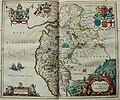
 Atlas Van der Hagen-KW1049B11 036-CVMBRIA Vulgo CUMBERLAND..jpeg 5,500 × 4,592; 3.61 MB
-
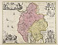
 Cumbria & Westmoria vulgo Cumberland & Westmorland (8642493049).jpg 800 × 668; 140 KB
-
 "Cumbria, vulgo Cumberland" (22072524838).jpg 3,616 × 3,013; 2.03 MB
-

-
 Maps of England circa 1670, Cumberland, Westmoreland 9 of 40 (13433786323).jpg 4,925 × 6,565; 4.66 MB
-
 A Correct Map of Cumberland from the best Surveys.jpg 2,520 × 3,136; 2.83 MB
-
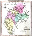
 Aikin(1800) p051 - Cumberland.jpg 1,187 × 1,870; 431 KB
-
 A topographical dictionary of the United Kingdom (1808) (14784755602).jpg 3,072 × 1,736; 1.3 MB
-
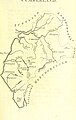
 Gray1824.cumberland.jpg 799 × 909; 119 KB
-
 William Smith geological map of Cumberland.jpg 1,070 × 1,232; 506 KB
-
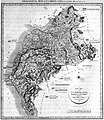
 Pigot and Co (1842) p2.042 - Map of Cumberland.jpg 1,310 × 2,158; 806 KB
-
 Cumbria & Westmoria vulgo Cumberland & Westmorland - CBT 6596122.jpg 6,084 × 4,715; 8.4 MB


.jpg)
.jpg)
.5.(54).jpg)
.jpg)

_p051_-_Cumberland.jpg)
_(14784755602).jpg)


_p2.042_-_Map_of_Cumberland.jpg)
