Category:Old maps of Aberdeenshire
Subcategories
This category has the following 3 subcategories, out of 3 total.
A
- Old maps of Aberdeen (24 F)
Media in category "Old maps of Aberdeenshire"
The following 10 files are in this category, out of 10 total.
-
 183 of 'Bennachie' (11206123584).jpg 5,780 × 5,011; 6.54 MB
-

-
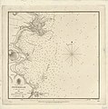 Admiralty Chart No 1438 Peterhead, Published 1842.jpg 5,197 × 5,226; 3.79 MB
-
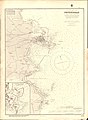 Admiralty Chart No 1438 Peterhead, Published 1884.jpg 8,099 × 11,075; 24.9 MB
-
 Auchenblae Plan 1828.jpg 409 × 640; 79 KB
-
 Ordnance Survey One-Inch Sheet 31 Peterhead, Published 1930.jpg 8,734 × 12,478; 40.36 MB
-
 Ordnance Survey Sheet NJ 96 Fraserburgh, Published 1950.jpg 7,604 × 8,754; 12.94 MB
-
 Ordnance Survey Sheet NK 06 Inverallochy, Published 1950.jpg 7,588 × 8,771; 13.52 MB
-
 Smiles 1876 b2192983x 0171 Map of North Aberdeenshire.jpg 1,276 × 1,044; 372 KB
-
 Turriff, Aberdeenshire - Ordnance Survey Map 1892-1914.gif 709 × 629; 158 KB
.jpg)
_(14598357620).jpg)


