Category:Old maps of Arkansas in the American Civil War
States of the United States: Alabama · Arkansas · Florida · Georgia · Kentucky · Louisiana · Maryland · Mississippi · Missouri · North Carolina · Pennsylvania · South Carolina · Tennessee · Texas · Virginia – Washington, D.C.
Subcategories
This category has only the following subcategory.
Media in category "Old maps of Arkansas in the American Civil War"
The following 24 files are in this category, out of 24 total.
-

-
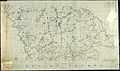
 -Maps of Dallas, Desha, Drew, and Ouachita counties.-, p. 1 of 5 - NARA - 305708.jpg 9,144 × 7,251; 59.68 MB
-
 -Maps of Dallas, Desha, Drew, and Ouachita counties.-, p. 2 of 5 - NARA - 305708.jpg 10,400 × 6,125; 64.41 MB
-
 -Maps of Dallas, Desha, Drew, and Ouachita counties.-, p. 3 of 5 - NARA - 305708.jpg 9,494 × 7,528; 51.36 MB
-
 -Maps of Dallas, Desha, Drew, and Ouachita counties.-, p. 4 of 5 - NARA - 305708.jpg 7,125 × 9,200; 56.19 MB
-
 -Maps of Dallas, Desha, Drew, and Ouachita counties.-, p. 5 of 5 - NARA - 305708.jpg 9,800 × 6,888; 60.75 MB
-

-

-
 (Map of the Red River campaign, March 10-May 22. 1864). LOC 2008626486.jpg 9,238 × 14,971; 14.89 MB
-
 240 of 'History of the American Civil War, etc' (11246731554).jpg 1,381 × 1,440; 408 KB
-
 242 of 'History of the American Civil War, etc' (11059642934).jpg 923 × 1,078; 231 KB
-
 Abraham Lincoln - a history (1914) (14583544379) (Cane Hill crop).jpg 940 × 864; 250 KB
-
 Abraham Lincoln - a history (1914) (14583544379) (cropped).jpg 1,338 × 1,263; 463 KB
-
 Abraham Lincoln - a history (1914) (14583544379).jpg 2,648 × 2,016; 1.56 MB
-
 Abraham Lincoln - a history (1914) (14747182256).jpg 2,608 × 1,428; 1.1 MB
-
 Battle of Pea Ridge 1.png 2,000 × 1,462; 2.03 MB
-

-

-

-

-
 North Side of Arkansas River opposite Little Rock - NARA - 305762.jpg 7,200 × 3,986; 25.85 MB
-
 Red River campaign map.jpg 9,238 × 14,971; 3.1 MB
-
 Vicinity of Dooleys Ferry, Ark - NARA - 305735.jpg 5,000 × 3,946; 21.22 MB
-
 Vicinity of Dooleys Ferry, Ark - NARA - 305735.tif 5,000 × 3,946; 56.45 MB


_Plan_of_the_Fortification_(Fort_Hindman)_at_Post,_Arkansas,_Surrendered_to_the_U.S._Forces..._-_NARA_-_305724.jpg)

._LOC_2008626486.jpg)
.jpg)
.jpg)
_(14583544379)_(Cane_Hill_crop).jpg)
_(14583544379)_(cropped).jpg)
_(14583544379).jpg)
_(14747182256).jpg)


