Category:Old maps of Aruba
Countries of South America: Argentina · Bolivia · Brazil · Chile · Colombia · Ecuador · Guyana · Paraguay · Peru · Suriname · Trinidad and Tobago‡ · Uruguay · Venezuela
Other territories: Aruba · Bonaire · Curaçao · Falkland Islands · French Guiana · South Georgia and the South Sandwich Islands
‡: partly located in South America
Other territories: Aruba · Bonaire · Curaçao · Falkland Islands · French Guiana · South Georgia and the South Sandwich Islands
‡: partly located in South America
Media in category "Old maps of Aruba"
The following 8 files are in this category, out of 8 total.
-

-

-
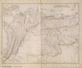 South American States. New Granada & Venezuela. (IA bp 33154).pdf 3,327 × 2,752; 2.81 MB
-
 Frazier Aruba Gold Mining Co circa 1885.jpg 2,294 × 1,674; 422 KB
-
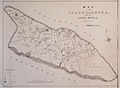
 Item 53141.jpg 600 × 373; 32 KB
-
 Item 53159.jpg 600 × 427; 26 KB
-
 Item 53193.jpg 600 × 430; 27 KB
-
 Map of Dutch Guiana and of Curaçao, Bonaire, and Aruba, 1781.jpg 4,980 × 3,976; 8.01 MB
.jpg)
.jpg)


