Category:Old maps of Bnei Brak
Media in category "Old maps of Bnei Brak"
The following 7 files are in this category, out of 7 total.
-
 Bnei Brak, Map of measuring plots. 1940.jpg 6,240 × 5,496; 2.58 MB
-

-
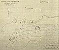 Chalcolithic Necropolis at Benei Beraq. Site plan.jpg 2,682 × 2,285; 2.12 MB
-
 Esh Sheikh Muwannis cropped.jpg 2,939 × 3,072; 2.82 MB
-

-
 Historical map series for the area of al-Jammasin al-Sharqi (1940s).jpg 741 × 744; 279 KB
-
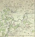
 Illustrated map of Benei Beraq including archaeological sites.jpg 2,872 × 2,811; 385 KB


.jpg)
.jpg)
