Category:Old maps of Bristol
Subcategories
This category has the following 4 subcategories, out of 4 total.
Media in category "Old maps of Bristol"
The following 76 files are in this category, out of 76 total.
-
 Bristol Castle in the time of John Earl of Mortain.jpg 5,088 × 5,824; 7.84 MB
-
 Map of Bristol in the 13th century.jpg 5,160 × 3,808; 4 MB
-
 1478 Robert Ricart map of Bristol, England.png 590 × 924; 1.04 MB
-
 Robert Ricart's map of Bristol.png 590 × 924; 914 KB
-
 Bristol in 1480.jpg 5,488 × 7,472; 8.62 MB
-
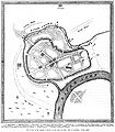
 Bristol Castle plan ancient times.jpg 5,202 × 4,927; 6.46 MB
-
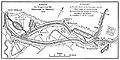
 Sketch of the outworks of Bristol in 1644.jpg 3,040 × 4,032; 1.96 MB
-
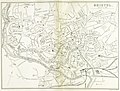
 Millerd's Map of Bristol.jpg 5,918 × 5,566; 10.36 MB
-
 Millerd Map of Bristol.jpg 5,931 × 5,365; 4.6 MB
-
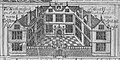
 The Pest-House, Bristol (1673).jpg 1,975 × 1,301; 830 KB
-
 1673 map of the Severn Estuary.jpg 1,830 × 1,086; 1.37 MB
-
 Jacobs Well Rocque map 1743.jpg 1,289 × 846; 974 KB
-
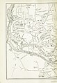
 Roque's Map of Bristol 1747.jpg 5,280 × 5,665; 11.8 MB
-
 Roads leading to Clifton and Redland in 1759.jpg 5,504 × 3,624; 1.81 MB
-
 Bristow (BM 1868,0822.5921).jpg 2,429 × 1,858; 1.09 MB
-
 Jessop's plan for the Floating Harbour (adopted).jpg 4,070 × 1,848; 1.2 MB
-
 Jessop's Plan for the Floating Harbour (not adopted).jpg 4,097 × 2,062; 1.6 MB
-
 1815somersetsmall.jpg 720 × 514; 217 KB
-
 Forlorn Hope Estate, 1828.jpg 3,765 × 2,802; 1.63 MB
-
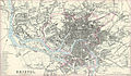 Bristol published by A. Fullarton & Co in 1866 edited.jpg 783 × 455; 133 KB
-
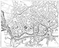 Map of Bristol 1882.jpg 7,520 × 6,144; 7.15 MB
-
 EW(1884) p.174 - Bristol (left) - A + C Black (pub).jpg 1,297 × 1,899; 609 KB
-
 EW(1884) p.174 - Bristol (merged) - A + C Black (pub).jpg 2,396 × 1,824; 1.66 MB
-
 EW(1884) p.175 - Bristol (right) - A + C Black (pub).jpg 1,225 × 1,902; 783 KB
-
 Comprehensive gazetter of England and Wales (1895) (14769409821).jpg 1,584 × 2,748; 985 KB
-
 Comprehensive gazetter of England and Wales (1895) (14772244152).jpg 1,609 × 2,862; 1.18 MB
-
 Bristol map 1946.jpg 4,960 × 4,608; 3.75 MB
-

-
 44 of '(Our own country. Descriptive, historical, pictorial.)' (11287300873).jpg 923 × 1,733; 484 KB
-
 44 of '(Our own country. Descriptive, historical, pictorial.)' (11297765263).jpg 900 × 1,708; 451 KB
-

-

-
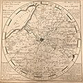 A Map of the Country Eleven Miles round the City of Bristol.jpg 2,511 × 2,518; 1.87 MB
-

-
 Bewell's Cross plaque Bristol.jpg 3,024 × 4,032; 5.08 MB
-
 Bristol Gallows on Rocque map 1743.jpg 1,215 × 1,127; 1.39 MB
-
 BristolCastle 1882Map.svg 744 × 574; 666 KB
-
 Buck NW Prospect of Bristol.jpg 8,110 × 3,528; 14.64 MB
-
 Buck SE Prospect of Bristol.jpg 8,038 × 3,405; 14.72 MB
-
 Design for Improving the Harbour of Bristol.jpg 14,717 × 6,525; 10.74 MB
-
 Donne's New And Correct Plan Of Bristol, Clifton And The Hot Wells 01.jpg 5,866 × 4,608; 8.2 MB
-
 Donne's New And Correct Plan Of Bristol, Clifton And The Hot Wells 02.jpg 5,907 × 4,537; 8.21 MB
-
 Forlorn Hope Estate.jpg 1,725 × 1,502; 472 KB
-
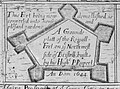 Ground Plan of the Royal Fort, Bristol, 1644.jpg 1,428 × 1,063; 1 MB
-
 High Cross of Bristol in James Millerd's map of Bristol 1728.tif 1,363 × 2,833; 11.08 MB
-
 Map of Redcliffe in 1728.jpg 5,151 × 3,468; 12.31 MB
-
 Millerd map 1728 Queens Square.jpg 3,374 × 2,834; 6.59 MB
-
 Millerd1728cornmarket1684.jpg 1,638 × 1,407; 1.62 MB
-
 Millerd1728dallsaints.jpg 3,402 × 1,362; 3.24 MB
-
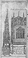
 Millerd1728dcathedral.jpg 2,743 × 2,412; 4.52 MB
-
 Millerd1728dcornmarket.jpg 2,676 × 1,154; 2.07 MB
-
 Millerd1728dcustomhouse.jpg 1,391 × 2,534; 2.44 MB
-
 Millerd1728dgatehouse.jpg 1,381 × 2,862; 2.7 MB
-
 Millerd1728dgreathouseback.jpg 2,353 × 1,168; 1.97 MB
-
 Millerd1728dgreathouseredcliffe.jpg 1,429 × 2,892; 2.83 MB
-
 Millerd1728dguildhall.jpg 2,347 × 1,410; 2.36 MB
-
 Millerd1728dhighcross.jpg 1,363 × 2,833; 2.62 MB
-
 Millerd1728dhotwells.jpg 1,434 × 2,806; 2.79 MB
-
 Millerd1728dhotwells.tif 1,434 × 2,806; 11.55 MB
-
 Millerd1728dmerchantshall.tif 2,143 × 1,420; 8.74 MB
-
 Millerd1728full.jpg 4,867 × 4,579; 15.77 MB
-
 Millerd1728full.tif 4,867 × 4,579; 63.8 MB
-
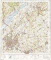
 Ordnance Survey Half-inch Sheet 32 Bristol & Cardiff, Published 1925.jpg 11,928 × 8,911; 13.01 MB
-
 Ordnance Survey One-Inch Sheet 111 Bath & Bristol, Published 1919.jpg 12,119 × 8,418; 10.8 MB
-
 Ordnance Survey One-Inch Sheet 155 Bristol & Newport, Published 1946.jpg 10,929 × 12,822; 17.45 MB
-
 Ordnance Survey One-Inch Sheet 155 Bristol & Newport, Published 1953.jpg 8,282 × 9,952; 12.01 MB
-
 Ordnance Survey One-Inch Sheet 155 Bristol & Newport, Published 1972.jpg 11,058 × 13,150; 47.6 MB
-
 Ordnance Survey One-Inch Sheet 156 Bristol & Stroud, Published 1946.jpg 10,939 × 12,823; 18.14 MB
-
 Ordnance Survey One-Inch Sheet 156 Bristol & Stroud, Published 1953.jpg 8,245 × 9,924; 10.47 MB
-
 Ordnance Survey One-Inch Sheet 156 Bristol & Stroud, Published 1972.jpg 11,086 × 13,175; 48.11 MB
-
 Prospect of Bath in 1673.jpg 2,039 × 1,315; 1.75 MB
-
 South Prospect of the Tollzey of Bristol 1673.jpg 1,781 × 1,407; 1.8 MB
-
 Southeast prospect of Bristol in 1673.jpg 2,107 × 1,045; 1.53 MB
-
 St Mary Redcliffe Church, Bristol from Millerd's Map (1728).jpg 3,409 × 2,893; 6.68 MB
-
 The Gallows, St Michaels Hill, Bristol (1743).png 891 × 1,104; 1.3 MB
-
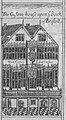
 The Merchants Hall, Bristol (1673).jpg 2,143 × 1,420; 2.09 MB


.jpg)


.jpg)
.jpg)
.jpg)


_p.174_-_Bristol_(left)_-_A_%2B_C_Black_(pub).jpg)
_p.174_-_Bristol_(merged)_-_A_%2B_C_Black_(pub).jpg)
_p.175_-_Bristol_(right)_-_A_%2B_C_Black_(pub).jpg)
_(14769409821).jpg)
_(14772244152).jpg)

.jpg)
%27_(11287300873).jpg)
%27_(11297765263).jpg)
.jpg)
.jpg)


.jpg)
.png)
.jpg)