Category:Old maps of Chester County, Pennsylvania
Counties of Pennsylvania : Adams · Allegheny · Armstrong · Beaver · Bedford · Berks · Blair · Bradford · Bucks · Butler · Cambria · Cameron · Carbon · Centre · Chester · Clarion · Clearfield · Clinton · Columbia · Crawford · Cumberland · Dauphin · Delaware · Elk · Erie · Fayette · Franklin · Fulton · Greene · Huntingdon · Indiana · Jefferson · Juniata · Lackawanna · Lancaster · Lawrence · Lebanon · Lehigh · Luzerne · Lycoming · McKean · Mercer · Mifflin · Monroe · Montgomery · Montour · Northampton · Northumberland · Perry · Philadelphia · Pike · Potter · Schuylkill · Snyder · Somerset · Sullivan · Susquehanna · Tioga · Union · Venango · Warren · Washington · Wayne · Westmoreland · Wyoming · York
Subcategories
This category has the following 3 subcategories, out of 3 total.
Media in category "Old maps of Chester County, Pennsylvania"
The following 75 files are in this category, out of 75 total.
-
 1683 Charles Ashcom, surveyor map (Chester Co.) (1b) (GreenGuerra.blogspot).jpg 1,437 × 1,040; 88 KB
-

-

-

-

-

-

-

-

-

-

-

-

-

-

-

-

-

-

-

-

-

-

-

-

-

-

-

-

-

-

-

-

-

-

-

-

-

-

-

-

-

-

-

-

-

-

-

-

-

-

-

-

-

-

-

-

-

-

-

-

-

-

-

-

-

-

-

-

-

-

-
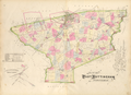 Breou's Farm Atlas East Nottingham Township.png 3,377 × 2,445; 10.74 MB
-

-
 Holme's Map of Pennsylvania (1687).jpg 16,622 × 10,049; 92.9 MB
-
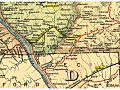 LO&S RR map 1895.jpg 960 × 720; 205 KB
_(1b)_(GreenGuerra.blogspot).jpg)


.jpg)
.jpg)


.jpg)
.jpg)
.jpg)
.jpg)
.jpg)
.jpg)


_with_the_attack_made_by_Major_General_Grey_against_the_rebels_near_White_Horse_Tavern._LOC_gm71000677.jpg)
.jpg)
