Category:Old maps of Franeker
Subcategories
This category has the following 3 subcategories, out of 3 total.
A
Media in category "Old maps of Franeker"
The following 20 files are in this category, out of 20 total.
-
 Franeker 1649 Blaeu.jpg 1,590 × 1,317; 524 KB
-
 Plattegrond gedeelte naar een gravure in Blaeu - Franeker - 20073712 - RCE.jpg 891 × 1,200; 389 KB
-

-

-
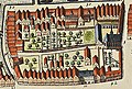
 Atlas de Wit 1698-pl051-Franeker-KB PPN 145205088-uitsnede Egmondshuis.png 1,065 × 622; 1.95 MB
-
 Atlas de Wit 1698-pl051-Franeker-KB PPN 145205088-uitsnede Groot Botnia.png 1,045 × 627; 1.93 MB
-

-
 Atlas de Wit 1698-pl051-Franeker-KB PPN 145205088.jpg 2,000 × 1,679; 1.73 MB
-
 Beleg van Franeker, 1500 Het belech van Franeker (titel op object), RP-P-1905-5709.jpg 5,306 × 4,460; 4.19 MB
-
 Bijzondere Collecties UvA HB-KZL O.K. 83 Franeker door Jansonius.jpg 1,485 × 1,192; 474 KB
-
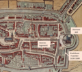
 Kaart met Universiteit van Franeker in 1664.jpg 515 × 359; 203 KB
-
 Oude kaart van Franeker.jpg 3,425 × 2,628; 5.71 MB
-
 Plan of Franeker PK-P-111.581, PK-P-112.711.tiff 5,533 × 4,492; 71.14 MB
-

-
 Plattegrond van Franeker, 1598, RP-P-1878-A-499.jpg 6,198 × 4,992; 6.61 MB
-
 Plattegrond van Franeker, 1598, RP-P-1939-1423.jpg 5,926 × 4,752; 6.46 MB
-
 Plattegrond, uit Blaue - Franeker - 20073715 - RCE.jpg 1,200 × 877; 442 KB
-
 Plattegrond, uit Blaue - Franeker - 20073716 - RCE.jpg 1,200 × 874; 352 KB
-
 Uitsnede plattegrond Franeker.png 792 × 693; 1.54 MB
-
 Universiiteit van Franeker Atlas de Wit 1698-pl051-Franeker-KB.jpg 315 × 212; 102 KB


,_RP-P-1905-5709.jpg)


