Category:Old maps of Galloway
Traditional districts (lordships, provinces etc) of Scotland: The Aird · Annandale · Atholl · Boyne · Buchan · Badenoch · Breadalbane · Carrick · Clydesdale / Lanark · Cowal · Cunninghame · Eskdale · Fothriff · Galloway · Garioch · Garmoran · The Glenkens · Gowrie · Kintyre · Knapdale · Kyle · Lauderdale · Lennox · Liddesdale · Lochaber · Lorn · Lothian · Mar · Mearns · Menteith · Merse · Nithsdale · The Rhinns · Ross (Easter · Wester) · Stormont · Strathavon · Strathbogie · Strathearn · Strathgryfe · Strathnaver · Strathspey · Teviotdale · Tweeddale ·
Subcategories
This category has the following 2 subcategories, out of 2 total.
K
W
Media in category "Old maps of Galloway"
The following 12 files are in this category, out of 12 total.
-
 "Gallovidia vernacule Galloway - Auct. Timothy Pont" (22233386576).jpg 4,188 × 3,168; 2.56 MB
-

-
 260 of 'Rambles in Galloway. (Second edition.) L.P' (11301022455).jpg 1,470 × 1,213; 356 KB
-
 262 of 'Rambles in Galloway. (Second edition.) L.P' (11300431115).jpg 1,205 × 1,495; 331 KB
-

-
 589 of 'Rambles in Galloway. (Second edition.) L.P' (11239366304).jpg 2,427 × 3,051; 2.51 MB
-
 9 of 'Tours in Galloway, etc. (Signed, W. M'C.)' (11245928955).jpg 2,384 × 1,444; 648 KB
-
 Admiralty Chart No 45 Lough Carlingford to Lough Larne, Published 1890.jpg 24,206 × 16,278; 118.08 MB
-
 Atlas Van der Hagen-KW1049B11 042-GALLOVIDIA vernacule GALLOWAY.jpeg 5,500 × 4,374; 2.74 MB
-
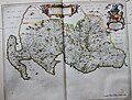
 Blaeu - Atlas of Scotland 1654 - GALLOVIDIA - Galloway.jpg 6,242 × 4,941; 6.62 MB
-
 Galloway map.jpg 1,840 × 1,748; 665 KB
-

.jpg)
.6.(13).jpg)
_L.P%27_(11301022455).jpg)
_L.P%27_(11300431115).jpg)
.jpg)
_L.P%27_(11239366304).jpg)
%27_(11245928955).jpg)


_(14593870769).jpg)