Category:Old maps of Hövelhof
Media in category "Old maps of Hövelhof"
The following 10 files are in this category, out of 10 total.
-
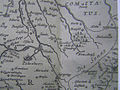
 Gigas-Karte (Ausschnitt Hövelhof).jpg 713 × 429; 144 KB
-
 Karte Monumenta Paderbornensia - Ausschnitt Hoevelhof.jpg 1,137 × 850; 978 KB
-
 LeCoq (Ausschnitt Hoevelhof).jpg 721 × 431; 105 KB
-
 Topographisch-militairischer Atlas - Ausschnitt Hoevelhof.jpg 813 × 480; 115 KB
-
 Special-Karte des Fuerstenthums Lippe - Ausschnitt Hoevelhof.jpg 739 × 482; 111 KB
-
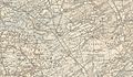
 Karte Hoevelhof 1843.jpg 1,022 × 700; 234 KB
-
 Karte Regierungsbezierk Minden 1848 (Ausschnitt Hövelhof.jpg 810 × 476; 118 KB
-

-
 Wegekarte der Provinz Westfalen, Paderborn (Ausschnitt Hövelhof).jpg 1,226 × 674; 215 KB
-
 Karte Hoevelhof 1909.jpg 1,415 × 828; 589 KB
.jpg)

.jpg)


.jpg)
