Category:Old maps of Hann. Münden
Subcategories
This category has only the following subcategory.
Media in category "Old maps of Hann. Münden"
The following 9 files are in this category, out of 9 total.
-
-
 Glashütte bei Hemeln 1868.jpg 722 × 551; 307 KB
-
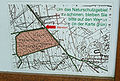 Hühnerfeld Karte.jpg 766 × 515; 286 KB
-
 Kurfürstentum Hessen Altmünden 1857.jpg 809 × 711; 524 KB
-
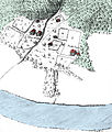
 Münden Karte 1728 Graumühle.jpg 391 × 253; 160 KB
-
 Münden Questenberg Karte 1728.jpg 1,104 × 777; 1.07 MB
-
 PreussischeLandesaufnahmeHMUe.jpg 1,920 × 1,123; 2.03 MB
-
 Stadtplan Münden 1850 mit Porzellanmanufaktur.jpg 1,240 × 718; 1.32 MB
-
 Tanzwerderbrücke 1728.jpg 234 × 180; 74 KB


