Category:Old maps of Kempten (Allgäu)
Use the appropriate category for maps showing all or a large part of Kempten. See subcategories for smaller areas:
| If the map shows | Category to use |
|---|---|
| Kempten on a recently created map | Category:Maps of Kempten (Allgäu) or its subcategories |
| Kempten on a map created more than 70 years ago | Category:Old maps of Kempten (Allgäu) or its subcategories |
| the history of Kempten on a recently created map | Category:Maps of the history of Kempten (Allgäu) or its subcategories |
| the history of Kempten on a map created more than 70 years ago | Category:Old maps of the history of Kempten (Allgäu) or its subcategories |
Subcategories
This category has only the following subcategory.
M
Media in category "Old maps of Kempten (Allgäu)"
The following 35 files are in this category, out of 35 total.
-
 Burghalde Kempten Merian.jpg 864 × 676; 222 KB
-
 De Merian Sueviae 144.jpg 3,767 × 2,328; 1.39 MB
-
 De Merian Sueviae RH.jpg 3,767 × 2,328; 4.79 MB
-
 Grundriß des Ihler Flusses 1730.jpg 6,959 × 5,159; 23.62 MB
-
 Herrenwieser Weiher historische Flurkarte.png 3,352 × 1,464; 11.1 MB
-
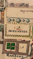 Hofgarten.PNG 245 × 433; 258 KB
-
 Holzschnitt, anonym 1567 RH.png 4,395 × 1,430; 3.25 MB
-
 Holzschnitt, anonym 1567.jpg 4,395 × 1,430; 4.05 MB
-
 Kataster Burghalde Kempten 1823.png 1,025 × 575; 1.5 MB
-
 Kempten 1569.jpg 1,400 × 905; 490 KB
-
 Kempten 1599.jpg 4,950 × 5,002; 11.83 MB
-
 Kempten 1633-2.jpg 2,190 × 1,622; 2.07 MB
-
 Kempten 1633.jpg 2,190 × 1,622; 2.72 MB
-
 Kempten 1853.jpg 1,918 × 1,780; 1.83 MB
-
 Kempten im Algäu, 1639.jpg 1,004 × 677; 349 KB
-
 Kempten im Jahr 1633.jpg 2,240 × 1,680; 4.13 MB
-
 Kempten Reichsstadt-Fürststift 1823.jpg 1,183 × 645; 526 KB
-
 Kempten Stadtansicht 1729 Johann Georg Esser.JPG 3,878 × 2,420; 4.51 MB
-
 Kempten, Imperial City and Imperial Abbey.jpg 1,199 × 1,505; 557 KB
-
 Kempten, Leutkirch, Waldburg an other states in southeastern Swabia.jpg 925 × 819; 232 KB
-
 Kempten1569HolzschnittvonHanßAbelinundHanßRogel.jpg 6,264 × 4,088; 11.6 MB
-
 KemptenGabrielBodenehr1720 (Zuschnitt).jpg 3,656 × 4,776; 11.5 MB
-
 KemptenGabrielBodenehr1720.jpg 4,440 × 2,236; 4.86 MB
-
 KemptenGabrielBodenehr1720RH.png 2,011 × 2,627; 8.59 MB
-
 KemptenHeinrichBeusch1599.jpg 4,378 × 2,354; 17.96 MB
-
 KemptenHeinrichBeusch1599RH.png 4,378 × 2,354; 27.35 MB
-
 Kloster Kempten mit Markierung der Nikolauskapelle.jpg 1,024 × 722; 396 KB
-
 Lenzfried alte Flurkarte.png 1,470 × 859; 2.6 MB
-
 Lützelburg in Kempten Holzschnitt, anonym 1567.jpg 1,039 × 804; 820 KB
-
 Marienmünster Kempten 1569.jpg 1,193 × 817; 455 KB
-
 Plan der Stadt Kempten 1823.jpg 2,432 × 2,412; 2.79 MB
-
 RathausKempten1569HolzschnittvonHanßAbelinundHanßRogel.jpg 440 × 492; 174 KB
-
 Stadtansicht-kempten.jpg 2,500 × 2,027; 5.08 MB
-
 Stiftstadt Kempten (Plan des 17. Jahrhunderts).JPG 2,904 × 2,717; 4.86 MB
-
 Ökonomiegebäude Kempten (Plan des 17. Jahrhunderts).JPG 1,559 × 1,605; 1.1 MB


.jpg)


.JPG)
.JPG)