Category:Old maps of Kingston upon Hull
Subcategories
This category has only the following subcategory.
Media in category "Old maps of Kingston upon Hull"
The following 33 files are in this category, out of 33 total.
-
 119 of '(Our own country. Descriptive, historical, pictorial.)' (11174292715).jpg 1,995 × 1,881; 1.22 MB
-
 Hull. 1611 John Speed in The Theatre of the Empire of Great Britaine.jpg 632 × 591; 136 KB
-
 Hull in Engellandt. 1620 Daniel Meisner.jpg 500 × 344; 180 KB
-
 Drypool, cropped from Wenceslas Hollar - Hull, c.1640.jpg 426 × 705; 186 KB
-
 Wenceslas Hollar - Hull.jpg 3,183 × 2,749; 2.74 MB
-
 1668, Map of Hull, Joseph Osborne.jpg 969 × 1,030; 399 KB
-
 Plan of the environs of Hull 1725 showing th numerous water courses round the town.jpg 3,081 × 2,293; 1.62 MB
-
 A plan of Kingston upon Hull.jpg 2,153 × 1,749; 1.33 MB
-
-
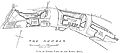
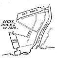 Plan of Hull Docks West.jpg 561 × 573; 82 KB
-
-

-
 Bastilles.Kingston.sur.Hull.png 663 × 810; 49 KB
-
 Hull1866.jpg 796 × 475; 118 KB
-
 EW(1884) p.510 - Hull (left) - A + C Black (pub).jpg 1,225 × 1,902; 517 KB
-
 EW(1884) p.511 - Hull (right) - A + C Black (pub).jpg 1,388 × 1,902; 717 KB
-
 Alexandra Dock Hull, Min. Proc. ICE. Vol. 92.png 3,770 × 1,057; 3.26 MB
-
 Situationsplan von Hull.jpg 355 × 359; 50 KB
-

-
 Yorkshire. Maps and plans by Bartholomew (1890) (14595325387).jpg 2,438 × 2,160; 1.14 MB
-

-
 Hull Docks East.jpg 5,396 × 2,387; 1.34 MB
-
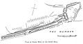 Hull Docks West.jpg 2,673 × 1,419; 268 KB
-

-

-

-

-
 A new Plan of Hull - btv1b8444208d.jpg 7,276 × 6,480; 8.38 MB
-
 A Plan of Kingston upon Hull - btv1b530620552.jpg 9,296 × 7,151; 12.25 MB
-
 Meyers b8 s0782 b1.png 388 × 392; 83 KB
-
 New Plan of Hull, engraved and published by M. C. Peck and son... - btv1b530209560.jpg 9,264 × 6,163; 10.25 MB
-
 Ordnance Survey One-Inch Sheet 33 Hull, Published 1924.jpg 12,406 × 9,197; 8.78 MB
-
 Wenceslas Hollar - Hull defences, detail.jpg 1,948 × 936; 1.11 MB
%27_(11174292715).jpg)


_p.510_-_Hull_(left)_-_A_%2B_C_Black_(pub).jpg)
_p.511_-_Hull_(right)_-_A_%2B_C_Black_(pub).jpg)

.jpg)
_(14595325387).jpg)
.jpg)


%27_(11235938484).jpg)
.jpg)
.jpg)
.jpg)


