Category:Old maps of Landkreis Breisgau-Hochschwarzwald
Urban districts (cities): Freiburg · Heidelberg · Heilbronn · Karlsruhe · Mannheim · Ulm
Use the appropriate category for maps showing all or a large part of Breisgau-Hochschwarzwald. See subcategories for smaller areas:
| If the map shows | Category to use |
|---|---|
| Breisgau-Hochschwarzwald on a recently created map | Category:Maps of Landkreis Breisgau-Hochschwarzwald or its subcategories |
| Breisgau-Hochschwarzwald on a map created more than 70 years ago | Category:Old maps of Landkreis Breisgau-Hochschwarzwald or its subcategories |
| the history of Breisgau-Hochschwarzwald on a recently created map | Category:Maps of the history of Landkreis Breisgau-Hochschwarzwald or its subcategories |
| the history of Breisgau-Hochschwarzwald on a map created more than 70 years ago | Category:Old maps of the history of Landkreis Breisgau-Hochschwarzwald or its subcategories |
Media in category "Old maps of Landkreis Breisgau-Hochschwarzwald"
The following 4 files are in this category, out of 4 total.
-
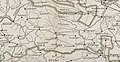 Amt Löffingen 1800.jpg 1,651 × 857; 341 KB
-
 Amt Neustadt Baden 1800.jpg 1,543 × 1,149; 371 KB
-
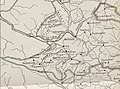
 Bezirksamt Neustadt 1830.JPG 2,062 × 1,850; 775 KB
-
 Herrschaft Badenweiler untere Vogteien 1718.jpg 650 × 574; 409 KB


