Category:Old maps of Livonia
Subcategories
This category has the following 4 subcategories, out of 4 total.
1
E
M
Media in category "Old maps of Livonia"
The following 31 files are in this category, out of 31 total.
-
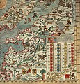
 1493--Nuremberg chronicles - map 2--Fragment.jpg 950 × 760; 295 KB
-
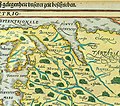
 1539-Samogethia-and-Lituania.jpg 1,640 × 1,708; 983 KB
-
 LIVONIAE NOVA DESCRIPTIO 1573-1578.jpg 1,998 × 1,791; 1.57 MB
-
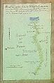
 Permia map.jpg 943 × 830; 317 KB
-
 Beschryvinghe van Lyflandt.jpg 2,990 × 2,448; 3.9 MB
-
 Atlas Van der Hagen-KW1049B10 029-LIVONIA Vulgo Lyetland.jpeg 5,500 × 4,318; 3.12 MB
-

-
 Map - Special Collections University of Amsterdam - OTM- HB-KZL 31-07-29.tif 7,885 × 6,739; 152.03 MB
-
 1706 Livoniæ de Wit- Mortier.jpg 3,000 × 2,494; 4.15 MB
-
 Poland1739old.jpg 1,668 × 1,457; 1.46 MB
-
 Russian Empire 1745 (Map III in Latin).jpg 7,704 × 6,754; 17.16 MB
-
 1757 Narva detail of map Russians March to Prussia BPL 14326.png 559 × 714; 886 KB
-
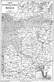
 Governorate of Livonia 1820.jpg 4,920 × 4,751; 4.65 MB
-
 Hydrographische Karte 1852 Rathlef.jpg 1,603 × 2,112; 1,000 KB
-
 Litauen BV044875323.jpg 4,000 × 5,821; 2.47 MB
-

-
 Bm03037am.jpg 310 × 480; 40 KB
-
 Cēsu apriņķis Rīgas vietniecībā 1783.jpg 811 × 715; 362 KB
-
 Darstellung der neuen auf Keiserl(ichen) Befehl i. J. 1783.jpeg 3,283 × 2,228; 4.28 MB
-
 Ducatuum Livoniæ et Curlandiæ Nova Tabula.jpg 4,089 × 3,400; 7.75 MB
-
 Europe 1550.jpg 1,500 × 1,138; 374 KB
-
 Europe mediterranean 1190-ar.jpg 2,293 × 1,806; 1.34 MB
-
 Kyivstar vkraina 1650.jpg 2,500 × 2,088; 2.9 MB
-
 Le Tour du monde-12-p115.jpg 1,908 × 2,874; 1.89 MB
-
 Litvania map 1570.png 764 × 593; 1.02 MB
-

-
 Rīgas apriņķis Rīgas vietniecībā 1783.jpg 848 × 607; 328 KB
-
 Valkas apriņķis Rīgas vietniecībā 1783.jpg 703 × 673; 301 KB
-
 Valmieras apriņķis Rīgas vietniecībā 1783.jpg 532 × 555; 200 KB
-
 Река Ланга на карте 1772 года.png 583 × 435; 672 KB
-
 Река Ланга на карте конца XVIII века.png 735 × 555; 860 KB


.2.(10).jpg)


.jpg)


_Befehl_i._J._1783.jpeg)


