Category:Old maps of Lorraine
Administrative regions and territorial collectivity of Metropolitan France (‡ since start of 2016):
Auvergne-Rhône-Alpes‡ · Bourgogne-Franche-Comté‡ · Brittany · Centre-Val de Loire · Corsica · Grand Est‡ · Hauts-de-France‡ · Île-de-France · Normandy‡ · New Aquitaine‡ · Occitania‡ · Pays de la Loire · Provence-Alpes-Côte d'Azur
Former administrative regions of Metropolitan France (until end of 2015):
Alsace · Aquitaine · Auvergne · Burgundy · Champagne-Ardenne · Franche-Comté · Languedoc-Roussillon · Limousin · Lorraine · Midi-Pyrénées · Nord-Pas-de-Calais · Lower Normandy · Upper Normandy · Picardy · Poitou-Charentes · Rhône-Alpes
Overseas departments and regions: Guadeloupe · Martinique · French Guiana · Réunion · Mayotte
Overseas collectivities: Saint Barthélemy · Saint-Martin · Saint Pierre and Miquelon · French Polynesia · Wallis and Futuna · French Southern and Antarctic Lands+
Sui generis territories: New Caledonia · Clipperton Island+
Use the appropriate category for maps showing all or a large part of Lorraine. See subcategories for smaller areas:
| If the map shows | Category to use |
|---|---|
| Lorraine on a recently created map | Category:Maps of Lorraine or its subcategories |
| Lorraine on a map created more than 70 years ago | Category:Old maps of Lorraine or its subcategories |
| the history of Lorraine on a recently created map | Category:Maps of the history of Lorraine or its subcategories |
| the history of Lorraine on a map created more than 70 years ago | Category:Old maps of the history of Lorraine or its subcategories |

Subcategories
This category has the following 13 subcategories, out of 13 total.
- 18th-century maps of Lorraine (17 F)
L
O
- Old maps of Meurthe (department) (11 F)
- Old maps of Pays messin (5 F)
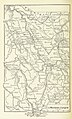
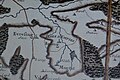
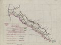
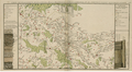
Media in category "Old maps of Lorraine"
The following 46 files are in this category, out of 46 total.
-
-

-

-
 Austrasie752.jpg 484 × 689; 78 KB
-

-
 Meyers leiner Hand-atlas 1893 (73136696).jpg 6,352 × 9,522; 11.82 MB
-
 Autour de Toul 1866.png 1,596 × 982; 3.57 MB
-
 Biding.jpg 576 × 384; 156 KB
-
 Carte Nousseviller-lès-Bitche.jpg 867 × 1,091; 362 KB
-
 Dräi Bistümer.png 393 × 432; 386 KB
-
 Fonderie mouterhouse.jpg 405 × 305; 25 KB
-
 Front de Lorraine - btv1b84461360.jpg 10,486 × 7,992; 14.65 MB
-
 Front de Lorraine LOC 92684032.jpg 6,087 × 4,589; 3.52 MB
-
 Front de Lorraine LOC 92684032.tif 6,087 × 4,589; 79.92 MB
-

-
-

-

-

-

-
-

-

-
 Herzogtum Lothringen 1000.PNG 980 × 976; 623 KB
-
 Herzogtum Lothringen 1250.PNG 368 × 382; 138 KB
-
 Herzogtum Lothringen 1400.PNG 659 × 883; 456 KB
-
 Hingsange Morhange Château Voué 1700.jpg 800 × 600; 323 KB
-

-
 Le Verdunois XIIIe-XVIe siecle.jpg 1,475 × 1,023; 496 KB
-
 Lorraine - Province.jpg 2,793 × 1,866; 1.91 MB
-
 Lorraine 1618-1648.JPG 414 × 504; 90 KB
-
 Lotharingia-1508.jpg 1,521 × 2,086; 2.05 MB
-
 Meyers b11 s0553a.jpg 2,360 × 1,468; 4.19 MB
-
 Moyenvic1662.png 380 × 263; 181 KB
-
 Palatinatus Rheni (Merian) 253 (Jamez).jpg 1,464 × 556; 142 KB
-
 Palatinatus Rheni (Merian) 253 (Moyenvic).jpg 1,451 × 551; 184 KB
-
 Palatinatus Rheni (Merian) 253 (vic sur seille).jpg 1,488 × 556; 153 KB
-
 Palatinatus Rheni (Merian) 274.jpg 2,000 × 2,890; 737 KB
-
 Palatinatus Rheni Merian 274 Lixheim.jpg 1,523 × 1,162; 908 KB
-
 PlanLocalUrbanismeVigy CarteDeCassini1760-c.jpg 1,000 × 725; 118 KB
-
 PlanLocalUrbanismeVigy CarteDeCassini1760.jpg 740 × 390; 111 KB
-
 Postrouten1786L1100283 (2).jpg 2,520 × 3,776; 4.45 MB
-
 Toulois chatellenie 69186 MT (Commercy).jpg 901 × 617; 550 KB
-
 Toulois chatellenie 69186 MT.jpg 2,921 × 2,002; 4.37 MB
-
 Trois-Évêchés.png 393 × 432; 359 KB
-
 Карта к статье «Нуасвиль». Военная энциклопедия Сытина (Санкт-Петербург, 1911-1915).jpg 2,602 × 2,684; 1.1 MB
.jpg)
.jpg)
.jpg)

.jpg)
.jpg)


_274.jpg)


.jpg)
.jpg)


.jpg)
_253_(Jamez).jpg)
_253_(Moyenvic).jpg)
_253_(vic_sur_seille).jpg)