Category:Old maps of Mobile, Alabama, during the American Civil War
Media in category "Old maps of Mobile, Alabama, during the American Civil War"
The following 27 files are in this category, out of 27 total.
-
 Capture of Mobile, Alabama LOC gvhs01.vhs00283.tif 1,720 × 1,940; 9.55 MB
-
 Capture of Mobile, Alabama LOC gvhs01.vhs00283.jpg 1,720 × 1,940; 531 KB
-

-

-

-

-
 Battle of Mobile Bay map.png 1,000 × 1,428; 1.02 MB
-
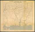
 Confederate Defenses of Mobile Confederate Military History Volume 7.jpg 2,027 × 1,359; 722 KB
-

-

-
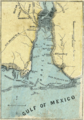
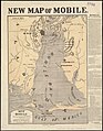 Map of Mobile showing the Rebel stronghold in the Gulf (5961390040).jpg 1,558 × 2,000; 2.91 MB
-
 Map of the defences of the city of Mobile. (1862-64) LOC 99447254.jpg 4,646 × 3,370; 2.29 MB
-
 McAlesterMobilePlans1.JPG 450 × 286; 14 KB
-
 McAlesterMobilePlans2.JPG 450 × 280; 14 KB
-
 Battle of Mobile Bay map.jpg 560 × 800; 349 KB
-
 Mobile bay defense.jpg 627 × 1,016; 503 KB
-

-

-

-

-

-

-
-

-

-

-


_of_Mobile_shewing_(sic)_Union_attack_April_3rd-9th_1865_on_Spanish_Fort._LOC_gvhs01.vhs00201.jpg)


_(14589627859).jpg)
_(14784509832).jpg)
.jpg)
_LOC_99447254.jpg)


_(14598503169).jpg)
_(14576357817).jpg)


.jpg)
.jpg)
.jpg)