Category:Old maps of Nanterre
Arrondissement of Antony:
Arrondissement of Boulogne-Billancourt:
Arrondissement of Nanterre: Bois-Colombes · Colombes · Courbevoie · La Garenne-Colombes · Nanterre · Neuilly-sur-Seine · Puteaux · Suresnes ·
Arrondissement of Boulogne-Billancourt:
Arrondissement of Nanterre: Bois-Colombes · Colombes · Courbevoie · La Garenne-Colombes · Nanterre · Neuilly-sur-Seine · Puteaux · Suresnes ·
Subcategories
This category has the following 2 subcategories, out of 2 total.
Media in category "Old maps of Nanterre"
The following 7 files are in this category, out of 7 total.
-
 Carte-em-suresnes.JPG 1,348 × 1,762; 966 KB
-
 Carte postale - Nanterre - Plan de la ville - 9FI-NAN 411.jpg 2,477 × 3,712; 5.52 MB
-
 Cassini.Nanterre.jpg 412 × 126; 19 KB
-
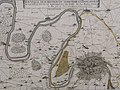 Nanterre sur la carte de Jean Boisseau (1640) 01.jpg 2,193 × 1,647; 993 KB
-
 Nanterre sur la carte de Jean Boisseau (1640) 02.jpg 3,120 × 4,160; 3.85 MB
-
 Nanterre sur la carte de Jean Boisseau (1640) 03.jpg 3,984 × 3,071; 2.95 MB
-
 Nanterre sur la carte de Jean Boisseau (1640) 04.jpg 3,064 × 2,314; 1.72 MB


_01.jpg)
_02.jpg)
_03.jpg)
_04.jpg)