Category:Old maps of Niigata prefecture
日本語: 新潟県の古地図
Subcategories
This category has only the following subcategory.
- Old maps of Nagaoka, Niigata (19 F)
Media in category "Old maps of Niigata prefecture"
The following 6 files are in this category, out of 6 total.
-
 Echigo Shibata Murakami Map in Tenpo era.jpg 7,277 × 12,166; 10.77 MB
-
 Map of Kashiwazaki, Niigata Prefecture, Japan by U.S. Army Map Service in 1945.jpg 3,500 × 2,949; 7.47 MB
-
 Map of Naoetsu, Niigata Prefecture, Japan by U.S. Army Map Service in 1945.jpg 2,700 × 2,183; 4.21 MB
-
 Map of Niigata, Niigata Prefecture, Japan by U.S. Army Map Service in 1945.jpg 5,000 × 4,288; 3.74 MB
-
 Map of Takada, Niigata Prefecture, Japan by U.S. Army Map Service in 1945.jpg 2,266 × 2,500; 2.31 MB
-
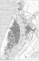 Niigata map circa 1930.PNG 1,072 × 1,685; 1.17 MB


