Category:Old maps of Old City of Acre
Media in category "Old maps of Old City of Acre"
The following 15 files are in this category, out of 15 total.
-
 Mont Carmel 1666.jpg 4,676 × 3,284; 3.81 MB
-
 Monte Carmelo Alexis.jpg 1,894 × 2,723; 2.4 MB
-
 1840–43 Royal Engineers map of Acre (close up).jpg 2,344 × 3,098; 440 KB
-
 1840–44 Royal Engineers map of Acre and surrounding region.jpg 2,270 × 2,475; 658 KB
-
 Bodleian Libraries, Map of Acre.jpg 1,000 × 675; 115 KB
-

-
 City Acre.jpg 922 × 614; 190 KB
-
 Civitas acon sive Ptolomaida - Bosio Giacomo & Boissat Pierre De - 1659.jpg 1,478 × 1,172; 1.1 MB
-
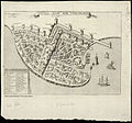 Civitas Acon sive Ptolomaida.jpg 807 × 750; 225 KB
-

-
 Jean Picart. Civitas Acon sive Ptolomaida. 17th century.jpg 5,421 × 3,864; 4.56 MB
-
 Marino Sanudo's plan of ACRE.jpg 2,280 × 1,800; 1.17 MB
-
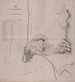
 Plan de St. Jean d'Acre. 1799.jpg 2,615 × 1,743; 672 KB
-
 Plan of Acre. After a Drawing by Marino Sanuto (11229880494).jpg 1,923 × 1,278; 732 KB
-
 Ptolémaïde ou Acre. Jean Baptiste Bourguignon d'Anville. 18th century.jpg 1,120 × 1,300; 194 KB


.jpg)


.jpg)
