Category:Old maps of Palestine in the time of Jesus
English: Old biblical maps showing Palestine in the lifetime of Jesus'. Secular maps showing that era should be sorted under "Maps of Palestine in <Century>".
See also: Category:Maps of Jesus.
See also: Category:Maps of Jesus.
Media in category "Old maps of Palestine in the time of Jesus"
The following 24 files are in this category, out of 24 total.
-
-
-
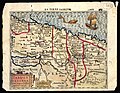
 Johann Nepomuk Sepp, Palæstina zur Zeit Christi (FL33144862 3882654).jpg 7,520 × 11,148; 120.04 MB
-

-

-
 1889 Palestine in the beginning of the Christian Era.jpg 1,766 × 2,970; 2.74 MB
-

-

-
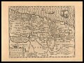
 Atlas of ancient and classical geography (1909) (14782039652).jpg 1,328 × 2,880; 901 KB
-
 Nr. 4. Palaestina und Phoenizien zur Zeit der Geburt Christi.png 4,185 × 3,343; 40.05 MB
-
 Szczepanski - 4 Ewangelie (1917) Mapa.jpg 2,826 × 3,762; 3.63 MB
-
 391 of 'The Fifth Gospel, the land where Jesus lived' (11224846563).jpg 1,263 × 1,585; 492 KB
-
-

-

-
 Palestine in the time of Christ (1880).jpg 2,014 × 3,240; 741 KB
-
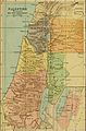
 Palestine in the time of Christ.jpg 590 × 893; 172 KB
-

-
 Palestine in the time of Jesus.jpg 1,826 × 2,573; 720 KB
-
 PEF Survey of Western Palestine showing the New Testament.jpg 7,194 × 12,319; 13.06 MB
-
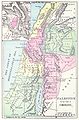
 Sea of galilee map 1903.jpg 596 × 655; 278 KB
-
 Sea of galilee map 1903closeup.jpg 5,120 × 3,000; 1.49 MB
-

-

.jpg)
.jpg)
.jpg)
_(14578167450).jpg)
_(14741859296).jpg)

%27_(11245323116).jpg)
%27_(11248198965).jpg)
_(14782039652).jpg)

_Mapa.jpg)
.jpg)
_(14757711296).jpg)

_(14596945910).jpg)
.jpg)

_LOC_2009579463.jpg)


.jpg)
.jpg)