Category:Old maps of Samsun
Media in category "Old maps of Samsun"
The following 13 files are in this category, out of 13 total.
-
 1752 Samson detail map Turkish Empire by Moll BPL 17082.png 1,068 × 748; 1.87 MB
-
 Ptolemy Cosmographia 1467 - Black Sea states (Amissos).jpg 352 × 271; 76 KB
-
 Anavatan 1927 (Samsun).jpg 963 × 616; 229 KB
-
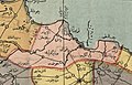
 Osmanlıca Orta Karadeniz haritası.jpg 500 × 423; 80 KB
-
 Piri Reis. Map of the Black Sea (Samsun).jpg 1,601 × 1,507; 2.18 MB
-
 Pontus Euxinus, 1590 (cropped).jpg 2,097 × 1,735; 1.5 MB
-
 Samsun Kalesi sınırları, 1856.jpg 1,023 × 586; 227 KB
-
 Samsun kent planı, 1905.png 3,048 × 1,887; 6.08 MB
-
 Samsun ve Sinop civarı Kızılırmak haritası, 12 Ağustos 1923.jpg 1,839 × 3,659; 3.09 MB
-
 Samsun ve çevresi, 1876.jpg 1,246 × 1,472; 709 KB
-
 Tabvla Asiae I, Münster (Samsun).jpg 1,281 × 942; 988 KB
-
 Trabzon Vilayeti haritası.png 2,651 × 1,773; 5.69 MB
-
 Turcici Imperii, Ortelius (Samsun).jpg 457 × 429; 228 KB

.jpg)
.jpg)

.jpg)
.jpg)


.jpg)

.jpg)