Category:Old maps of Tbilisi
Subcategories
This category has only the following subcategory.
M
Media in category "Old maps of Tbilisi"
The following 43 files are in this category, out of 43 total.
-
 Map of Tbilisi 1800.JPG 4,583 × 3,781; 3.01 MB
-
 1800 Teflis detail map of Asia by Mathew Carey BPL 12333.png 1,225 × 594; 1.24 MB
-
 Plan of Tbilisi 1802.gif 2,492 × 2,724; 3.55 MB
-
-
-
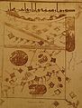 Arabic map indicating Tbilisi, 10th century.jpg 1,422 × 1,865; 938 KB
-

-
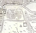
 Map of Khojivank Armenian cemetery, 1850 (cropped).jpg 536 × 536; 100 KB
-
 Map of Khojivank Armenian cemetery, 1878 (cropped).jpg 2,444 × 2,003; 1.96 MB
-
 Map of Khojivank Armenian cemetery, 1887 (cropped).jpg 1,494 × 1,522; 964 KB
-
 Map of Khojivank Armenian cemetery, Beginning of the 18th century (cropped).jpg 1,190 × 1,093; 371 KB
-
 Map of Tbilisi 1782 (1).jpg 8,966 × 6,021; 22.6 MB
-
 Map of Tbilisi 1782.jpg 2,225 × 2,390; 2.91 MB
-
 Map of Tbilisi 1821.jpg 7,059 × 12,735; 38.47 MB
-
 Map of Tbilisi 1844.jpg 9,364 × 8,432; 48.82 MB
-
 Map of Tbilisi 1850.jpg 2,023 × 2,310; 1.18 MB
-
 Map of Tbilisi 1878.jpg 9,534 × 7,077; 17.03 MB
-
 Map of Tbilisi 1884.jpg 1,955 × 2,036; 4.87 MB
-
 Map of Tbilisi 1913.jpg 5,907 × 5,935; 7.83 MB
-
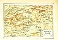
 Map of Tiflis (Élisée Reclus).JPG 457 × 536; 92 KB
-
 Map of Tiflis 1876.jpg 1,146 × 1,201; 405 KB
-
 Pishchevich map of Tiflis, 1785.jpg 2,940 × 2,268; 2.13 MB
-
 Plan of Tbilisi. 18th century.jpg 566 × 393; 57 KB
-
 Tbilisi map 1800 (Chuiko).jpg 6,741 × 7,799; 19.27 MB
-
 Tbilisi map 1911.jpg 5,149 × 4,153; 5.42 MB
-
 Tbilisi plan by Prince Vakhushti (edited).jpg 2,436 × 2,777; 2.5 MB
-
 Tbilisi plan by Prince Vakhushti (original).jpg 2,576 × 3,071; 2.47 MB
-
 Tbilisi plan by Prince Vakhushti 1 (chromo).jpg 1,267 × 1,746; 705 KB
-
 Tbilisi plan by Prince Vakhushti 2 (chromo).jpg 1,204 × 1,442; 509 KB
-
 Tiflis BaedekerMapI-1914.jpg 1,296 × 1,945; 1.3 MB
-
 Tiflis BaedekerMapII-1914.jpg 1,296 × 1,951; 1.55 MB
-
 Tiflis city plan, 1887.jpg 4,925 × 4,746; 7.23 MB
-
 Tiflis map (Moskvich guide, 1913)-2.jpg 1,269 × 869; 335 KB
-
 Tiflis map (Moskvich guide, 1913).jpg 2,765 × 1,294; 957 KB
-
 USSR map NK 38-8 -verso- Tbilisi and Vicinity.jpg 3,668 × 3,261; 2.78 MB
-
 USSR map NK 38-8 Tbilisi.jpg 5,922 × 4,739; 8.55 MB
-
 Vakhushti's Plan of Tiflis (Russian version, 1871).jpg 423 × 600; 62 KB
-
 Vakhushti. plan of tbilisi. 1735.gif 536 × 548; 62 KB
-
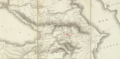
 Vom Kaukasus zum Persischen Meerbusen b 045.jpg 1,278 × 1,412; 419 KB
-
 Tbilisi city map (Wagner & Debes, Leipzig 1914).jpg 500 × 373; 175 KB
-
 План г. Тифлиса.png 1,983 × 2,987; 3.66 MB
-
 Планъ Тифлиса (2e édition) - btv1b53020910n.jpg 9,534 × 7,077; 12.26 MB
-
 Тбилиси. План города, составленный Вахушти Багратиони. 30-е годы XVIII в..jpg 2,516 × 3,454; 1.02 MB


.jpg)


.jpg)
.jpg)
.jpg)
.jpg)
.jpg)


.JPG)


.jpg)

.jpg)
.jpg)
.jpg)
.jpg)


-2.jpg)
.jpg)


.jpg)


.jpg)

_-_btv1b53020910n.jpg)
