Category:Old maps of Ukraine by Guillaume le Vasseur de Beauplan
| NO WIKIDATA ID FOUND! Search for Old maps of Ukraine by Guillaume le Vasseur de Beauplan on Wikidata | |
| Upload media |
Subcategories
This category has only the following subcategory.
Media in category "Old maps of Ukraine by Guillaume le Vasseur de Beauplan"
The following 34 files are in this category, out of 34 total.
-
 Красне на мапі Гійома Левассера де Боплана.jpg 751 × 522; 70 KB
-
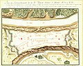
 Atlas Van der Hagen-KW1049B10 043-UKRAINAE PARS, QUA KIOVIA PALATINATUS Vulgo dicitur.jpeg 5,500 × 3,961; 3.77 MB
-
 Beauplan special frag6.gif 3,500 × 2,687; 440 KB
-
 Beauplan special fragment 7.jpg 5,860 × 4,600; 6.9 MB
-
 Boplan black forest.png 1,083 × 779; 85 KB
-
 Boplan-border-1650.jpg 10,000 × 4,000; 7.19 MB
-
 Busza-1648.jpg 400 × 292; 26 KB
-
 Carte d'Ukranie by Beauplan, Guillaume Le Vasseur (16..-1673), cartographer.jpg 7,866 × 3,926; 17.56 MB
-

-
 Crop focusing on the Kiev Voivodeship in the Prototype of the "special" map of Ukraine.jpg 6,067 × 4,857; 1.65 MB
-
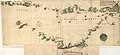
 Dnipro river map Guillaume le Vasseur de Beauplan.jpg 3,563 × 24,713; 6.08 MB
-

-
 Govtva map ua 1650 Boplan.jpg 2,678 × 2,009; 707 KB
-
 Kapustynci-Boplan-1650.jpg 570 × 473; 41 KB
-
 Kodak getkant boplan.jpg 328 × 438; 41 KB
-
 Kyiv and Zhytomyr Polissia on Beauplan map.jpg 3,638 × 2,439; 1.5 MB
-
 Old map of Ukraine (cropped).jpg 6,515 × 5,828; 2.99 MB
-
 Old map of Ukraine.jpg 6,515 × 6,287; 3.19 MB
-
 Pereniatynmap1650.png 800 × 458; 665 KB
-
 Plan and map of the fortress of Okopy (cropped).jpg 6,363 × 5,096; 2.51 MB
-
 Plan and map of the fortress of Okopy.jpg 6,482 × 5,777; 2.77 MB
-
 Prototype of the "special" map of Ukraine (cropped).jpg 13,850 × 6,296; 3.66 MB
-
 Prototype of the "special" map of Ukraine.jpg 13,850 × 6,891; 4.31 MB
-
 Rotkowcze.jpg 424 × 285; 79 KB
-

-
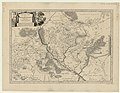
 Ukrainae pars quae Kiovia Palatinatus vulgo dicitur.jpg 4,360 × 3,136; 5.33 MB
-
-
 Valiava on the map in 1648.jpg 595 × 565; 94 KB
-
 Vcb.png 943 × 652; 625 KB
-
 Боплан Ольшана.jpg 500 × 389; 74 KB
-
 Боплан Район.jpg 500 × 389; 74 KB
-
 Гирло Бузького лиману з позначенням Виноградної Криниці.jpg 716 × 609; 98 KB
-
 Краснопіль (Великі Сорочинці) на карті Боплана 1648 року.jpg 748 × 504; 110 KB
-
 Муравский шлях из карты де Боплана.png 992 × 3,060; 4.77 MB


,_cartographer.jpg)


.jpg)


.jpg)

.jpg)


_%D0%BD%D0%B0_%D0%BA%D0%B0%D1%80%D1%82%D1%96_%D0%91%D0%BE%D0%BF%D0%BB%D0%B0%D0%BD%D0%B0_1648_%D1%80%D0%BE%D0%BA%D1%83.jpg)
.jpg)
_Together_with_its_Neighboring_Provinces_WDL79.png)
.jpg)