Category:Old maps of Utrecht
This category is for historic maps (over 70 years old) for Utrecht province, the Netherlands.
Subcategories
This category has the following 4 subcategories, out of 4 total.
A
G
U
Media in category "Old maps of Utrecht"
The following 48 files are in this category, out of 48 total.
-
 Kerkenkaart Oversticht - Bisdom Utrecht.jpg 2,672 × 3,803; 13.47 MB
-
 Kaerius1617Ultraiectum.jpg 3,500 × 2,712; 3.19 MB
-
 1628 Kaart van Holland en Utrecht.jpg 6,272 × 4,845; 8.3 MB
-
 1628 Ultraiec tinus Hondius'.jpg 3,370 × 2,696; 9.94 MB
-
 "Ultraiectum dominium" (22068687498).jpg 3,893 × 3,030; 3.03 MB
-
 IJsselstein-Blaeu-1665.jpg 1,253 × 796; 608 KB
-
 1694 Lubbenes.jpg 550 × 263; 28 KB
-

-
-
 De VII Vereenigde Nederlandsche Provinciën COLLBN Port 3 N 87 - sheet 3.tif 8,449 × 6,330; 153.01 MB
-
-

-
 7 Sup Hol 1573 Sgrooten.jpg 1,971 × 1,758; 2.94 MB
-
 Beeldsnijder-Noord Holland.jpg 1,446 × 1,617; 457 KB
-
 Blaeu 1645 - Ultraiectum Dominium.jpg 3,661 × 3,053; 4.55 MB
-
 COMITATUS HOLLANDIAE 1682.jpg 4,400 × 3,653; 4.19 MB
-
 Comitatus Hollandiae et dominii Ultrajectini tabula - F. de Wit - btv1b53039594n (09 of 16).jpg 11,068 × 7,341; 9.62 MB
-
 Comitatus Hollandiae et dominii Ultrajectini tabula - F. de Wit - btv1b53039594n (11 of 16).jpg 11,087 × 7,332; 11.13 MB
-
 De Ronde Venen 1665.JPG 860 × 593; 139 KB
-
 Departement utrecht 1802.jpg 598 × 499; 478 KB
-
 DeRoij1715UltrajectinæCr.jpg 5,337 × 4,403; 9.38 MB
-
 FMIB 43958 Zuyder Polder.jpeg 895 × 1,016; 417 KB
-
 Heerlijkheid utrecht.jpg 1,000 × 740; 349 KB
-
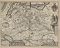
 Holland & Sticht Utrecht, Gerardus Mercator, Atlas Sive Cosmographicae, etc.jpg 1,797 × 1,949; 2.14 MB
-
 Holland1477.png 336 × 333; 188 KB
-
 Joost Jansz Bilhamer-Beeldsnijder-Kaart van Noord-Holland 1575.jpg 2,790 × 3,160; 3.18 MB
-
 Kaart Bernard de Roij - 1696.png 1,021 × 639; 1.03 MB
-
 Kaart uit 1648 met percelen van de voormalige abdij Oostbroek te De Bilt.jpg 1,400 × 995; 421 KB
-
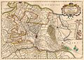
 Kaart van de provincie Utrecht Episcop. Ultraiectinus (titel op object), RP-P-AO-5-5A.jpg 5,272 × 4,494; 4.03 MB
-

-
 Kaart Vechtstreek door Daniël Stoopendaal in De Zegepralende Vecht 1719.jpg 1,381 × 2,682; 2.89 MB
-

-
 Kaerius1617UltraiectumCr.jpg 800 × 600; 267 KB
-
 Lambert-van-den-Bos-Lieuwe-van-Aitzema-Historien-onses-tyds MGG 0418.tif 4,188 × 3,429; 41.12 MB
-
 Landkaarten, polders, Noorderbuursche Polder, Bestanddeelnr 253-6807.jpg 3,465 × 2,383; 3.05 MB
-
 Map of Sticht Utrecht, around 1650.jpg 902 × 647; 540 KB
-
 Nederhorst.JPG 1,936 × 1,936; 1.3 MB
-
 Oude landkaart.jpg 808 × 474; 282 KB
-
 Oude Rijn Blaeu.jpg 795 × 497; 188 KB
-
 Steevlied op minuutkaart uit 1832.jpg 1,445 × 893; 268 KB
-
 Ten Brink's nieuwe Zak-Atlasje van Nederland voor sport en op reis 1922 scan07.jpg 5,479 × 4,820; 5.48 MB
-
 TopographicMapUtrecht1820.png 5,600 × 4,400; 38.67 MB
-
 Ultraiectum dominium - Petrus Kaerius excud. - btv1b53043163p (1 of 2).jpg 5,770 × 4,581; 5.8 MB
-
 Utrecht 1892.jpg 6,161 × 3,950; 18.19 MB
-
 Waterstaat en grensscheiding van Holland, Utrecht en Gelderland (3381208445).jpg 2,000 × 1,486; 1.02 MB
-
 Waverveen.JPG 2,592 × 1,936; 1.78 MB
-
 Wiltenburch.jpg 386 × 589; 94 KB
-
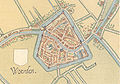 Woerden c1550map.jpg 906 × 632; 935 KB


.jpg)


.jpg)
.jpg)

.jpg)


.jpg)
.jpg)


,_RP-P-AO-5-5A.jpg)


.jpg)

.jpg)


